Połonina Caryńska - routes, where to exit, how to get there, parking, bus timetable
Magnetic meadows
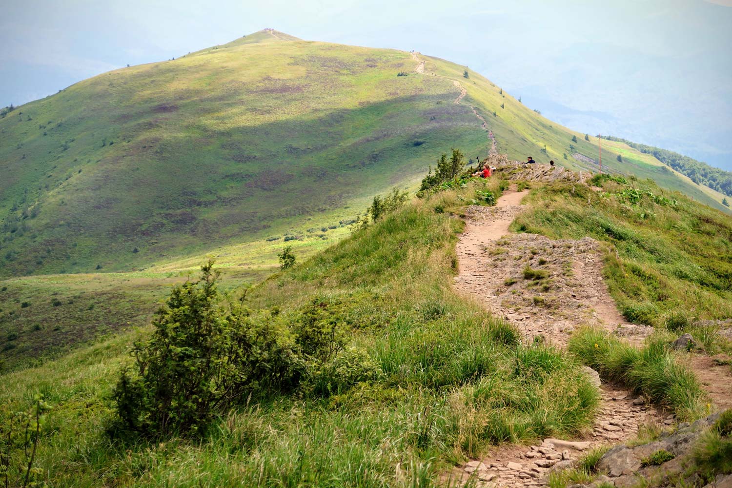
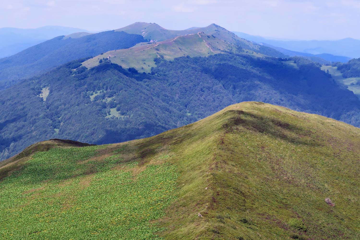
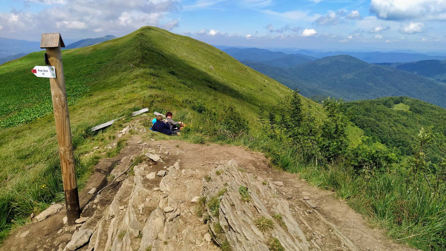
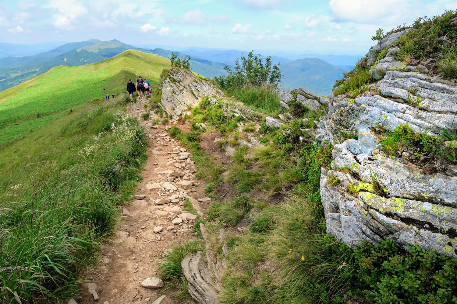
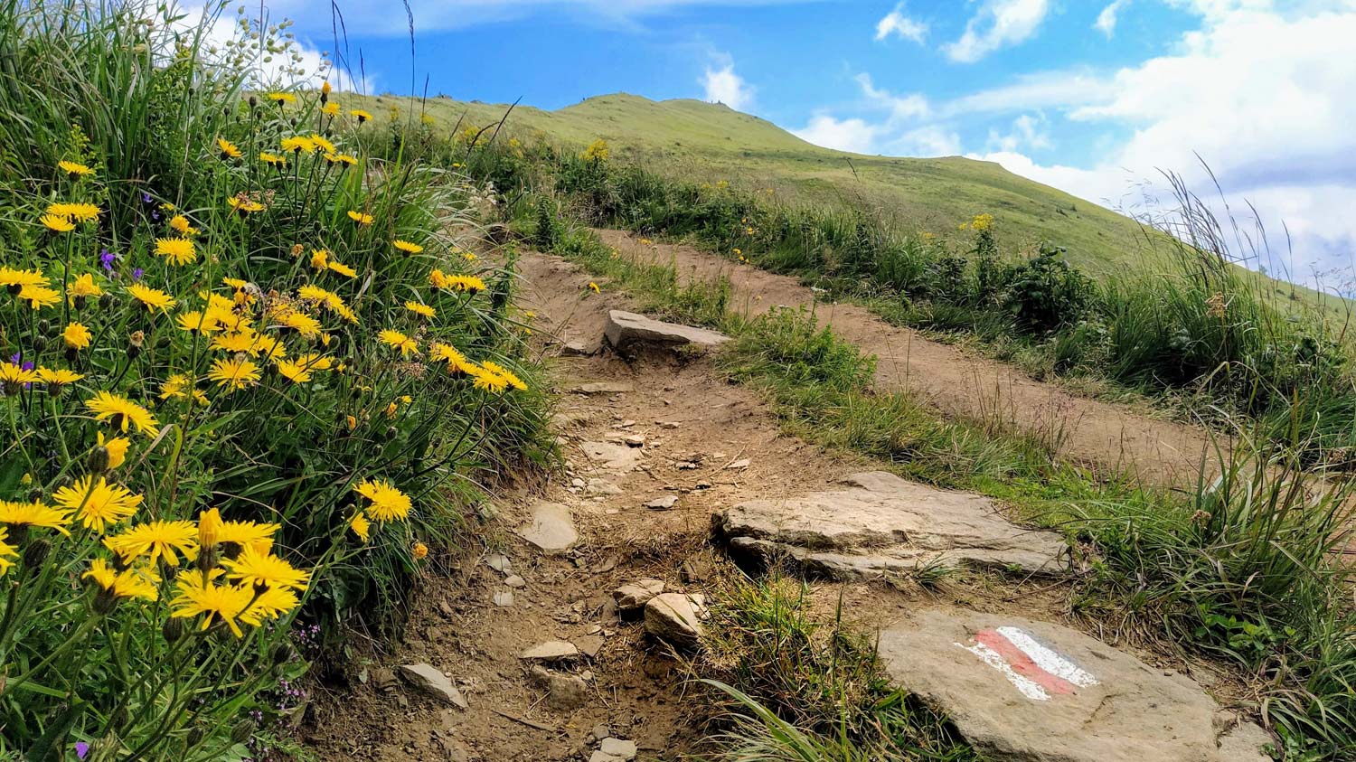
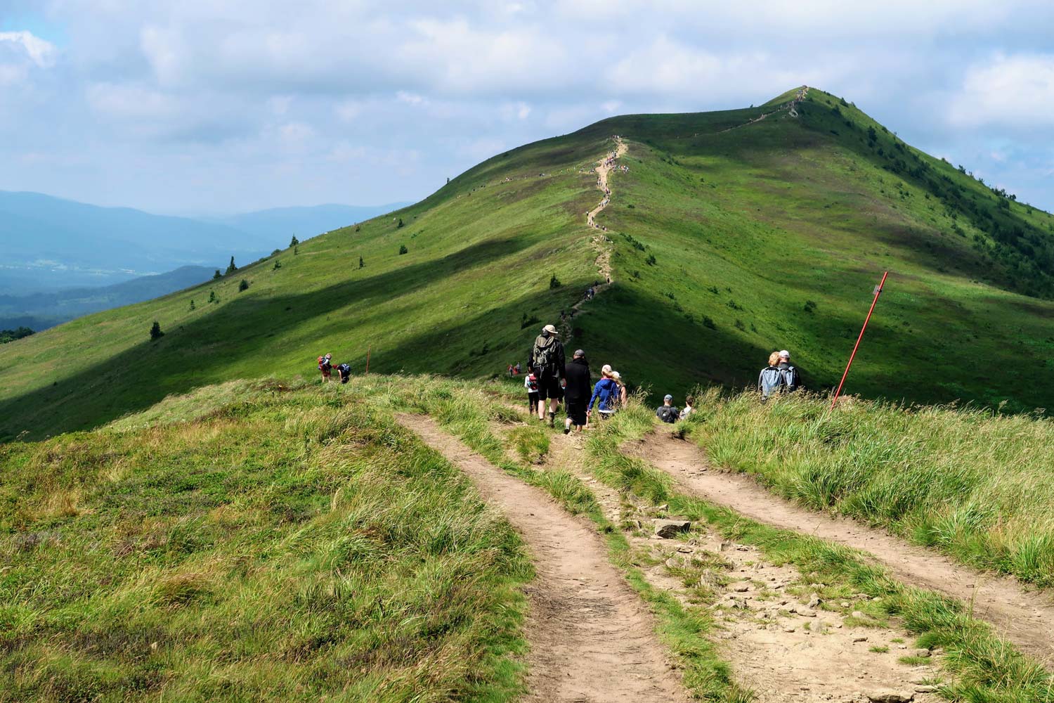
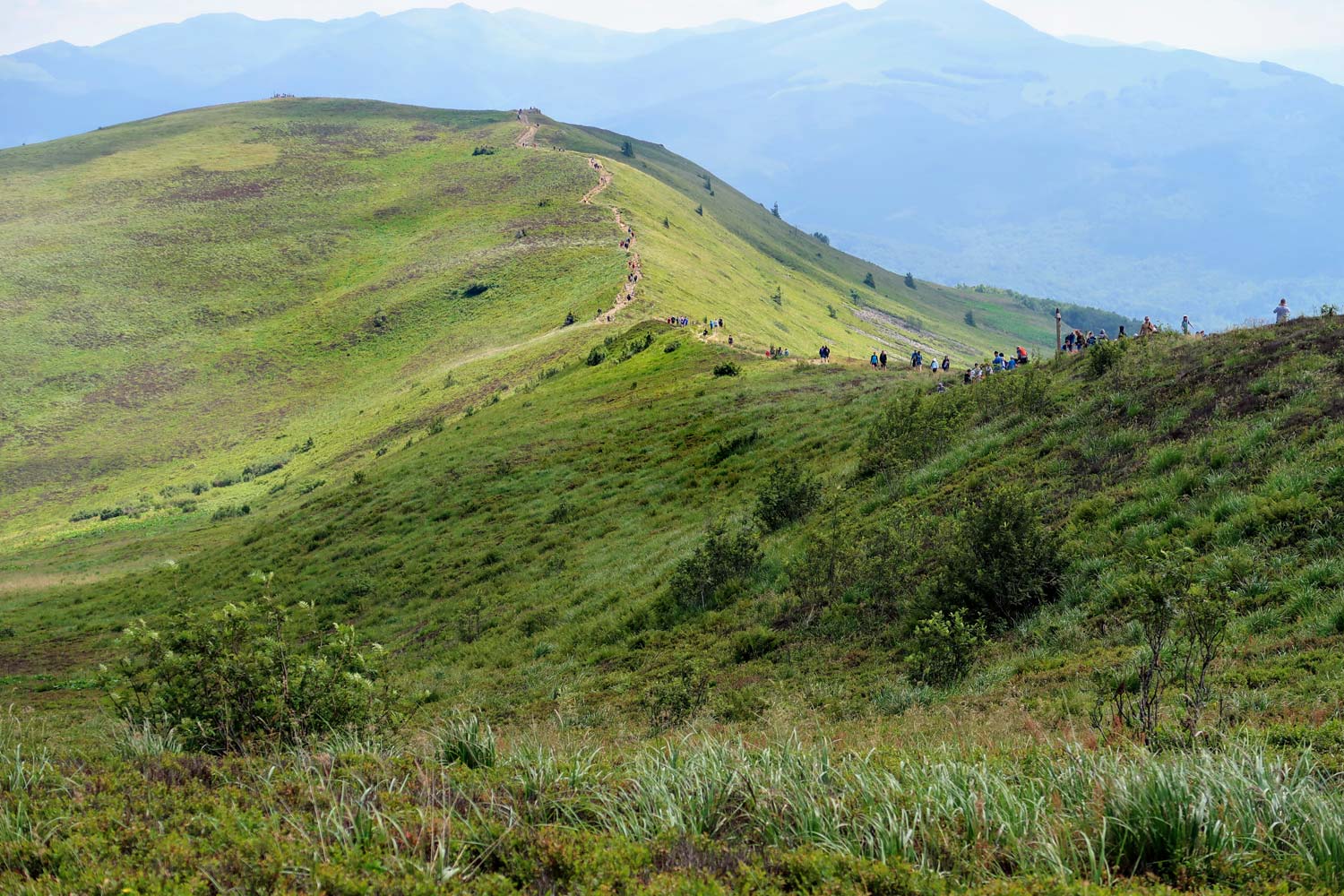
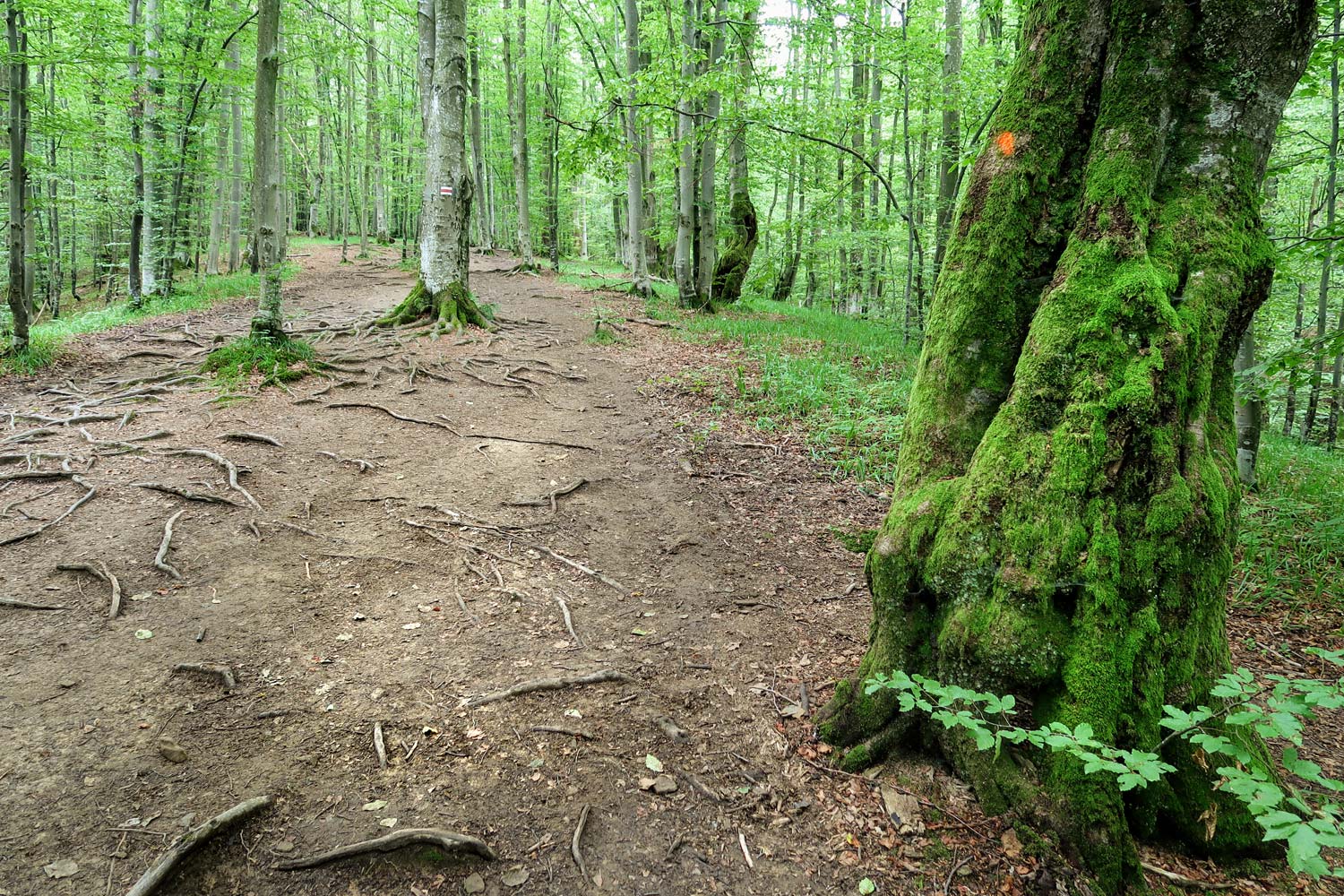
Połonina Carynska is one of the two (next to Wetlińska) the most popular meadows in the Bieszczady Mountains. This is a must for every beginner wanderer in Bieszczady, and at the same time a place where even the most experienced Bieszczadniks return more than once. Everyone is attracted by the beauty of this place. The mountain pasture itself, with its undulating shapes, looks very picturesque. However, if you add this to the background views that extend from the height of the mountain meadows to the almost infinite rolling hills, mountains, hills and mounds… it is no wonder that several benches were installed on the mountain ridge. After reaching the ridge of the mountain meadows and the first "wow !!!" effect, everyone wants to sit down for a moment and have some time to embrace this extraordinary scenery. And it takes some time to cover even the closest and most famous points of the Bieszczady Mountains, the more so because the conditions for it are perfect. Połonina Caryńska (1297m above sea level) is higher than Wetlińska (1255m above sea level), so you can see further: Mała Rawka, Wielka Rawka, Dział, Połonina Wetlińska, Bukowe Berdo, Krzemień, Halicz, Rozsypaniec, Tarnica ... it could be exchanged for a long time .
And so passes minute by minute as you calmly follow the peaks, valleys and passes with your eyes. Although it really feels like that is when time stood still.
Połonina Caryńska - weather
It is always worth checking the weather before going to the mountains. Below you will find a live weather forecast for the next 7 days. The given temperature values apply to the Brzegi Górne, located nearby, which are 550 m lower than the top of the mountain pasture. Given the difference in height, in the mountain pastures expect a temperature of about 3 degrees Celsius lower than shown in the graphic below.
Połonina Caryńska - routes, map
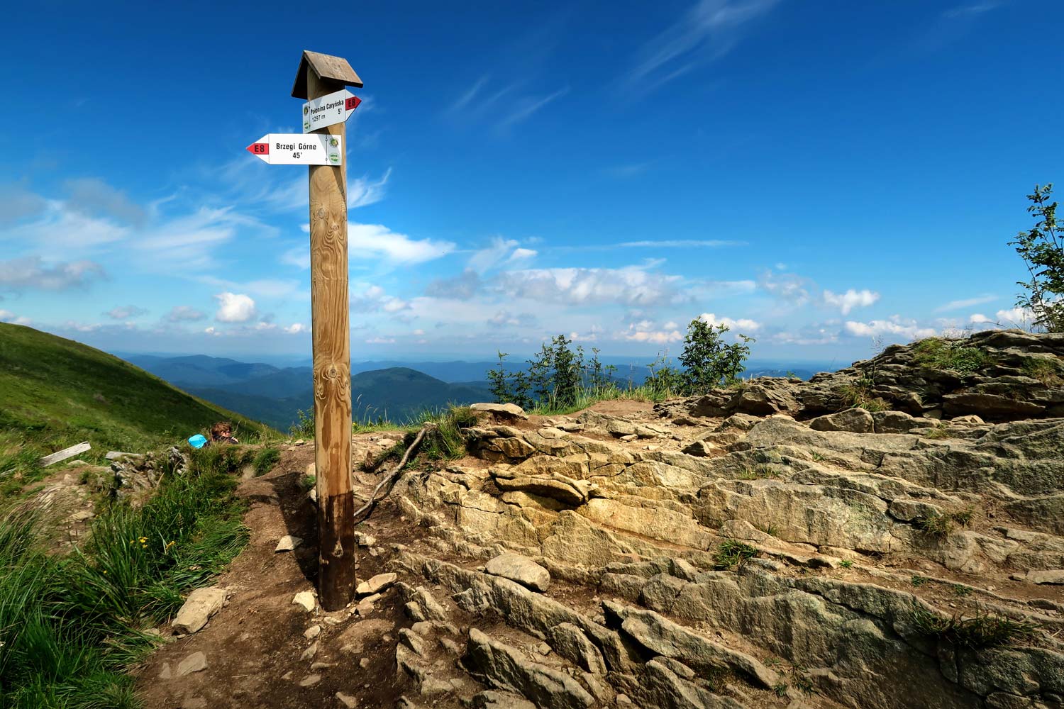
Two dishes lead to Połonina Caryńska:
- red trail: runs along the entire length of the mountain pasture
- green trail: it crosses the meadow, running through a short fragment along its peak.
The course of the trails is well illustrated by the map below.
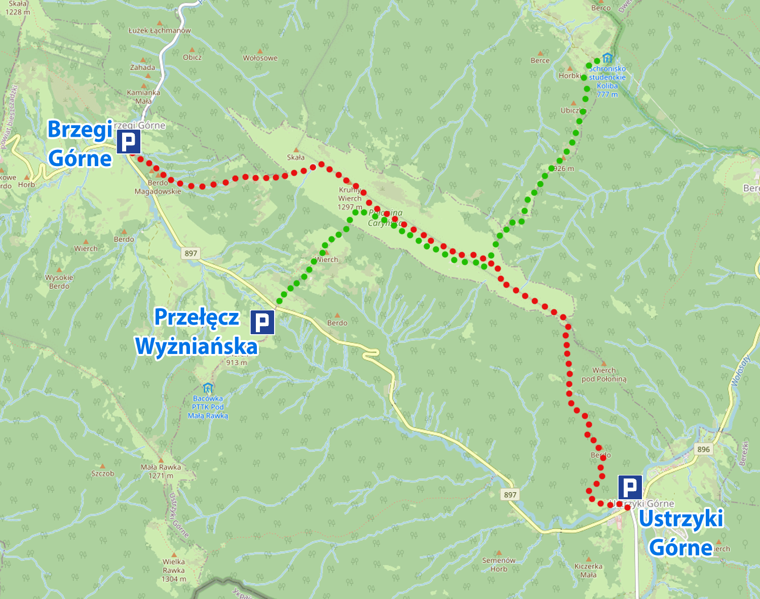
The map shows that the most convenient way to get the mountain pasture is from one of the three points, and the choice of the starting point translates into the difficulty of the trail. Each of the starting points lies at a different height, which obviously translates into the number of ascents and elevations that will have to be overcome on the way to the top of the mountain pasture.
A bit below you will find several suggestions for climbing the mountain pastures, indicating the degree of difficulty of each of them.
By analyzing the map above, you will surely notice that the routes leading to the mountain pasture are not looped. This means that it is not possible to enter the mountain pastures by one trail and return to another. You have to go in and then go back the same way, or find another way to get from the end to the beginning of the trail.
Here, private buses, popular in the Bieszczady, come to the rescue.
Połonina Caryńska - buses
Buses in the Bieszczady Mountains make visiting the mountains much easier and more enjoyable. Because they free us tourists from unnecessary driving kilometers, walking back and forth along the same trail. How does it work in practice?
In practice, it works in such a way that you first drive your car to the end of the route you have planned and leave your car there. Then you get on the bus that takes you to the beginning of the route and then, on your feet, you go back to the end, where your car is waiting.
Simple and effective.
I do not recommend the reverse order, i.e. first walking the assumed route, and then searching for a bus to return to the starting point next to the car. Buses run only when there is tourist traffic. If nothing happens, they just go home. In the second part of the day, or with little traffic, you may find that you have nothing to get back to where you started.
Therefore, it is better to first take the bus to the starting point of the hike and go back on the planned trail to the starting point.
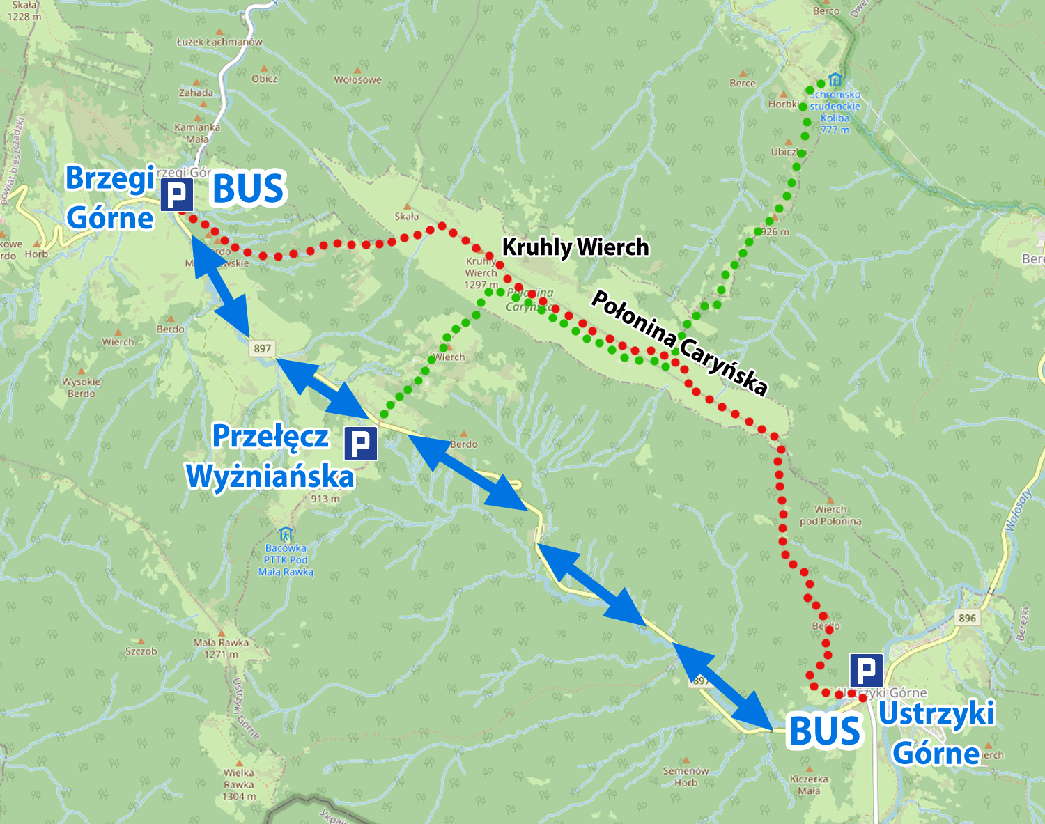
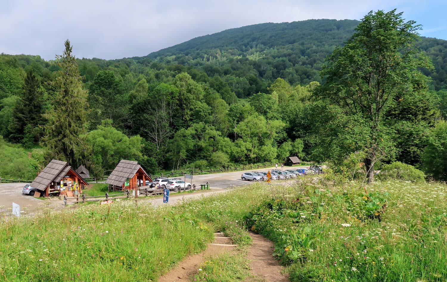
Below you will find a map of Połonina Caryńska routes, supplemented with the locations of car parks for passenger cars (letter P), bus stops (BUS) and the route of buses (blue arrows). The GPS coordinates for navigation for all car parks can be found at the end of the entry.
Do buses in Bieszczady have a timetable?
No, they do not have. They just stand and wait at the start and end stops. When enough volunteers are gathered, they just go. In high season, the buses fill up quickly and the waiting time for the course is rather short. The number of buses is usually such that everything goes quickly and efficiently. The cost of the trip per person (price from July 2020) is PLN 7.
In the case of Połonina Caryńska, buses have two final stops: Brzegi Górne (Berehy) and Ustrzyki Gorne. There is one intermediate stop between them: Wyżniańska Pass. So you can go from Brzegi Górne to the Wyżniańska Pass or Ustrzyki Górne and in the opposite direction, from Ustrzyki Górne to the Wyżniańska Pass or Brzegi Górne.
In all three places, buses have their stops right next to car parks for tourists or even in these car parks (Ustrzyki Górne).
Połonina Caryńska - hiking plans
Below I will propose three plans for climbing Połonina Caryńska with different levels of difficulty and duration. Choose for yourself the tan that suits you best, or create a new one. Regardless of the way you get to Połonina Caryńska, the views will make you forget about fatigue… it's guaranteed.
Easy trail: Wyżniańska Pass - Połonina Caryńska - Wyżniańska Pass
Walking time (both ways): 2 hours
Total approaches: 386m
Trail Length: 4 km
We start with arriving and leaving the car in the car park at the Wyżniańska Pass.
The route follows the green trail. It is the easiest and fastest option to get to Połonina Caryńska. The trail is short, but relatively steep from the very beginning. Height is gained quite quickly, so don't push the pace too much. Going above the tree line means that there are several minutes to the top of the mountain pasture. The last part of the trail is traversed along the slope of the meadow, and the effort is rewarded with beautiful views already available from this level. After reaching the ridge of Połonina Caryńska, where the green trail joins the red trail, it is worth continuing the walk (turning left into the red trail) to the summit of Połonina Caryńska (Kruhly Wierch 1297m above sea level), which is reached after another 10 minutes. From this place, the views are the most beautiful. This is where the journey ends. We are back to square one.
Medium trail: Wyżniańska Pass - Połonina Caryńska - Brzegi Górne
Walking time: 2 min 15h
Total approaches: 428m
Trail Length: 5,2 km
The variant is only a bit more difficult than the previous one, but we avoid returning the same way that we reached the top of the mountain pasture.
You start your trip by arriving at the car park in Brzegi Górne. Here you leave your car and get on the bus that goes towards Ustrzyki Górne. You get off on the way at the Wyżniańska Pass. You follow the green trail towards Połonina Caryńska. The approach is the same as for the previously described easy route. On the ridge of the mountain pasture, where the green trail crosses the yellow trail, you turn left towards Brzegi Górne and continue your march along the red trail. After about 10 minutes you will reach the highest peak of Połonina Caryńska (Kruhly Wierch 1297m above sea level).
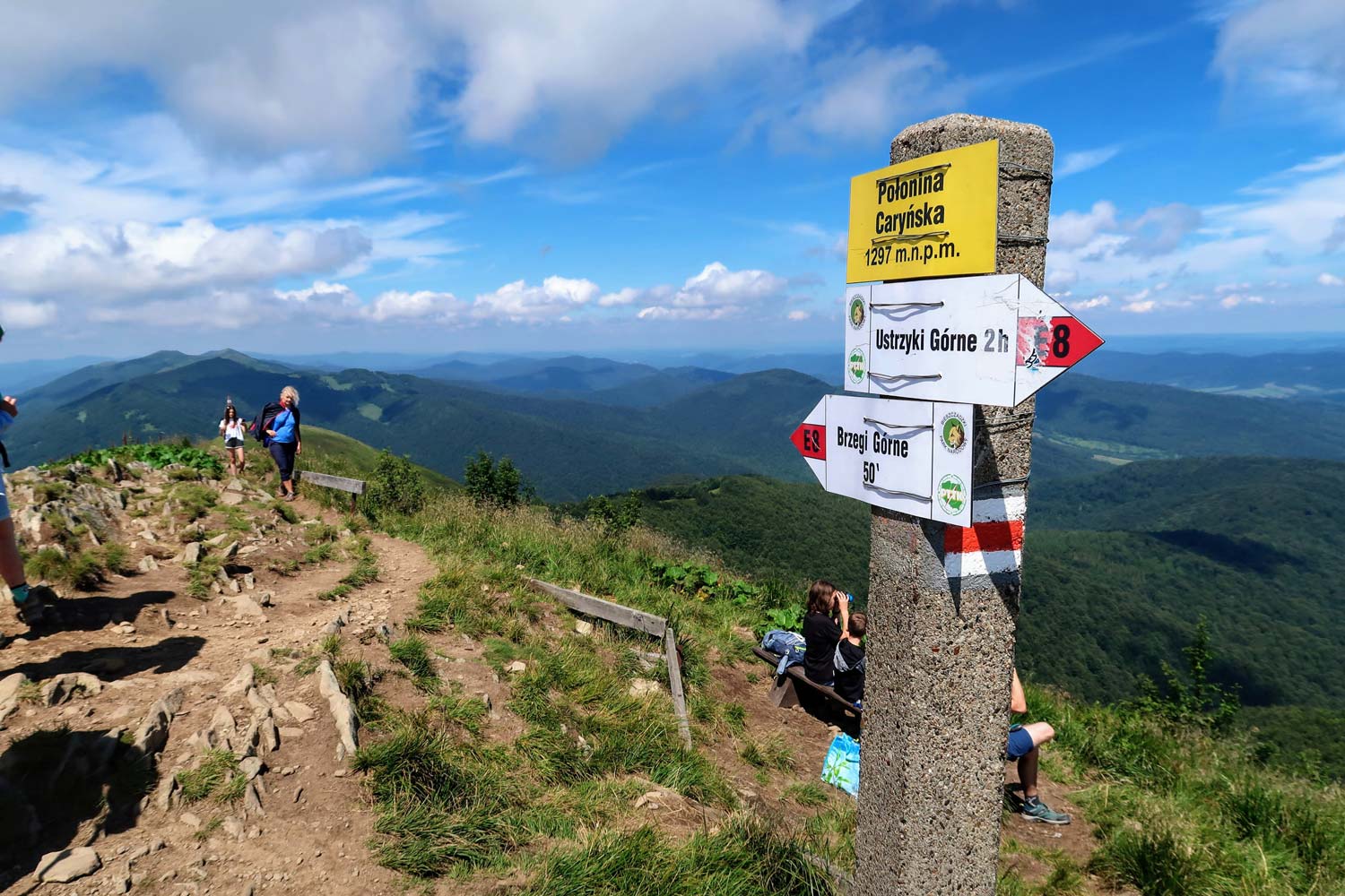
Then, just before the last climax, the red trail turns left, down. Here (on the rocks near the trail tree) it is worth stopping for a while. It is a beautiful vantage point.
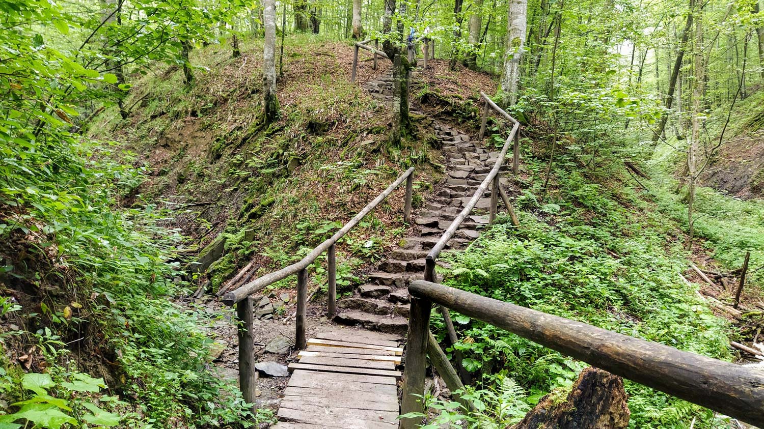
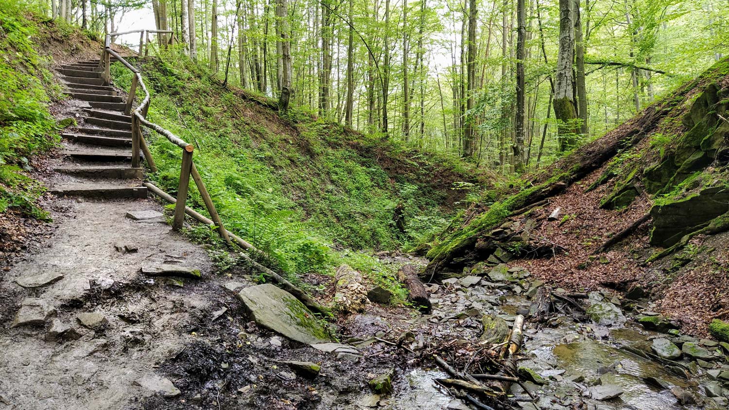
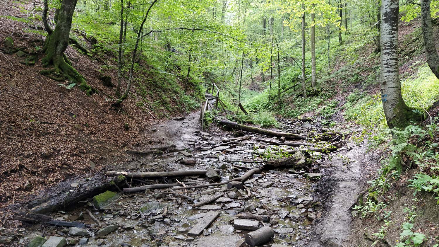
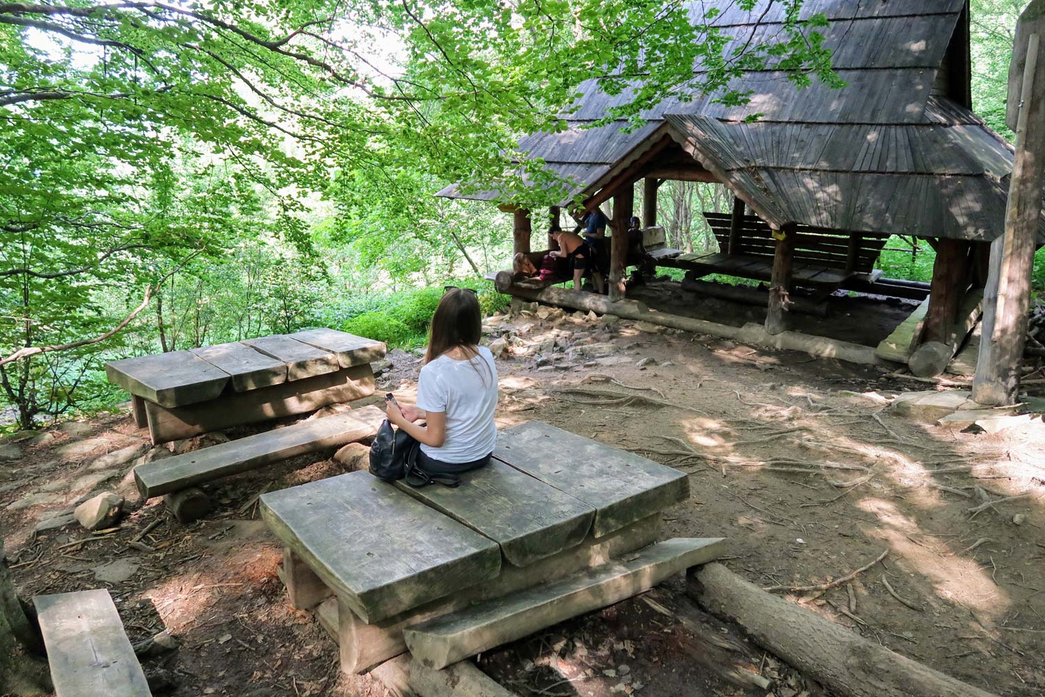
Further on, the trail goes downhill and becomes gentler with time, leading through exceptionally climatic forest nooks, colored with the sound of streams, connecting ravines and bridges flowing right next to it.
Just before the end of your trip in Brzegi Górne, to the right of the trail, you will come across an old Greek Catholic cemetery, in fact its remains. There are over a dozen tombstones and remains of the church foundation. The remaining tombstones were destroyed and used as building material in the early 60s during the construction of the Bieszczady beltway.
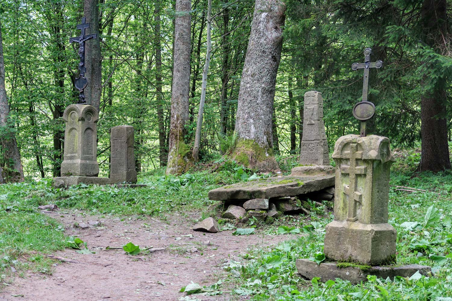
There used to be a village in this area Upper Berehy. It stretched between the Wyżnia Pass and the Wyżniańska Pass. Before World War II, it had 121 houses. After World War II, all residents were displaced to the USSR, and the buildings were destroyed.
The walk ends 200m further, in the parking lot in Brzegi Górne.
Difficult trail: Ustrzyki Górne - Połonina Caryńska - Brzegi Górne
Walking time: 3 min 30h
Total approaches: 673m
Trail Length: 9 km
To distinguish it from the other proposals, I called this trail difficult, but its level of difficulty is not very high. An adult in average physical condition will be able to overcome it easily. Younger children will find it difficult to overcome it due to the long journey time. The approaches, due to the fact that they are long and stretched, are gentler than on the previously proposed short routes.
We start our adventure in the car park in Brzegi Górne. Here you should leave the car in the parking lot for tourists and take the bus to Ustrzyki Górne.
At the car park in Ustrzyki Górne, we set off on the red trail towards Połonina Caryńska. We follow this trail along the entire length of the mountain pasture until the end of the trip in the parking lot in Brzegi Górne, where there is a car.
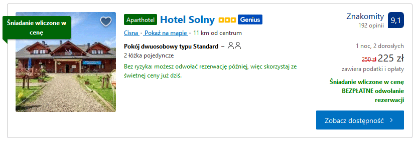
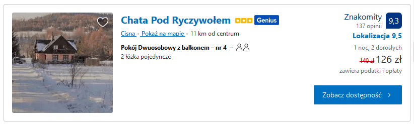
Accommodation near Połonina Caryńska
Staying overnight in the immediate vicinity of Połonina Caryńska is also a great starting point for trips to other parts of the Bieszczady Mountains. Below you will find a few proposals that I found interesting and a link to accommodation located in the Bieszczady National Park.
You should start looking for accommodation for your vacation in February. March is the peak of booking accommodation on holiday dates and interesting offers disappear very quickly. In April, only the less attractive, less situated or the most expensive ones are available.
See: accommodation in the Bieszczady Mountains (Bieszczady National Park) - [click]
Hotel Solny - [click]
Chata Pod Ryczywolem - [click]
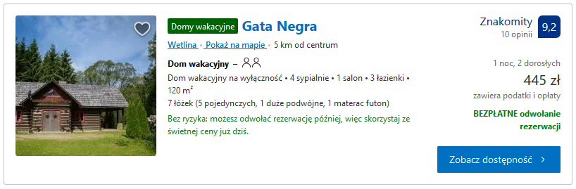
Gata Negra - [click]
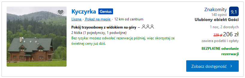
Kyczyrka - [click]
GPS coordinates of car parks at the routes to Połonina Caryńska
Parking in Brzegi Górne, GPS coordinates:
49°08’29.9″N 22°34’06.5″E
49.141650, 22.568478 - click and route
Parking at the Wyżniańska Pass, GPS coordinates:
49°07’29.8″N 22°35’29.8″E
49.124941, 22.591596 - click and route
Parking in Ustrzyki Górne, GPS coordinates:
49°06’16.8″N 22°38’47.9″E
49.104660, 22.646651 - click and route
Important to me!
Give the article a good rating (5 stars welcome 😀)!It's free, a for me it is very important! The blog lives on visits and thus has a chance to develop. Please do it and ... thank you in advance!
If you like my guides, you will certainly find the one I created useful guide catalog - [click]. There you will find ready-made ideas for your next trips, descriptions of other tourist destinations and an alphabetical list of guides divided into countries, cities, islands and geographical regions.
I also post link to Facebook profile - [click]. Come in and press "Follow"then you will not miss new, inspiring posts.
Unless you prefer Instagram. I'm not a social media demon, but you can always count on something nice to look at on my instagram profile - [click]. The profile has just been created, so for now he is starving, due to the lack of followers. He is happy to receive any observer who feeds him with his love.
I make the content I create available free of charge with copyright, and the blog survives from advertising and affiliate cooperation. So, automatic ads will be displayed in the content of the articles, and some links are affiliate links. This has no effect on the final price of the service or product, but I may earn a commission for displaying ads or following certain links. I only recommend services and products that I find good and helpful. Since the beginning of the blog's existence, I have not published any sponsored article.
Some of the readers who found the information here very helpful, sometimes ask me how you can support the blog? I do not run fundraisers or support programs (type: patronite, zrzutka or "buy coffee"). The best way is to use links. It costs you nothing, and support for the blog is self-generating.
Pozdrawiam

Still no crowds yet.
Great article, very helpful.
1. The ascent to Połonina Caryńska from the Wyżniańska Pass is not easy at all. It consists of several very steep ascents. Very steep. In winter, without handles, poles and gaiters, I definitely do not recommend it.
The route is shorter than the other two, but definitely not easy, especially in winter!
2. When it blows very strongly, especially in winter, it is worth checking the wind direction and walking with the wind (as today walking from Ustrzyki Dolne with the wind on the back than against the wind). The readable temperature at the top was today around -20C.
A very helpful article.
Great article. Very helpful, detailed but not too boring. Thorough explanation, helped me a lot when choosing the route
A very helpful article. Professionally, especially for beginners, well-described routes, beautiful photos.
Powerful article Especially the information about buses!
Great article
Thanks for the helpful articles too! I use it a lot as a beginner in the Bieszczady Mountains
Article 100% on point, helpful. Thank you and best regards.
great article