
Fuerteventura: attractions, MAP, and sightseeing plan. What to see?
If you're visiting Fuerteventura for the first time, it's worth dedicating at least seven days to the island and renting a car. I've prepared a map of attractions and a seven-day itinerary for Fuerteventura, covering the most beautiful beaches, dunes, viewpoints, towns, and the island's most important attractions. I've included a ready-made route for each day, and the map has marked all the described places, as well as key points and access roads.
Fuerteventura delights primarily with its rugged volcanic landscapes, turquoise ocean, vast beaches and the famous Corralejo dunes, but it also has less obvious places – from the mountainous interior to the wild coast of Cofete.
The itinerary is moderately intense. I personally traveled the entire route, checking the routes and collecting GPS coordinates. Therefore, if you have more time, it's worth exploring at a more leisurely pace, leaving room for sunbathing and weather-dependent excursions. I also provide GPS coordinates for parking lots and other key points in the descriptions.
Wind, space and eternal summer
For most people, Fuerteventura brings to mind simple, unified images: endless beaches of light sand, ocean breezes, surfers in wetsuits, and sprawling hotels stretching to the horizon. And that's no exaggeration… but if you stop there, you won't understand Fuerteventura. This isn't just "another Canary island" perfect for escaping a Polish winter. It's the oldest, most rugged stretch of land in the archipelago, one that has lived its own, almost desert-like rhythm for millions of years.
Before the Spanish conquistadors arrived on the island, Fuerteventura was ruled by the Majos – its original, indigenous inhabitants. They lived in two distinct kingdoms divided by a stone wall, in a harsh land where water was more precious than gold. Today, traces of their presence, ancient sacred mountains, and archaeological sites, are lost in the harsh, almost cosmic landscape of the "badlands" (from the Spanish: malpais), formed from centuries-old black and rusty lava. From this perspective, Fuerteventura doesn't resemble a green oasis; it looks more like a slice of Mars dropped into the middle of the Atlantic, where the lack of trees is completely compensated for by the interplay of light, shadow, and inspiring space.
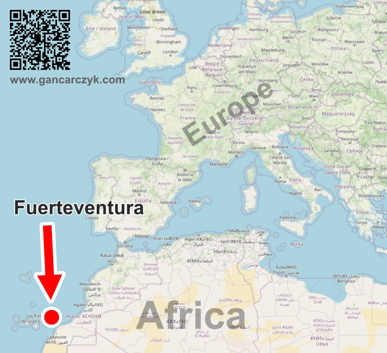
Surprisingly, many tourists don't realize that Fuerteventura is geographically almost part of Africa. It's only about 100 kilometers from the shores of the Sahara. It's from there that the hot wind from Africa (the calima) brings desert dust, which, over millennia, combined with ocean currents and crushed shells, has created the massive, shifting dunes of Corralejo. Standing atop them, it's easy to be fooled into believing you're surrounded by a true desert that suddenly ends at the ocean's edge.
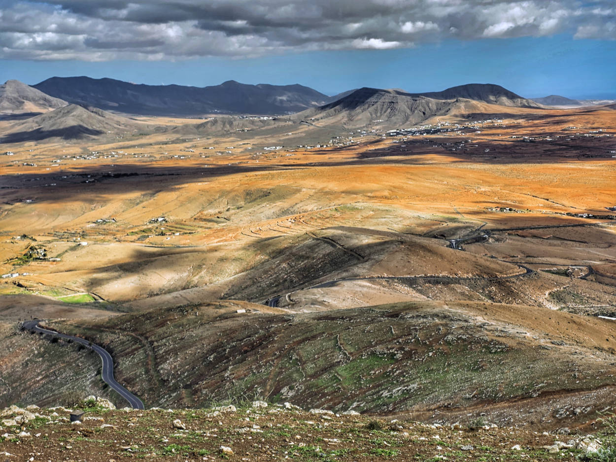
Fuerteventura will transform your sense of space and time. Those who have stayed here say that it all comes down to two things: the wind and the tranquility. Here, the wind isn't a hindrance. It's a brilliant and patient landscape architect and the reason the air has such a unique sharpness. The second ingredient is the absolute lack of rush. In Fuerteventura, the concept of time has a different meaning. The locals and the goats (of which there are almost as many as people) know perfectly well that you can't beat nature, so it's best to simply adapt to its pace. A watch and phone notifications cease to have any meaning.
Fuerteventura is much more diverse than you might think after looking at a few photos online. The north, with its volcanic cones, the artistic village of Lajares, and atmospheric El Cotillo, is a stark contrast to the wild, inaccessible south and the Jandía Peninsula, where gravel roads reign supreme, and Cofete beach is so isolated and imposing that standing on the shore feels like the end of the world. Between them lies the mountainous, deserted center of the island, with its oldest towns (like Betancuria, the island's first capital), where white houses contrast with the rust-colored rocks and palm trees proudly standing in the valleys.
Add to that the delicious local cuisine. In small taverns, you can sample the famous Queso Majorero (a traditional goat cheese from Fuerteventura), freshly caught fish, and papas arrugadas (small Canarian potatoes cooked in very salty water), served with distinctive sauces like mojo picón (a spicy red pepper sauce) and mojo verde (a milder cilantro-garlic sauce).
I've created this guide to organize this vast expanse and help you plan the perfect trip. I'll not only point out the most picture-perfect spots, but also lead you to wild viewpoints, hidden caves, and atmospheric towns. I'll try to plan the route so that each day brings new experiences: one day relaxing on golden sand, another a thrilling drive along a winding mountain road, another a walk across volcanic dunes.
I hope it will be more than just a collection of practical information for you. I hope it will become an invitation to experience the freedom that this extraordinary, windy island offers. Let this space and the wind be your guide to the island and, later, to the wonderful memories you will have in Fuerteventura.
Are you ready to head to the wildest of the Canary Islands?
Where is Fuerteventura and what is it like?
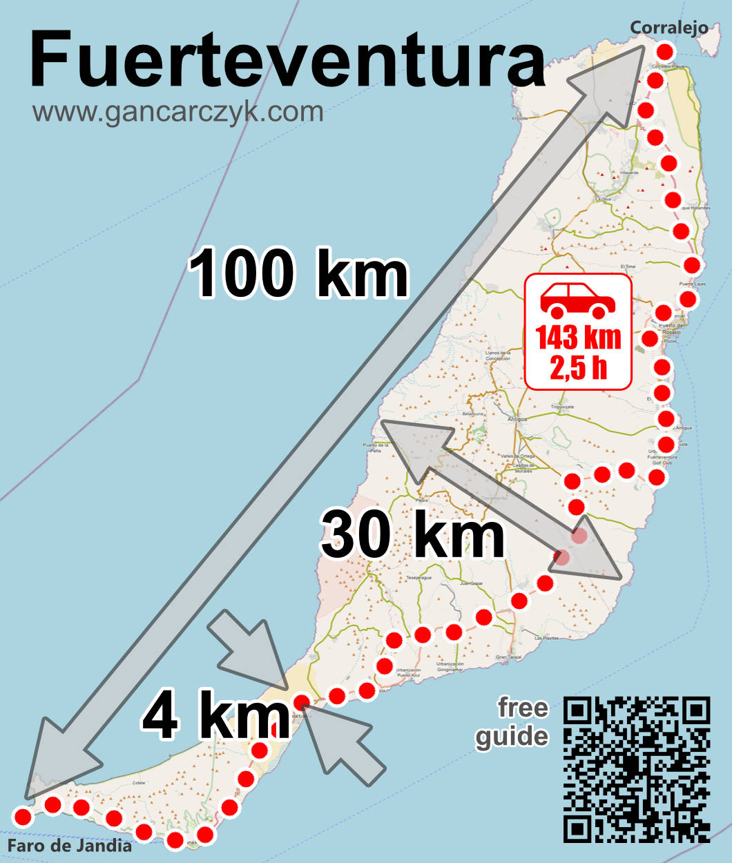
Fuerteventura lies in the Atlantic, somewhat isolated on the eastern edge of the Canary Islands archipelago. It's close enough to continental Europe that a direct flight from Poland takes just over five hours, and close enough to Africa to feel the desert heat upon landing. It's the second largest Canary Island (second only to Tenerife), but in terms of space and open horizons, it feels much larger. At over 1660 km², it's almost twice the size of neighboring Lanzarote, stretching over 100 kilometers from north to south.
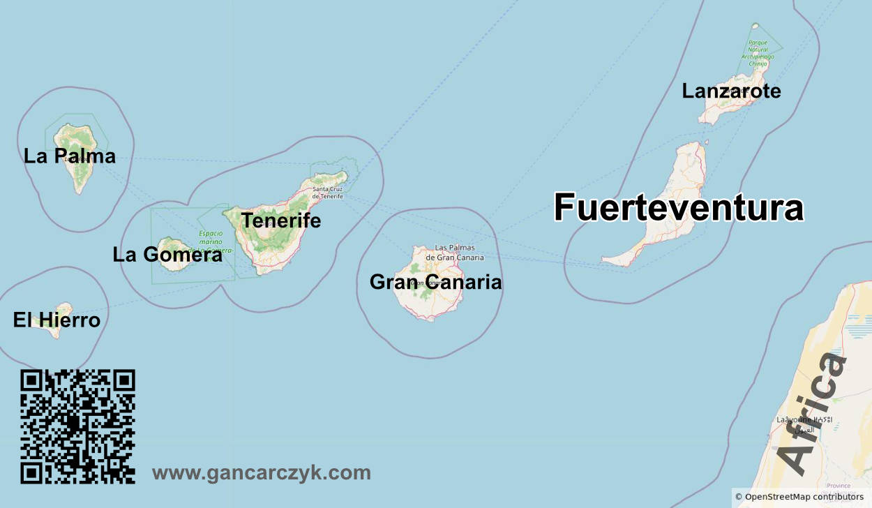
The closest neighbors in the archipelago are within easy reach: from the northern tip of the island you can see the tiny Isla de Lobos and the shores of Lanzarote, which you can reach by ferry in just half an hour.
The island lies directly in the path of the Atlantic trade winds, the constant winds that blow from the northeast. This explains why the locals consider the wind an integral part of the landscape: without it, the heat from the nearby Sahara would be unbearable, and surfers from around the world would have no reason to come here.
The island's coastline stretches over 340 kilometers, of which a whopping 150 kilometers are sandy beaches, ranging from fine, golden sand drawn from the desert, through several kilometers of shallow waters ideal for wading, to black, volcanic bays and caves carved by the Atlantic waves. The island's interior is a world apart, dominated by extinct volcanic cones and sandy valleys. The country is rugged and relatively flat compared to neighboring islands. The highest peak, Pico de la Zarza on the Jandía Peninsula, reaches a modest 807 meters above sea level, but the view from the summit over the unspoiled Cofete beach is breathtaking.
Curiosity
Fuerteventura is geologically the oldest of the Canary Islands. The first volcanic rocks began forming here over 20 million years ago. Over millions of years, wind, ocean, and massive landslides have almost completely eroded the former, towering volcanoes, leaving behind a remarkable landscape of gentle, smooth hills. Originally, some of these volcanoes may have reached heights of around 3000 meters.
Weather in Fuerteventura
Climate-wise, Fuerteventura is an island of eternal spring and summer. Rainfall is rare, the sun shines for over 300 days a year, and the seasons blur so much that locals rarely change their winter wardrobes. It's not without reason that it's said to be one of the most weather-stable places in all of Europe.
Spring
Spring in Fuerteventura is the perfect time for those looking to shake off the winter blues. It's pleasantly warm, with temperatures around 21-24°C in the shade. The ocean water takes a while to warm up after winter (in March and April it's around 18-19°C, reaching 20°C in May), but the sun is already intense. It's the perfect time to explore the island's interior, hike volcanoes, and soak up the first stress-free sunbathing session, as rainfall is virtually non-existent.
On average, in spring we have 1-2 rainy days per month.
Lato
Summers on the island are warm but rarely oppressive, thanks to the soothing winds. Daytime temperatures hover around 26-29°C, although during the Calima (hot wind from the Sahara), they can rise above 35°C for two or three days. The raging trade winds in July and August are a paradise for windsurfers and kitesurfers. The ocean reaches its most pleasant temperature of the year (22-23°C), and the sky remains cloudless for weeks.
On average, there is virtually no rainfall in summer (0-1 rainy day).
Autumn
Autumn (especially September and October) is considered by many to be the best time to visit. The winds die down slightly, the air remains at 25-28°C, and the Atlantic, warmed by the summer, maintains its highest temperature (22-24°C). It's a perfect time for swimming, leisurely exploring the island without the heat, and watching sunsets without the gusts.
On average, in autumn we have 2-3 rainy days per month.
Winter
To someone from Poland, winter in Fuerteventura looks like a beautiful Polish summer. In December, January, and February, the mercury regularly reaches 20-22°C during the day, and in sheltered areas, you can easily sunbathe. The ocean water temperature is around 18-19°C. Rain, when it does occur, is usually short, refreshing. For us, winter turned out to be the perfect time. The temperature was perfect for sightseeing.
On average in winter we have 3-4 rainy days per month.
How to visit Fuerteventura?
In my opinion, there's only one truly viable option in Fuerteventura: a rental car . You can also explore parts of the island by bus, and you'll find more details below.
Public transport
Fuerteventura has a network of local buses (called guaguas) that run between the main towns and resorts. These buses will take you from the airport to Puerto del Rosario, Corralejo, and Morro Jable. Unfortunately, while traveling north-south is feasible, reaching the largest and most beautiful attractions (wild beaches, mountain viewpoints, and attractions on the Jandía Peninsula) by public transport is very difficult, if not impossible.
In this guide, I won't focus or stubbornly pursue public transportation. I simply don't intend to forgo the most beautiful attractions. However, if you'd like to explore the island's public transportation for yourself, start with the largest carrier. Tiadhe and its bus network – [click]
Rented car
In Fuerteventura, a car is the key to experiencing that famous, windy freedom. It means you're not limited to staying in expensive, noisy resorts right next to the bus stops. You can choose the location that suits you best. Every other corner of the island is quickly accessible by car.
Fuerteventura has a well-developed rental network and is one of the places where renting a car is exceptionally easy and relatively inexpensive (especially outside of peak season). Importantly, the Canary Islands rental market is renowned for its exceptionally transparent and stress-free conditions. The most convenient way is to simply pick up your car directly at the airport upon arrival. Right in front of the terminal is a huge parking lot, where all the rental companies have their cars. Nowhere else has this been so easy for me as in Fuerteventura. You get off the plane, collect your suitcase, then get your keys in the main hall of the terminal, walk 50 meters across the street, and there you have your car in the parking lot.
So I've prepared a special, short guide to safely renting a car in Fuerteventura – [click] . With my guide, renting a car isn't difficult or complicated, and it's also very safe (no deposit required or comprehensive insurance required). You just need to know what to look for! I encourage you to read it.
Accommodation in Fuerteventura
Fuerteventura thrives on tourism, so it boasts an excellent and diverse range of accommodations, from sprawling beachfront resorts to intimate apartments in surf towns, and traditional country houses (casas rurales) inland. However, sifting through hundreds of offers can be time-consuming. I've decided to make a significant improvement here. I'll include helpful links in the descriptions of individual areas and attractions to make your search as easy as possible. I've designed these links to include pre-defined filters: they only present offers from the region you're interested in and immediately eliminate destinations that are unnecessarily far away. It's worth starting your search with these links, as they can save you a lot of time and frustration.
If you find a link to a specific hotel or apartment in the descriptions, don't treat it as the only accommodation option I absolutely recommend. This way, I simply use the search engine's mechanism, which always displays other, very similar options in the same area, often at even more attractive prices, next to a specific property. This is a brilliant way to avoid constantly entering dates and refilling forms. With a single click, you get a ready-made, curated list of interesting places in that specific location.
Prices in Fuerteventura
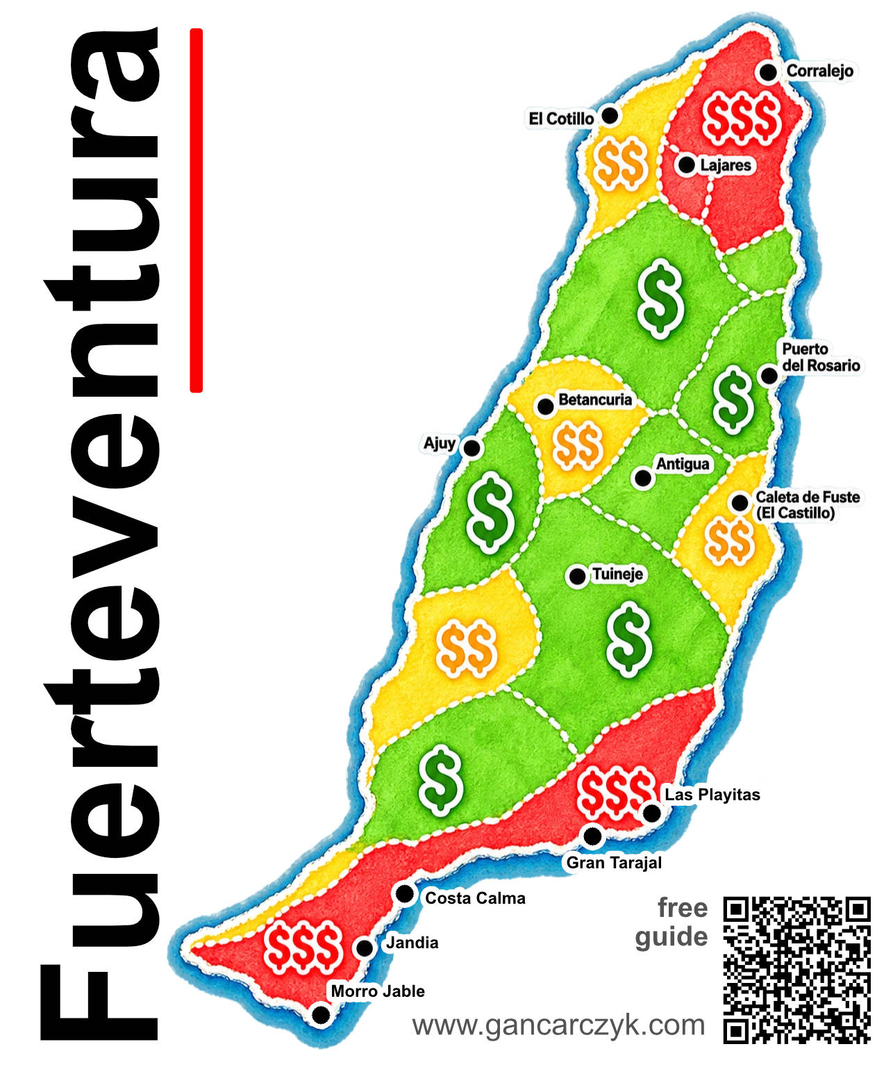
Here's a map that's proving quite popular. It quickly and clearly explains a crucial aspect of travel planning: where prices are higher and where they're cheaper. The map is, of course, for illustrative purposes only, and when using it, always remember that each of these zones will have exceptions, with prices that deviate significantly from the average.
This means that even in the $$$ zone, you can find a nice hotel for $$ if you search early and thoroughly. Conversely, if you're looking for luxury for $$$ in the $ zone, you'll probably find it too.
$$$ Zone
The most popular resorts, fashionable towns and beach giants (Corralejo, Lajares, Costa Calma, Morro Jable).
This is the zone most sought after by tourists, surfers and people looking for hotel resorts with direct access to the ocean.
For example: a set of two sun loungers and an umbrella on the beaches in Morro Jable or Costa Calma costs around €12-15 per day.
Hotels and resorts in high season : prices start at around €120-200 per night in good-quality properties, and in exclusive complexes reach €300 and more. A meal at a beachfront or city center restaurant: a main course (e.g., fresh fish or seafood) with a glass of wine costs around €25-40 per person. Prices are much cheaper in the off-season.
$$ Zone
Small towns, west coast and the heart of the island (El Cotillo, Betancuria)
In towns with a more local feel and atmosphere, prices are moderate: for example, the local dish papas arrugadas with sauces costs around €4-6, and a coffee in a café €1,20-1,80. A meal in a local restaurant/bistro: ~€15-25 per person.
Mid-range apartment or hotel (in high season): usually between €70-130 per night, depending on the distance to the beach.
filter link: accommodation near El Cotillo – [show accommodation]
filter link: accommodation near Betancuria – [show accommodation]
$ Zone
The province, interior and less touristy coast (Puerto del Rosario, Ajuy)
Inland and in the capital, there are significantly fewer tourists, and daily life there goes on at its own pace, almost untouched by mass tourism. In such places, prices drop noticeably.
Lunch at a traditional Canarian tasca (local restaurant): a filling daily menu (menú del día) or traditional goat stews will cost around €10-15 per person.
Accommodation in agritourism farms, apartments or country houses (casas rurales): outside the peak season, you can find accommodation from €40-60 per night.
filter link: accommodation near Ajuy – [show accommodation]
Cheap flights
Below, you'll find a tool I created that looks like a regular search engine, but is actually really fast and clever. It allows you to instantly check flight prices to your destination.One click on the "OK" button without entering anything, you can check the current prices of airline tickets from all airports in the country (Poland is entered by default). The form works in real time and immediately generates current call prices! If you want to check connections from another country (or city), simply enter its name in the box. Later (if the list proves interesting), you can modify the search parameters on the landing page (starting city, dates, currency, language, etc.). The search engine works on all devices (phone, computer, tablet) and automatically adjusts functionality to the device type and screen size.
The landing page is probably the world's largest airline ticket comparison and search engine: Skyscanner
The website works in 24 languages and if it opens in a language other than your preferred one, simply switch it (in the menu or the globe icon in the upper right corner).
Travel Insurance (Is It Necessary?)
I don't want to spend too much time on this topic, so I'll be really specific. I'll be brief: I never leave home on a trip alone without insurance. On a trip we are constantly moving to new places, our heads are occupied with delights and other pleasures. We are more relaxed and it is not difficult to have an adventure. Lack of insurance is asking for serious trouble.It is also worth remembering that the so-called EHIC, i.e. the insurance that we have as citizens of the European Union, does not reimburse everything. It only reimburses what is reimbursed in a given country (e.g. in France, 35% of the costs of state rescue services are paid out of pocket). We could go into details for a long time, but doing so is pointless, because a solid weekly insurance for one person in Europe, compared to the cost of the entire trip it's surprisingly cheap. You can easily find really good deals for around 10-15 EUR total for the whole week (!!!), which is the equivalent of two or three beers.
I usually look for the best deals in this area offer comparison - [click] (in this case it's Rankomat) and I buy them online. You can do it really quickly and cheaply.
Below is an example of a good and not at all the cheapest offer from a price comparison site (for an entire week in 2025).

Two parameters are key in the offers:
- goat goat (KL) - the minimum amount is PLN 250 (EUR 000)
- Civil protection (OC) - the minimum amount is PLN 250 (EUR 000)
it is worth paying attention to two additional parameters:
- Consequences of Accidents (NNW) - at your discretion
- travel luggage insurance - at your discretion
Fuerteventura - map of attractions
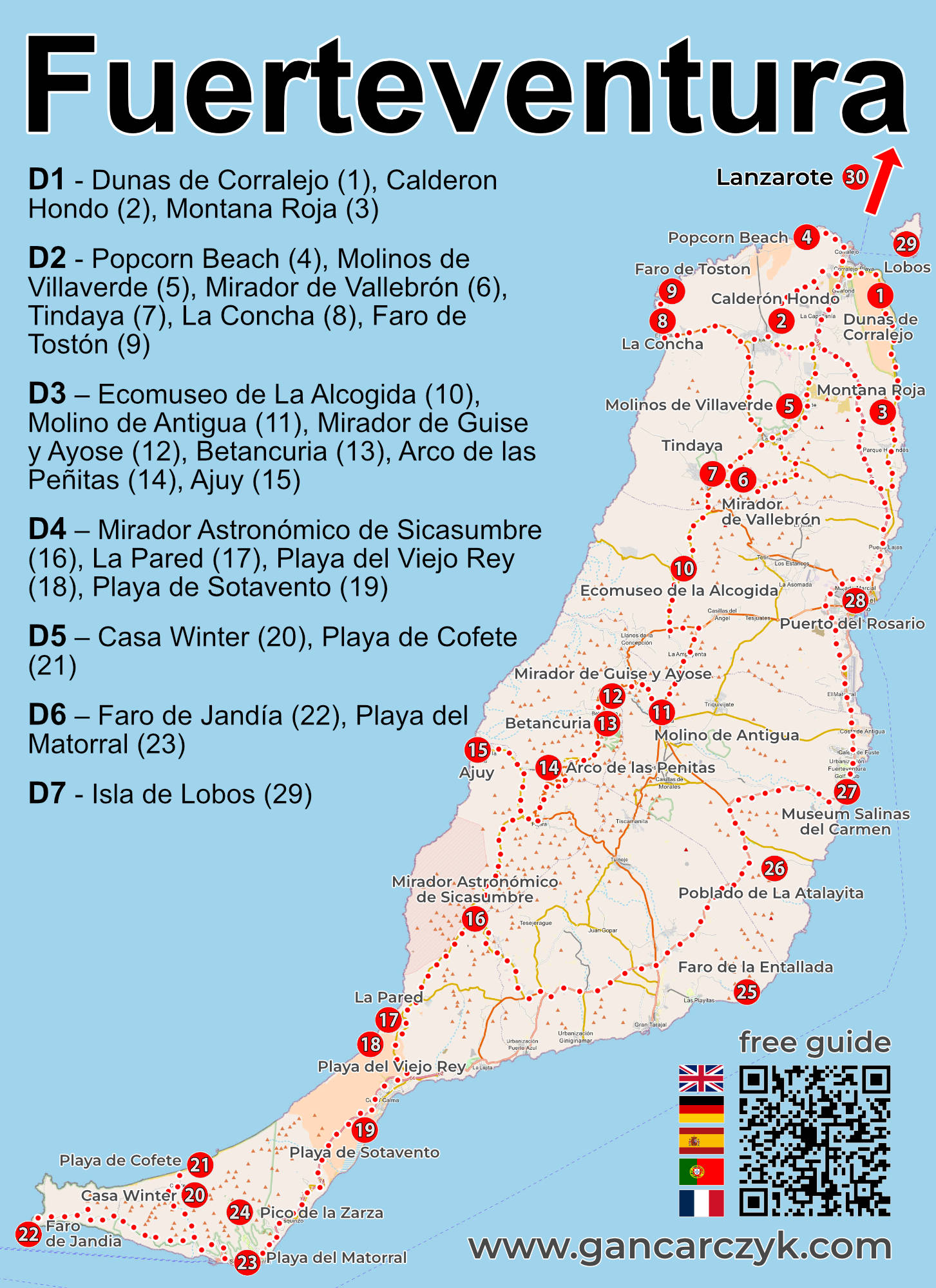
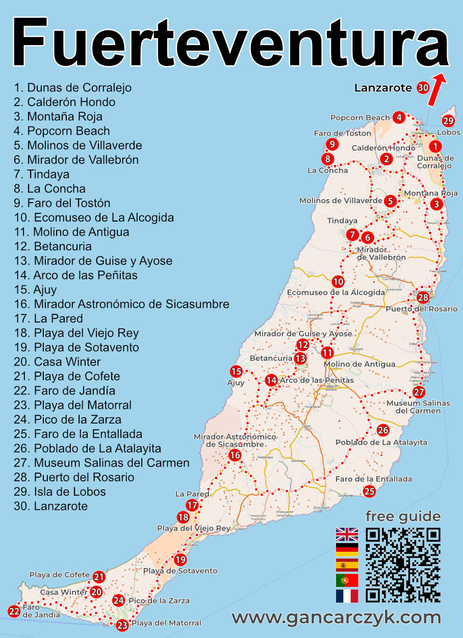
The map below is the most important part of this post. It's the basis of the entire sightseeing plan and will be the main tool we use together. I've marked the locations of all 30 attractions on the island I've described, as well as the route for the Fuerteventura road trip.
I suggest you first take a closer look at the map and check the locations of the places you're most interested in. Clicking on the map will open a higher-resolution image.
Tip:
If you lose your map, don't worry! You don't have to remember any pages!
Type in Google: Fuerteventura gancarczyk
I'll show up first! It always works!
(for other fields as well)
The organization of this article will make it easier for you to use the map (even outdoors) and create your own itinerary. Each attraction has a unique number (from 1 for the Dunas de Corralejo to 30 for the trip to Lanzarote). You'll also find this number in the table of contents at the beginning of the guide and in the chapter headings related to the more detailed descriptions of individual places. Each attraction I've mentioned has its own description later in the text, providing more details, interesting facts, and very useful GPS coordinates for important locations and parking lots. Navigation coordinates make it easy to reach your destination without stress. Use this data! They're incredibly simple: just click the link next to them, and your phone's navigation will automatically launch and calculate your route (just remember to switch between walking and driving modes if necessary).
Fuerteventura sightseeing plan
I've divided my Fuerteventura itinerary into 7 days (including one day off). Most tourists visit the island for a week, but it's often impossible to fully utilize this time. Flight schedules vary. It may be that the first or last day simply can't be used effectively due to a late arrival or early departure. Hence, I decided to divide my itinerary into 6 active days + 1 free day, rather than 7 days. This approach isn't a problem, as 6 active days for exploring Fuerteventura is still quite a lot of time. Logical planning will give you plenty of time for everything: sightseeing, relaxation, exploration, walks, beach time, and pleasant evenings watching the sunset.
Everything is visible on the map I've prepared. Before reading further, take a closer look at it and analyze it carefully. It will tell you more than any description could, and it will be useful for better understanding my commentary below.
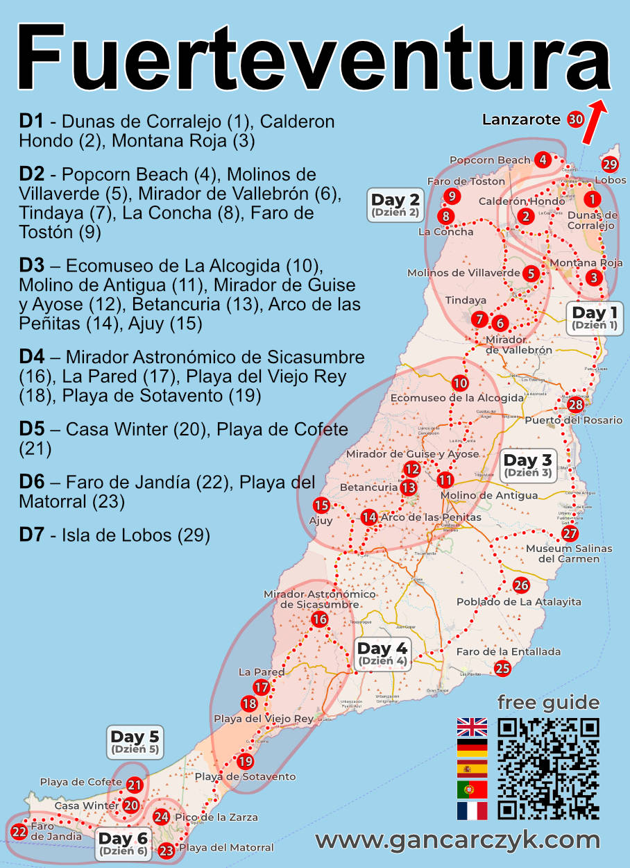
My itinerary begins in Corralejo (1). It's statistically the most popular town on the island, but don't worry if you plan to stay overnight elsewhere. The itinerary is divided into separate days, and each day is a self-contained segment that can be completed in any order. You can also skip a day entirely, and it still won't affect the rest of the itinerary. Using my suggestion, you can build your sightseeing like building blocks, creating your own unique trip with ease.
Looking at the elongated shape of the island, the question immediately arises: is it possible to implement the entire plan (i.e. without moving during your stay) by living all the time at one end of it (e.g. in the north in Corralejo)?
My answer is: Yes! It's possible, and it's not terribly tiring. I deliberately tested this out myself. I assumed I'd live in Corralejo and explore the entire island from there. So, if you like having a permanent base and don't like moving during a single trip, this option is definitely possible. Another selling point is that Corralejo has ferries to Lanzarote and Lobos. So, you have additional options at your fingertips.
Taking advantage of these opportunities, we organized an additional trip to Lanzarote. I bought the ferry ticket online (for 2 people + a car) at Direct Ferries [click] We sailed to Lanzarote with our rental car. The car fee wasn't that high, so it was more cost-effective to take the car we had in Fuerteventura than rent a new one on Lanzarote. Besides, taking your own car saves a lot of time. Once you arrive on the island, you simply disembark the ferry and are on your way, without wasting time getting to the rental company and picking up and returning the car. Before you go ahead with this idea, be sure to check whether the rental company you choose allows you to take their car on the ferry. The most popular rental company on the island, Cicar, doesn't have a problem with this, and its customers can often even count on discounts from ferry operators (e.g., Fred. Olsen or Líneas Armas). In either case, simply inform the rental company when renting a car.
If I were planning a trip just for myself, I'd probably do it a bit differently. I'd split the trip into two halves, renting accommodation in the north of the island for one part, like Corralejo or El Cotillo , and then moving to the south, like Morro Jable or Costa Calma , and completing my sightseeing from there. A single move (i.e., carrying one suitcase) isn't tiring or time-consuming, and moving from one side of the island to the other would allow me to easily complete the sightseeing itinerary I've marked on the map as Day 4.
Fuerteventura 7-day sightseeing plan – day by day
Day 1 – Dunas de Corralejo (1), Calderon Hondo (2), Montana Roja (3)
Transit route: Corralejo (1) – Dunas de Corralejo (1) – Calderón Hondo (2) – Montaña Roja (3) – Corralejo (1)
Length of the ride: approx. 55 km
Driving time (without breaks and time for sightseeing): approx. 1 hour 15 minutes
filter link: accommodation near Corralejo – [show accommodation]
I suggest spending the first day gently immersing yourself in Fuerteventura and experiencing its unique landscape for the first time. We start just outside Corralejo, in the Corralejo Dunas Natural Park (1). This incredible stretch of golden dunes offers a breathtaking view. Walking along the powdery sand, where the wind carves different patterns every time, instantly takes you away from the daily grind. And I encourage you to stop rushing right away. There's plenty of time, and you can spend it on the dunes.
From the dunes, we head inland to the town of Lajares, where we begin an easy and very pleasant trek to the Calderon Hondo volcano (2). The walk along the well-maintained path to the crater rim takes only a few dozen minutes, and the view from the summit of the volcano's perfectly preserved interior and the northern coast is truly impressive.
At the end of the day, we return to the Corralejo area for a closer look at the volcanic cone of Montana Roja (3). In the warm afternoon sunlight, the rusty and red hues of the rocks look incredibly photogenic, perfectly punctuating our first day on the island.
Day 2 – Popcorn Beach (4), Molinos de Villaverde (5), Mirador de Vallebrón (6), Tindaya (7), La Concha (8), Faro de Tostón (9)
Transit route: Corralejo (1) – Popcorn Beach (4) – Molinos de Villaverde (5) – Mirador de Vallebrón (6) – Tindaya (7) – La Concha (8) – Faro de Tostón (9) – Corralejo (1)
Length of the ride: approx. 95 km
Driving time (without breaks and time for sightseeing): approx. 2 hour 15 minutes
filter link: accommodation near El Cotillo – [show accommodation]
Day two is a trip full of unusual natural wonders, traditions, and views along the northwest coast. We begin with a visit to the famous Popcorn Beach (4), where instead of ordinary sand, the shore is covered with white fossilized algae (rhodolites), resembling popcorn.
From there, we head into the interior of the island. In the town of Villaverde, we stop at the Molinos de Villaverde (5), traditional windmills that recall the island's ancient agricultural history, when Fuerteventura was known as the Canary Islands' granary. Next, we climb a winding road to the Mirador de Vallebrón viewpoint (6), offering a sweeping panorama of the desert valleys. A few kilometers further on, we arrive at Tindaya (7), the sacred mountain of the island's ancient inhabitants (Majos). Its austere, solitary silhouette still commands respect.
Next, we move on to the atmospheric town of El Cotillo. We relax at La Concha Beach (8), famous for its natural rocky reefs that create calm pools of crystalline water. It's perfect for safe swimming. We end the day at the Faro de Tostón Lighthouse (9), where ocean waves crash against the black volcanic rocks and the sunset is spectacular.
Day 3 – Ecomuseo de La Alcogida (10), Molino de Antigua (11), Mirador de Guise y Ayose (12), Betancuria (13), Arco de las Peñitas (14), Ajuy (15)
Transit route: Corralejo (1) – Ecomuseo de La Alcogida (10) – Molino de Antigua (11) – Mirador de Guise y Ayose (12) – Betancuria (13) – Arco de las Peñitas (14) – Ajuy (15) – Corralejo (1)
Length of the ride: approx. 165 km
Driving time (without breaks and time for sightseeing): approx. 3 hour 10 minutes
filter link: accommodation near Betancuria – [show accommodation]
The third day takes us through the historic heart of the island and the western cliffs. We begin our introduction to the ancient culture at the Ecomuseo de La Alcogida (10) in Tefía. This restored traditional village offers a glimpse into daily life on the island before the advent of tourism. Next, we visit Molino de Antigua (11), where a cactus garden has been built around a majestic windmill and a local produce store.
Entering the mountainous interior, we stop at viewpoints, the most iconic of which is the Mirador de Guise y Ayose (12), with its massive bronze statues of two former kings of Fuerteventura. A little further on lies Betancuria (13), the island's first capital, a charming town with white buildings, a historic church, and a lush palm tree nestled among rust-colored rocks.
For those who enjoy light trekking, the next stop is a trip to Arco de las Peñitas (14) – an impressive natural rock arch hidden in a rugged canyon.
We end the day in the small settlement of Ajuy (15) on the west coast. Here, a black volcanic beach awaits, followed by a path along the cliffs leading to gigantic ocean caves where the water roars with incredible force.
Day 4 – Mirador Astronómico de Sicasumbre (16), La Pared (17), Playa del Viejo Rey (18), Playa de Sotavento (19)
Transit route: Corralejo (1) – Mirador Astronómico de Sicasumbre (16) – La Pared (17) – Playa del Viejo Rey (18) – Playa de Sotavento (19) – Corralejo (1)
Length of the ride: approx. 205 km
Driving time (without breaks and time for sightseeing): approx. 3 hour 20 minutes
Day four sees us hop south and explore the isthmus connecting the mainland with the Jandía Peninsula. We begin at the mountain viewpoint Mirador Astronómico de Sicasumbre (16), the perfect spot to admire the rolling desert landscape (and the starry sky at night).
Exploring the west coast, we reach La Pared (17) and the adjacent Playa del Viejo Rey (18). These rugged, windy areas boast powerful waves, where the ocean's power clashes with dark cliffs. This spot is beloved by surfers and those seeking untamed views.
From the rugged west, we move to the eastern side of the island's narrow isthmus, to an absolute gem: Playa de Sotavento (19). This gigantic beach, several kilometers long, shallows at low tide, creating a turquoise lagoon. Walking through the warm waters while watching the colorful sails of kitesurfers is one of the most relaxing experiences in all of Fuerteventura.
Day 5 – Casa Winter (20), Playa de Cofete (21)
Transit route: Corralejo (1) – Casa Winter (20) – Playa de Cofete (21) – Corralejo (1)
Length of the ride: approx. 280 km
Driving time (without breaks and time for sightseeing): approx. 5 hour 00 minutes
This will be the most spectacular, yet also the most demanding driving day. We descend to the very tip of the Jandía Peninsula, where the paved road gives way to a winding gravel trail stretching over sheer cliffs. Our destination is the legendary Playa de Cofete (21). This gigantic, 12-kilometer-long beach, surrounded by the island's highest mountain ranges, feels completely cut off from civilization. The roaring ocean, foaming waves, and vast expanse create a landscape that will forever be etched in the memory. In this desolate setting, we find the mysterious Casa Winter (20), a solitary villa built in the 40s by German engineer Gustav Winter. Many legends surround the house (including tales of a secret submarine base), which, combined with the wild surroundings, give this place a slightly mysterious atmosphere.
Day 6 – Faro de Jandía (22), Playa del Matorral (23)
Transit route: Corralejo (1) – Faro de Jandía (22) – Playa del Matorral (23) – Corralejo (1)
Length of the ride: approx. 240 km
Driving time (without breaks and time for sightseeing): approx. 3 hour 30 minutes
The last day of the basic itinerary is dedicated to the south coast and some well-deserved relaxation after a busy week. We reach the island's most southwestern tip, where the Faro de Jandía lighthouse (22) stands. This is the point where the ocean waters from both sides of the peninsula collide, creating spectacular "angel wings" of sea foam.
Next, we return to the atmospheric resort of Morro Jable and head for the expansive Playa del Matorral (23). Famous for its golden sand, distinctive lighthouse situated just offshore, and protected salt flats (Salar de Matorral), it's the perfect place for a leisurely stroll, a safe swim in the ocean, and lunch at one of the fish restaurants in Morro Jable's old town.
Day 7 – Reserve and Optional Attractions
If you have extra time, a flexible flight schedule, or simply want to expand your sightseeing plan, take a look at attractions numbered 24 to 30. I haven't included them in the main plan precisely so that they can serve as a supplement and alternative for those who want to spend their time differently than what I've suggested.
I especially recommend the idea of a trip to Lanzarote (30) or a shorter trip to the island of Lobos (29), which can be explored on foot.
Descriptions of attractions in Fuerteventura
1. Dunas de Corralejo
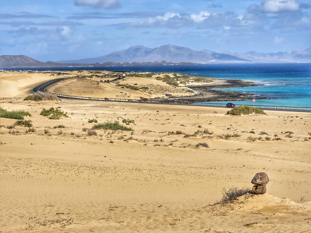
The ocean's silence is broken only by the steady roar of the trade winds, shifting sand particles from place to place. The landscape of Corralejo Natural Park on the northeastern coast of Fuerteventura is deceptively reminiscent of the heart of a sandy desert, yet just a few steps away, you can immerse your feet in the turquoise waters of the Atlantic Ocean. Contrary to popular belief, the sand didn't all drift here on the crest of the wind from the Sahara, less than a hundred kilometers away. The local erg is composed of, among other things, powdered crustacean shells, sea snail shells, and the skeletons of organisms living in the ocean depths, deposited on the shore by sea currents over hundreds of thousands of years.
It was here that the French navigator Gadifer de la Salle landed during his Norman expedition in 1402, marking the beginning of the European conquest of the island.
The rugged, almost cosmic terrain earned the 2600-hectare area a nature reserve status, and it also attracts Hollywood filmmakers these days. The dusty roads and sandy hills served as a Middle Eastern desert setting in the big-budget film Wonder Woman 1984, for which an entire settlement was built of clay and reeds amid the dunes.
Interesting facts
The sand of the dunes is almost entirely organic (so-called organogenic sand), formed from ground-up marine shells, which is why the dunes do not heat up as much under the influence of the sun as desert quartz.
The asphalt FV-1 road, which runs through the center of the nature park, is scheduled to be completely closed to traffic and dismantled in the future to restore the dunes' natural, uninterrupted movement. Currently, for several kilometers along the road, there are numerous wide shoulder areas used for parking. Finding a free space shouldn't be a problem. Parking is free.
Dunas de Corralejo Natural Park is open and accessible 24/7. Admission is free. There are no gates or ticket offices.
One of the large parking lots by the dune, GPS coordinates:
28°40’17.6″N 13°50’00.6″W
28.671545, -13.833507 - click and route
2. Calderon Hondo Volcano
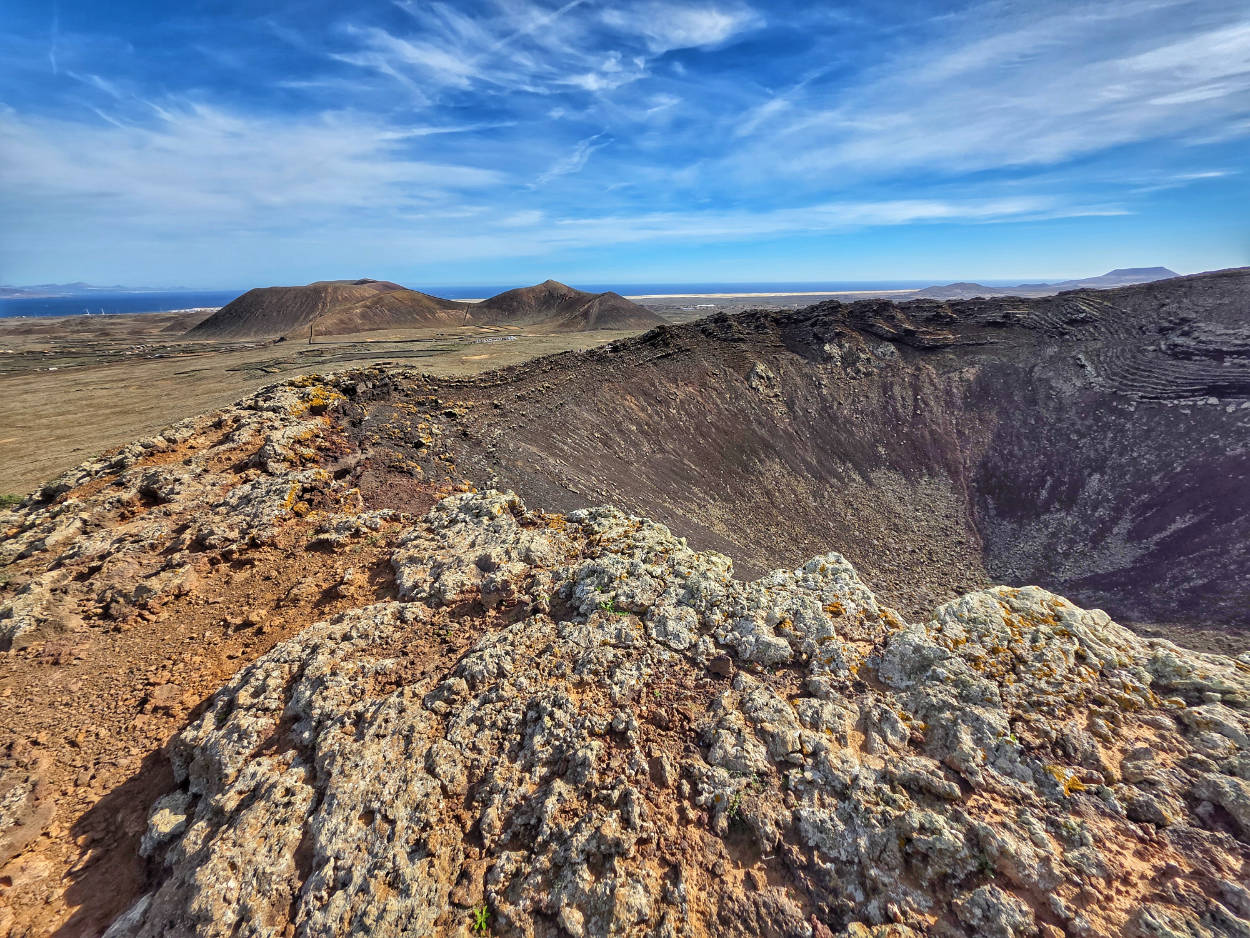
A dark gray, jagged crater rises dramatically from the harsh landscape of northern Fuerteventura, a reminder of a time when the island was a veritable hell on earth. Calderón Hondo is one of the best-preserved volcanic cones in the Hondo ejection tract (a series of volcanoes running north to south). Around 50,000 years ago, molten basaltic lava erupted violently from its interior and, after solidifying, created a vast area known as Malpaís de la Arena, or "bad land," expanding the island's surface towards the La Bocaina Strait.
The crater rim drops dramatically to a depth of approximately 70 meters, revealing a fascinating palette of colors. Oxidized iron deposits give the rock an intense rusty and reddish hue, contrasting with the yellow of sulfur compounds and the deep black of pumice. The steep, inner walls resemble a deliberately contoured, ancient amphitheater. From the vantage point installed on the crater rim, a panoramic view unfolds of the neighboring cones, endless lava fields, and the blue ocean lapping the coast of El Cotillo.
Interesting facts
Chipmunk Colony: As you climb to the summit, you'll encounter flocks of ground squirrels (Atlantoxerus getulus), which were introduced to Fuerteventura from North Africa in 1965. Although they are readily eaten by tourists, they are an invasive species that threatens the local ecosystem.
The sacred site of Majos: in the surrounding volcanic caves, archaeologists have found traces of ancient rituals and ceramic vessels used by the island's indigenous inhabitants before the 15th-century conquest.
The Calderón Hondo Volcano area is open and free of charge 24/7. There are no ticket offices or fences.
Some of my tips
Clothing and Equipment: Full-length hiking boots with stiff soles are required. The trail is littered with sharp, loose volcanic rocks that can be slippery in sandals. Be sure to bring a hat and plenty of water, as there is no shade or refreshments along the route.
Logistics and route: The most popular trail starts at the parking lot on the road out of Lajares. The loop around the volcano and up to the viewpoint takes about 1,5 to 2 hours of leisurely walking.
Avoiding crowds: It's best to hit the trail in the morning (before 9:00 a.m.) or late afternoon. This way, you'll avoid the harsh sun and the crowds of tour buses.
Viewpoint on the Calderon Hondo volcano, GPS coordinates:
28°42’04.9″N 13°55’09.7″W
28.701362, -13.919353 - click and route
Tourist parking lot under the Calderon Hondo volcano and at the beginning of the path to the volcano, GPS coordinates:
28°42’11.2″N 13°54’52.4″W
28.703102, -13.914561 - click and route
3. Montana Roja Volcano
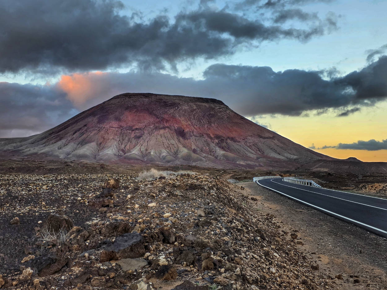
If you're tired of climbing volcanic cones, Montana Roja might be a good option. The trail is a bit wilder and less crowded than the more popular cones (perhaps because there's no large, convenient parking lot along the road), but it offers equally impressive views.
The rusty, almost purple hue of the mountain slopes is the result of powdered iron oxides and lapilli (small fragments of solidified lava thrown into the air during a volcanic explosion), which, at the right angle of sunlight, create the illusion that the entire hill is on fire.
In the distant past, before the Spanish conquest, the area around the mountain held sacred significance for the Majos (the indigenous Berber people who inhabited Fuerteventura and Lanzarote before the 15th century). These tribes believed that the high, isolated cones were a place of communion with the sky deities, and the volcanic caves served as temporary shelter and food caches. Over time, the stark, alien landscape of Montaña Roja acquired a mythical dimension. According to local legends, on the night before the summer solstice, the whisper of winds trapped within volcanic vents can be heard deep within the crater.
The cosmic, Martian landscape of the mountain and the surrounding lava fields has made this region a setting for international television and documentary productions seeking locations for shots imitating the surfaces of alien planets.
Interesting facts
An optical illusion: the mountain's color changes depending on the time of day. From bright yellow and orange at high noon to deep burgundy and crimson at sunset.
Underground tunnels: Beneath the ground at the foot of the mountain lie unexplored lava tunnels created by molten rock flowing towards the ocean.
Montana Roja, along with the trail leading to the summit, is open and free of charge 24/7. Entry to the reserve is free. There are no ticket offices or gates.
Some of my tips
Clothing and equipment: Hiking shoes with good grip are essential. The approach is covered in fine, loose volcanic gravel, which can be slippery. Sunglasses and a scarf to protect your face from the gusty wind will be useful.
Logistics and route: The ascent to the summit begins near the FV-104 road. There is no convenient parking here, but along the road you can find dirt bays that accommodate single cars. Below are the GPS coordinates for the point near which you should look for a parking space. When parking, make sure your entire car is parked off the road. There is a solid white line on the edge of the road, so cars parked off the road should not cross it. The FV-104 road is a through road, so safe and proper off-road parking is especially important.
The ascent to the crater rim and return takes about 1,5 hours of leisurely walking.
Viewpoint on the Montana Roja volcano trail, GPS coordinates:
28°38’30.2″N 13°50’25.7″W
28.641709, -13.840477 - click and route
A landmark, look for a parking space near it on the dirt shoulder off the road. You can look 200-300 meters before and after this point.
28°39’02.3″N 13°49’54.9″W
28.650631, -13.831927 - click and route
4. Popcorn Beach
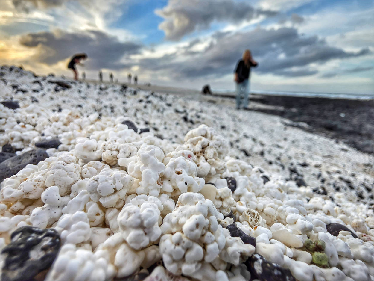
White, crunchy kernels create one of the most extraordinary landscapes on the Fuerteventura coast. The coast, commonly known as Popcorn Beach or Playa del Bajo de la Burra, attracts thousands of travelers. What looks like perfectly popped popcorn from a distance are actually rhodocytes (fossilized, spherical clusters of calcareous algae from the Corallinaceae family) that grew on the ocean floor for hundreds of years before the tide washed them ashore.
The process of creating these unique formations is long and slow. Living red algae extract calcium carbonate from the seawater, growing at a rate of just a millimeter per year. Only when they die do their skeletons lose their reddish hue, becoming snow-white and being pushed by currents towards the coast, where ocean tides grind them against the hard basalt. Each white grain takes over five hundred years to acquire its characteristic, irregular, protruding shape.
Discovered by travelers and widely publicized on social media, the reservoir quickly gained enormous popularity. Unfortunately, this created a significant ecological problem. Research showed that tourists fascinated by the balls reportedly carried away over 10 tons of white algae in their pockets and bags each year. This forced the authorities to introduce severe fines for taking even a single rock.
In response to the devastation of the beach at the Puerto del Rosario airport, a special campaign #PASSIONNOTPLUNDER was launched, making travelers aware that "popcorn" confiscated during security checks will not be returned to its place.
So please: enjoy this place, touch, look, take photos, but don't take even a single ball with you!
Interesting facts
A witness to prehistory: the oldest rhodocytes in this area, lying deeper beneath the surface belt, are estimated to be over 4000 years old.
Alternative location: Although this particular beach at El Cotillo/Majanicho is the most famous, there are several smaller beaches with similar structures throughout Fuerteventura, for example near Majanicho and Las Grises.
Opening hours
Popcorn Beach is open 24/7. Admission is free. There are no ticket offices or gated facilities.
Some of my tips
Logistics and access: The best access to the beach is from Corralejo. However, this is one of the worst technical roads you'll encounter on the island. This technically disastrous section is about 3,5 km long, and you should drive slowly and with great caution. The road is dirt and has many deep depressions and ruts. This doesn't mean it's impossible to drive on. You just need to drive slowly and carefully.
Insurance exclusion: I'd also like to point out a fact that most tourists don't know or forget, and that guidebooks often ignore. Car rental companies exclude this section of the road from their insurance. Therefore, if you damage your car while driving this road, the repairs will be entirely at your expense. Therefore, careful driving is highly recommended, and let those in a hurry go ahead.
Popcorn Beach Parking, GPS coordinates:
28°45’06.8″N 13°53’57.5″W
28.751877, -13.899297 - click and route
5. Molinos de Villaverde windmills
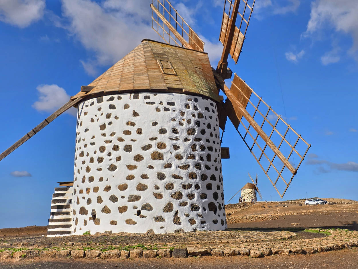
Perched on a hill in the small village of Villaverde, two traditional molino windmills (a two-story windmill with a rotating structure) stand as a quiet monument to the era when the island was considered the granary of the entire Canary Archipelago. Built at the turn of the 18th and 19th centuries, they responded to the rapid population growth and the constant, powerful trade winds that have dictated the rhythm of life in the Atlantic for centuries. Local craftsmen constructed them using dark basalt, Canary Island pine (pino canario – rich in resin and exceptionally resistant to weathering), and clay-lime plaster.
The building has a truncated conical shape and two levels: the lower level housed raw materials and the finished product, while the upper level housed the heart of the mill (the heavy stone millstones). The entire wooden roof truss, along with the large rudder (gobierno) mounted on it, could rotate 360 degrees using the miller's muscular power, allowing the four-bladed windmill to be perfectly aligned with the wind. The mills formed the foundation of the island's ancient inhabitants' diet: gofio (flour made from roasted barley, wheat, or corn), whose distinctive, nutty aroma once wafted throughout the valley.
In the mid-20th century, with the introduction of internal combustion engines and cheap flour imported from the Iberian Peninsula, windmills began to fall into oblivion.
Interesting facts
Gender Differences in Construction: In the Canary Islands, windmills are divided into male (molino – taller, masonry, multi-story towers) and female (molina – single-story, with a wooden superstructure). Those in Villaverde are of the classic male type.
An alternative warning system: windmills once served as telegraphs. The arrangement of the blades and the cloths hung from them signaled to nearby residents, among other things, an approaching storm, a fire, or… an upcoming family celebration for the miller.
Stones from abroad: the best, most durable millstones for grinding the hard corn kernels (millo) were imported to Fuerteventura by sea from all the way from France and Tenerife, and their transport to the hill required the use of camels.
Opening hours
The Molinos de Villaverde windmills are located in an open-air area and are open to public viewing 24/7. Entry to the area surrounding the windmills is completely free. The interiors of the windmills themselves are generally closed to tourists, except for selected cultural events.
Some of my tips
Clothing and equipment: The hill at Villaverde is very windy. Sunglasses (to protect your eyes from flying dust) and a light windbreaker are useful, even on hot days.
Photography: The best photo conditions are an hour before sunset, when the light warms the dark color of the basalt stone and the windmills cast long shadows against the Escanfraga volcano.
Ground parking at Molinos de Villaverde, GPS coordinates:
28°37’23.0″N 13°54’54.6″W
28.623060, -13.915153 - click and route
The last section of the access road before entering the parking lot is a fairly steep but short incline. Be prepared for this. Shift down a gear and slowly ascend in first gear. Be careful, as the hill limits visibility, and pedestrians often cross the road on their way to the windmill.
6. Mirador de Vallebron viewing point
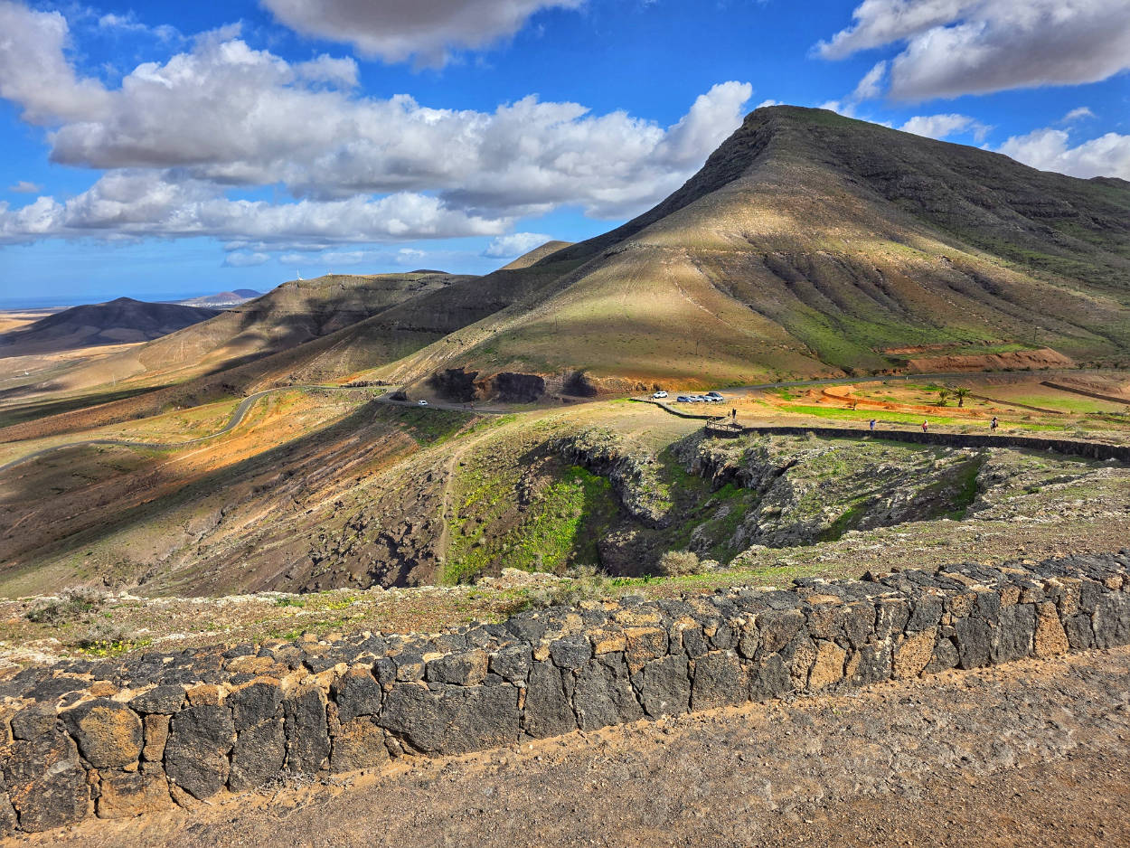
The silence here is broken only by gusts of wind lashing the Montana de la Muda ridge. Perched almost 300 meters above sea level, the Mirador de Vallebron (also known as Mirador de la Lanera) offers a geological balcony overlooking two completely different sides of the island. On one side, the gaze soars toward the fertile, sheltered Vallebron Valley, with its characteristic cultivated terraces, while on the other, it descends to the rugged, volcanic plains of Tindaya, the historical and spiritual heartland of Fuerteventura's ancient inhabitants.
The narrow ridge on which the Mirador de Vallebron was built has witnessed the island's turbulent history. It was at the foot of the neighboring Montana de la Muda that archaeologists discovered the extensive Majos cemetery and rock carvings. The view from the hill was used to observe possible threats from the ocean long before the arrival of European conquerors in the 15th century.
Nowadays, the place often attracts photographers and film crews looking for authentic, wild locations free from commercial tourist development.
Interesting facts
Traditional Gavias Agriculture: Looking down into the Vallebrón Valley, you can see a unique Canarian agricultural system based on so-called gavias, flattened valley floors surrounded by earthen embankments that retain the sparse rainwater runoff.
Natural Monument and Paleontology: the slopes of La Muda Mountain constitute a protected area (Monumento Natural de la Montaña de la Muda), where fossils of fossil sea snails dating back millions of years are still being found.
Opening hours
The Mirador de Vallebrón viewpoint is open and accessible 24/7. Admission is completely free. There are no ticket offices or gates.
Some of my tips
From the first observation deck, located right next to the parking lot, a short path leads slightly uphill. At the end of the path is a second observation deck, offering a wider view of both sides of the hill.
Best time to visit: Arrive in the late afternoon, when the setting sun casts long shadows across the rolling valley and highlights the rust-colored rocks around Mount Tindaya.
Parking at the Mirador de Vallebron, GPS coordinates:
28°34’50.7″N 13°57’23.7″W
28.580738, -13.956586 - click and route
7. The Holy Mountain of Tindaya
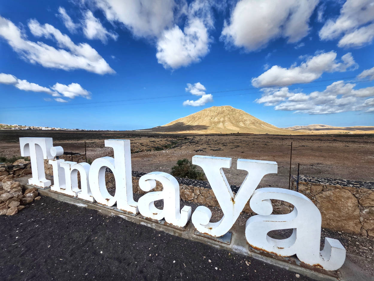
For the ancient inhabitants of Fuerteventura, this solitary, pyramidal cone rising from the desert plateau of La Oliva wasn't just a geological formation. For them, it was Esquen, a sacred place and the center of the universe. Towering 400 meters above sea level, Montana de Tindaya stands out against the rust-colored hills with its bright, almost pastel color. The shades of beige, gray, and copper are due to its unique composition and a very interesting geological process. Tindaya is not a classic volcanic cone, but a so-called volcanic neck (intrusion). It formed from magma that cooled slowly deep underground. Over 18 million years of erosion, the outer, soft basalt layers were completely washed away and blown away by the wind, revealing the hard, trachyte core of the ancient volcano. As a result, the mountain slopes shimmer with incredible shades of grey, beige, pink and copper depending on the time of day and the angle of sunlight.
Tindaya's greatest mystery lies in its rock carvings. On the flat, sun-baked plateau at the top of the mountain, there are over 300 carvings in the shape of human footprints. All the footprints face west and southwest. They point precisely toward the archipelago's highest peak (Teide volcano on Tenerife) and the spot on the horizon where the sun sets during the winter solstice. This, of course, suggests that the mountain also served as a giant astronomical calendar.
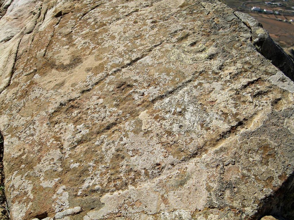
photo: José Mesa on the principles CC BY-SA 2.5
source: wikipedia.org
Interesting facts
The trachyte forming Montana de Tindaya has such a distinct and hard structure that for years the industrial exploitation of the mountain as a quarry for this valuable decorative rock was considered.
After the Spanish conquest of the island, Christians attempted to "disenchant" the pagan cult. They named the neighboring caves Bailadero de las Brujas (Witches' Parquet) and claimed that the devil and witches met on Mount Tindaya. They even built a hermitage (Ermita de Nuestra Senora de la Caridad) at the foot of the mountain to protect the area from "evil."
WARNING!
The Montana de Tindaya is a Natural Monument (Monumento Natural de la Montana de Tindaya) and a protected area. To protect the priceless rock carvings, access to the summit and the trekking paths leading up is currently strictly prohibited. It is not permitted to climb on your own.
A point on the road overlooking Mount Tindaya, GPS coordinates:
28°35’15.0″N 13°57’58.3″W
28.587500, -13.966194 - click and route
8. La Concha Beach
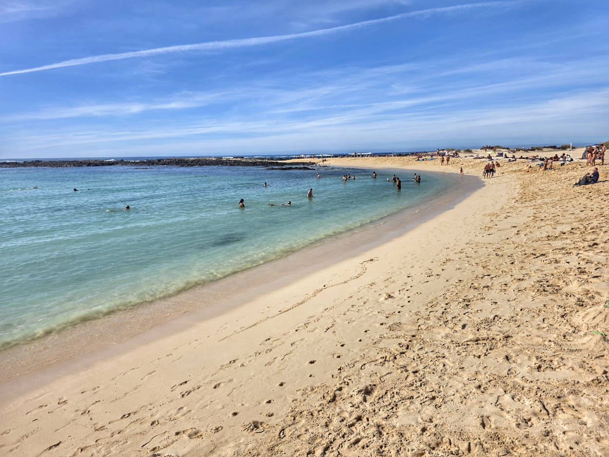
Its shape resembles a perfectly defined crescent moon. However, early Iberian cartographers saw it as a giant shell abandoned on the edge of the land. It's no surprise, then, that Playa de la Concha simply translates to "Shell Beach."
The phenomenal character of this place is based on a brutal contrast: while most of the island's western coast is mercilessly lashed by powerful ocean waves, this bay remains an unshakable oasis of peace. Its secret lies in a natural underwater breakwater made of porous basalt. This ring of rock, located a few dozen meters from the shore, absorbs the energy of the advancing Atlantic waters like a defensive wall, transforming the bay into a tranquil, blue pool.
Before sun-seekers took over these shores, they were a strategic point for pirates operating on routes to the New World. In the 17th and 18th centuries, the sheltered lagoons here served as natural repair docks for French pirate ships. Their presence was so disruptive that the Spanish authorities were forced to erect a massive, circular watchtower in nearby El Toston, using fire and smoke to warn residents further inland of the approaching threat.
When the tide ebbs, the bay's landscape undergoes a dramatic transformation. Miniature tidal pools form in the exposed, tens of centimeters-deep depressions of igneous rock. Warmed by the Saharan sun, the water in these natural baths reaches temperatures approaching those of thermal springs, providing a haven for schools of tiny fish and hermit crabs. During the winter months, when Atlantic storms rage, waves crashing against the outer reef can throw plumes of sea foam several meters into the air.
Interesting facts
Key scenes for the 2018 Hollywood film Solo: A Star Wars Story were filmed near the beaches of El Cotillo. The harsh, sandy, and volcanic landscape served as the setting for the desert planet Savareen.
Contrary to popular myth perpetuated in guidebooks, the snow-white sand on La Concha wasn't blown in from the Sahara. It was created by millions of years of grinding the exoskeletons of marine crustaceans and shells against basalt rocks.
Parking at La Concha Beach, GPS coordinates:
28°41’39.4″N 14°00’52.4″W
28.694278, -14.014556 - click and route
9. Faro de Toston lighthouse
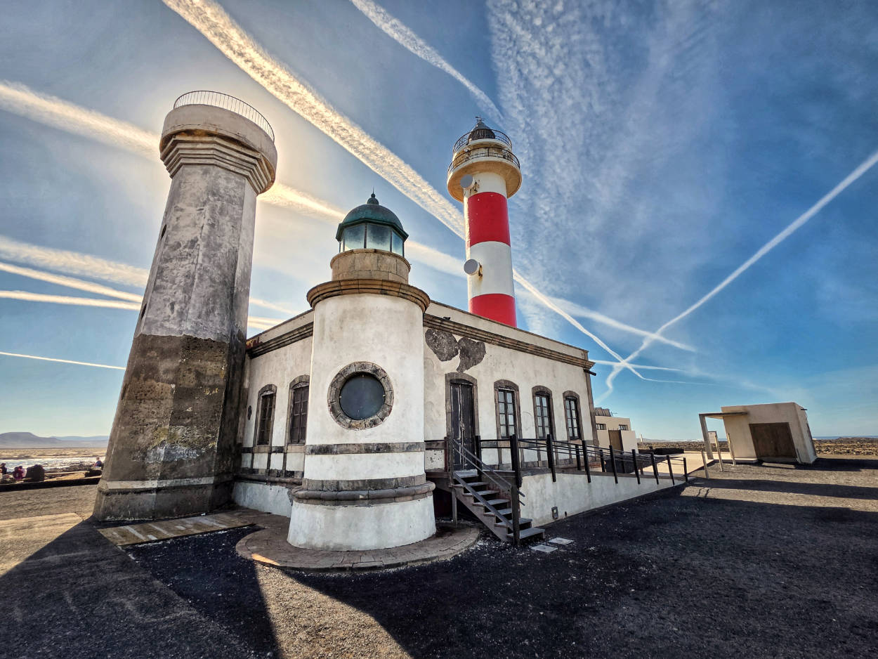
The Faro de Tostón Lighthouse, located on the northern tip of Fuerteventura near the fishing village of El Cotillo, is a historic navigational structure first commissioned in 1897. The original tower, less than ten meters high, proved insufficient, so in the 80s a new, thirty-meter-high structure with distinctive stripes was erected, now powered by photovoltaic energy. The lighthouse's former outbuildings house the Traditional Fishing Museum (Museo de la Pesca Tradicional), which showcases the culture of the island's ancient inhabitants. The entire site is surrounded by rugged volcanic cliffs and turquoise lagoons, creating one of the most picturesque locations in this part of the archipelago.
However, speaking less formally, the lighthouse isn't the prettiest I've seen. It's a rather simple building, essentially devoid of architectural finesse. Thanks to the appropriate framing, lighting, and interesting sky, it looks much more attractive in my photos than when you see it in person.
But you don't come here for the lighthouse. On this part of the coast, you can often see huge waves (especially in winter) crashing thunderously onto the shore near the lighthouse. And we did indeed manage to spot some. They are truly beautiful and impressive. We spent a lot of time observing them and didn't feel like going any further.
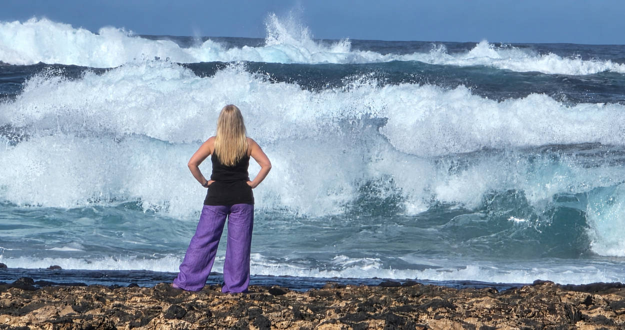
The area around the Faro de Toston lighthouse towers and the adjacent natural pool are accessible 24 hours a day, 7 days a week.
The Traditional Fishing Museum (Museo de la Pesca Tradicional) is usually open from Tuesday to Saturday from 10:00 AM to 17:00 PM, regardless of the tourist season. It is closed on national and religious holidays (January 1.01, January 6.01, December 25.12) and during maintenance periods.
In the case of this facility, it is worth checking the opening hours for a given day before visiting or consciously calculating that it may be closed unexpectedly.
Parking at the Faro de Toston lighthouse, GPS coordinates:
28°42’54.2″N 14°00’50.2″W
28.715062, -14.013938 - click and route
10. Ecomuseo de La Alcogida
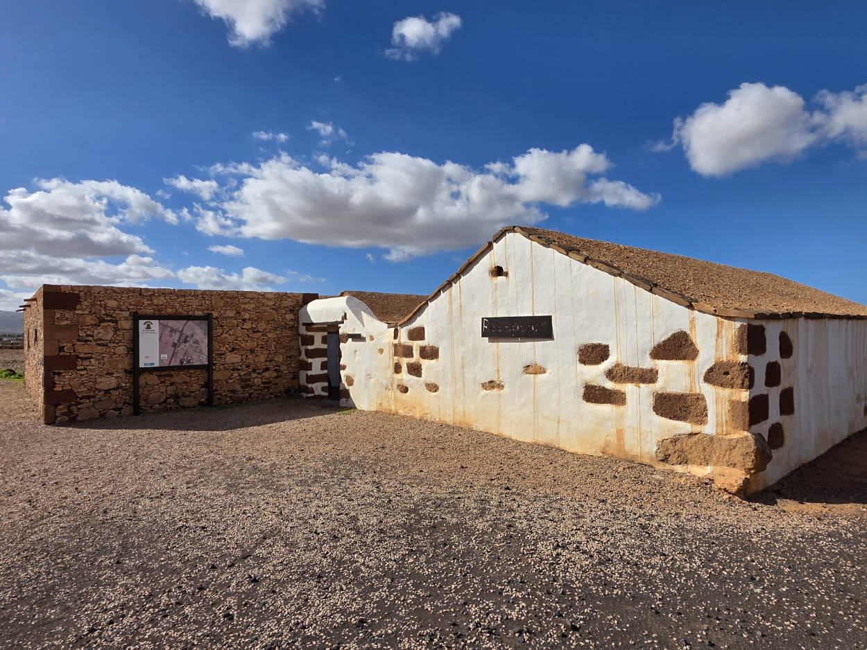
Sun-dried land and a perpetual lack of fresh water – these were the merciless elements that Fuerteventura's farmers had to contend with for centuries. To fully understand how they survived on this harsh plain, reading the chronicles isn't enough; you have to step inside the Ecomuseo de La Alcogida. The carefully reconstructed village near Tefía is a time machine, transporting us directly to the everyday lives of the island's ancient inhabitants.
In traditional Canarian nomenclature, the word "alcogida" referred to a vast, paved area surrounding buildings, designed solely to capture sparse rain and direct it through a system of gutters to underground reservoirs. Seven restored agricultural dwellings have been erected within the open-air museum, providing a striking illustration of the former social structure. An architectural tour allows for a direct comparison of the low peasant hut, fashioned from volcanic stone, clay, and straw, with the luxurious residences of the landowners of the time.
Around the farmyards, authentic bread ovens and stone mills are still in operation.
Interesting facts
Inside the houses, local craftsmen work to demonstrate the half-forgotten techniques of ancient weaving and traditional pottery.
In one of the historic stone ovens, aniseed bread is regularly baked according to an original Canarian recipe, the aroma of which can be felt throughout the village.
The museum promotes historical reenactment by organizing demonstrations of traditional backyard games for children. Examples include sack races, tug-of-war, and games with rolling hoops.
Opening hours
Ecomuseo de La Alcogida is open from Tuesday to Saturday from 10:00 to 17:00.
The facility is closed on Sundays and Mondays. However, you can freely stroll between the buildings and view everything from the outside.
Parking at the Ecomuseo de La Alcogida, GPS coordinates:
28°31’20.0″N 13°59’49.7″W
28.522230, -13.997151 - click and route
11. Molino de Antigua
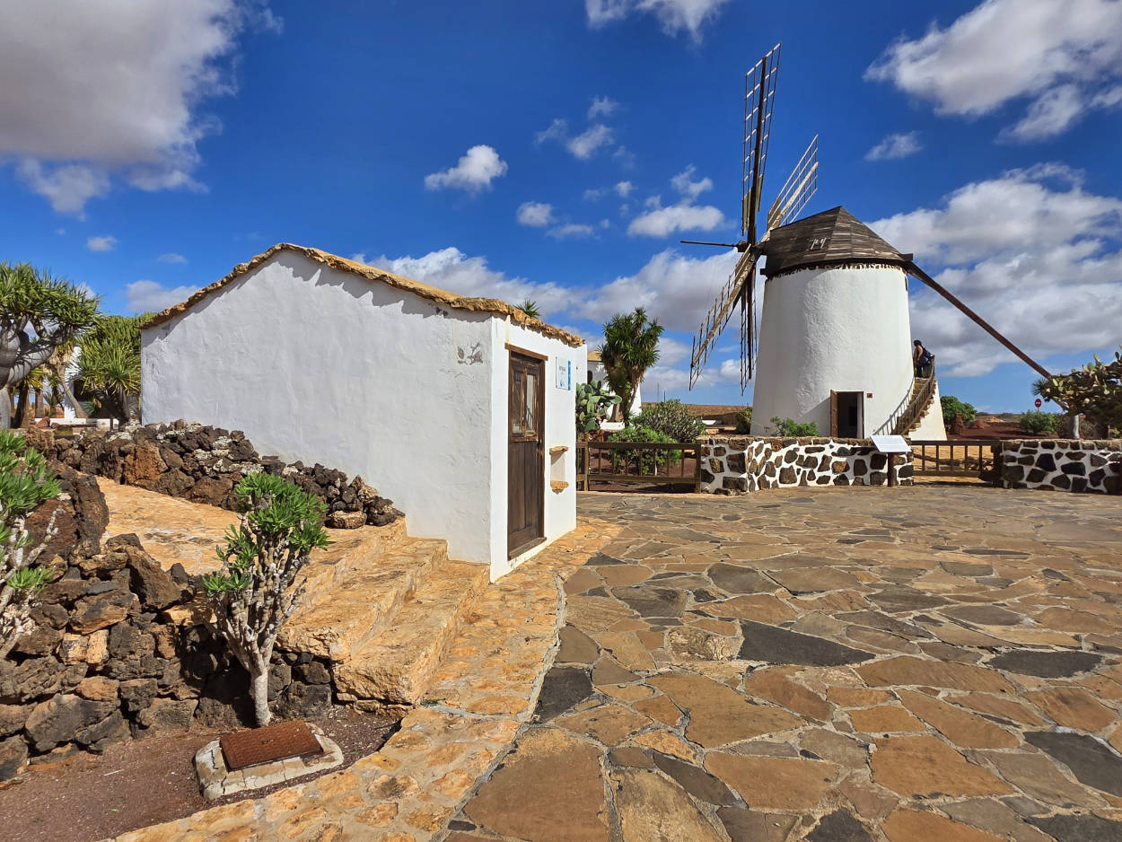
The white, conical silhouette of the windmill rises from the heated, ochre-red plain in the heart of Fuerteventura. The central plateau around Antigua has been the archipelago's agricultural center for centuries. For centuries, the strong trade winds have driven the mighty propellers of the Antigua Mill, transforming roasted grain into flour.
The Molino de Antigua windmill is a classic example of the so-called molino macho (male windmill). Unlike the lighter, most often wooden female structures (molinas), male windmills are characterized by a solid, fully masonry structure. The windmill's base was constructed of roughly hewn, dark volcanic stone (piedra volcanica), which was then covered with a thick layer of snow-white lime plaster (cal). This treatment not only served to reflect sunlight but also to protect the porous rock from damaging salt erosion. The rotating mechanism (a massive wooden roof truss with wings) allowed millers to manually rotate the entire head 360 degrees using a powerful pole to adjust its angle to the current wind direction.
The windmill's interior concealed a complex transmission mechanism. The main gear transferred energy from the blades directly to the massive stone millstones. The miller's work required considerable physical strength and an intimate knowledge of wind movements. Island legends have it that on days of intense trade wind activity, the mill operated continuously around the clock, and the distinctive, nutty aroma of freshly roasted wheat and corn carried for miles, signaling to the inhabitants of neighboring settlements that their flour rations were ready.
Currently, a carefully designed botanical garden has grown around the mill, containing endemic species of cacti and succulents, such as aloe and euphorbia.
Interesting facts
Although the mechanisms of the Molino de Antigua have been carefully restored, today the windmill's blades are permanently locked and are operated very rarely, only during special shows during local holidays.
Under the garden complex around the windmill, partially buried underground channels of the former irrigation system intersect, which in the 18th century made this place the most mechanized agricultural zone on the island.
Opening hours
The windmill and museum are open from Tuesday to Saturday from 10:00 a.m. to 18:00 p.m. (in the summer season) and from 10:00 a.m. to 17:00 p.m. (in the winter season).
Closed to visitors on Sundays and Mondays and major holidays (January 1.01, January 6.01, December 25.12).
Parking at Molino de Antigua, GPS coordinates:
28°25’48.9″N 14°00’43.9″W
28.430244, -14.012193 - click and route
12. Mirador de Guise y Ayose viewpoint
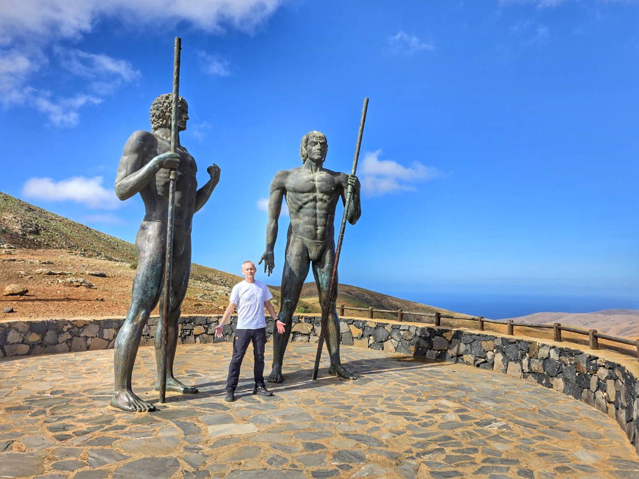
The Mirador de Guise y Ayose, perched on the Degollada de Corrales Pass along the narrow, winding FV-30 road, is much more than just a mountain terrace overlooking the sun-baked Betancuria Valley. It's a historic dividing line along which ancient Fuerteventura was divided in half. For centuries, the island was ruled by the majos (indigenous people of Berber origin), and the territory was divided into two feuding, rival kingdoms: Maxorata in the north and Jandía in the south.
The four-and-a-half-meter-tall figures immortalize the island's last pagan monarchs, Guise and Ayose. The moment they are frozen represents the capitulation of the Norman conquistador Jean de Béthencourt in 1405. Both leaders hold massive, traditional shepherd's staffs (symbols of power) and gaze into the distance with a compelling mixture of pride, defiance, and resignation.
Interesting facts
The colossal sculptures weigh approximately 1,5 tons each. Their safe installation on the steep, sliding volcanic bedrock of the pass required deep foundations to withstand the impacts of winter hurricanes.
The demarcation line symbolically guarded by the kings was not merely a conventional concept. The territories of Maxorata and Jandía were once divided by a physical, stone defensive wall (La Pared), the remains of which are still being excavated by archaeologists today.
The Mirador de Guise y Ayose viewpoint is an open public space, accessible without restrictions 24 hours a day, 7 days a week.
Parking at the Mirador de Guise y Ayose, GPS coordinates:
28°26’27.0″N 14°03’22.0″W
28.440832, -14.056099 - click and route
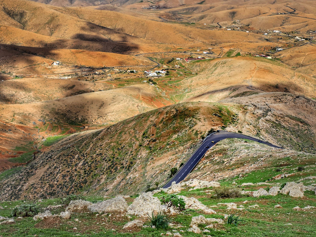
While you're there, it's worth visiting the Mirador de Morro Velosa viewpoint, located just two kilometers away . Perched over 600 meters above sea level, it offers a truly impressive panoramic view of the rugged, volcanic landscape of the central part of the island around Betancuria. In my opinion, it's definitely one of the most beautiful places in terms of scenery.
Parking at Mirador de Morro Velosa, GPS coordinates:
28°26’17.7″N 14°03’01.2″W
28.438238, -14.050320 - click and route
13. Betancuria
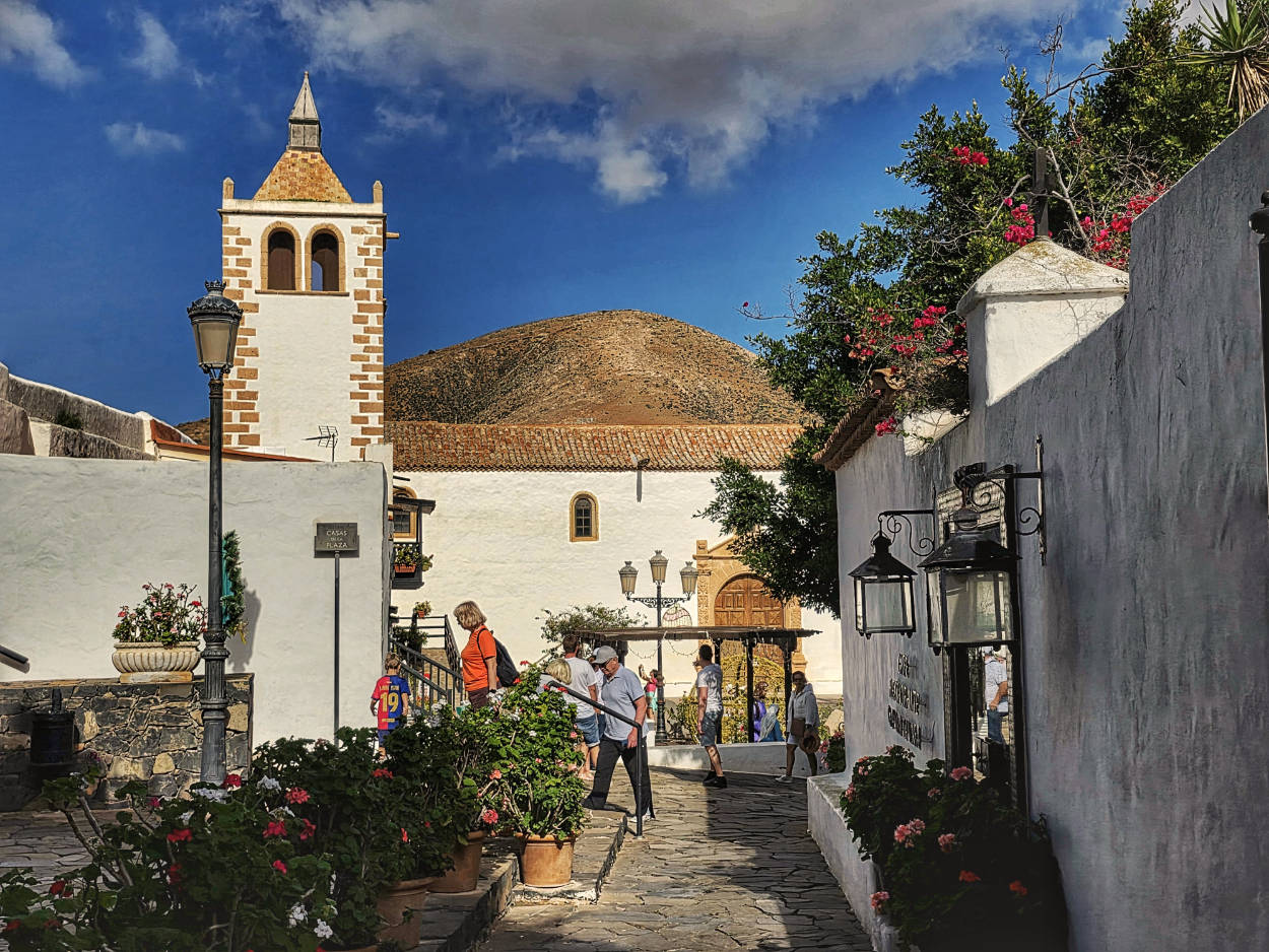
When, in 1404, the Norman knight Jean de Béthencourt gazed upon the lush green valley hidden deep in Fuerteventura, he knew exactly what he had to do. He chose a site far from the coast, surrounded by the massive basaltic cliffs of the Betancuria Massif, to protect the fledgling settlement from the devastating raids of Barbary pirates. Thus was born Betancuria, the island's first capital and the second oldest town in the entire Canary archipelago.
The heart of the town is the Iglesia de Santa María de Betancuria. Originally built as a modest chapel in the Norman Gothic style, it quickly gained importance. In 1424, Pope Martin V issued the papal bull Doctrina Dei nostrae, elevating the church to the rank of the first cathedral in the Canary Islands and establishing a short-lived diocese there. However, the natural shelter of the mountains did not prevent tragedy. In 1593, the Berber pirate Xaban Arraez invaded the island, reduced the town to ruins, and razed the Gothic church to the ground. The church's reconstruction, undertaken in the 17th century, gave it a completely new look. It combined local dark volcanic stone, snow-white limestone, and the exceptionally durable Canary Island pine. The carved, coffered ceiling, with its intricate geometric motifs in the Mudejar style, is the most beautiful accent of the interior.
A stroll through the narrow, cobbled streets reveals a traditional spatial layout: classic, two-story houses with charming wooden balconies suspended above the facades, and courtyards filled with climbing bougainvillea and palm trees. In the sunlight, the starkness of the dark basalt contrasts with the white walls.
Interesting facts
The entire historic centre of Betancuria has been placed under strict conservation protection as a Cultural Interest (Bien de Interes Cultural), which absolutely excludes modern expansion and protects the urban layout of the 17th century.
Betancuria lost its status as the island's capital in 1834 to Antigua, mainly due to disastrous, multi-year droughts and the relocation of economic life closer to seaports.
According to the Majos (the island's indigenous inhabitants), before the Norman conquest, the area of present-day Betancuria marked the border between two warring kingdoms: Maxorata in the north and Jandía in the south.
Opening hours
Iglesia de Santa María de Betancuria:
Monday - Friday: 11:00 - 17:00
Saturday: 11:00 – 19:00
Sunday: Closed to visitors (only masses)
Museo Arqueologico de Fuerteventura (Archaeological Museum):
Tuesday - Saturday: 10:00 - 17:00
Sundays and Mondays: Closed
Closed days: January 1, January 6 and December 25.
Betancuria – the main town square, GPS coordinates:
28°25’30.1″N 14°03’26.4″W
28.425028, -14.057333 - click and route
Betancuria – a small parking lot right next to the main square; GPS coordinates:
28°25’32.5″N 14°03’26.2″W
28.425689, -14.057277 - click and route
During our winter visit, despite the small parking lot, finding a spot wasn't a problem. However, if you're visiting in summer, you'll likely need to use the larger parking lot a bit further away (coordinates below).
Betancuria – second parking lot, about 400 meters from the main town square; GPS coordinates:
28°25’23.6″N 14°03’27.6″W
28.423222, -14.057667 - click and route
14. Las Penitas Barranco
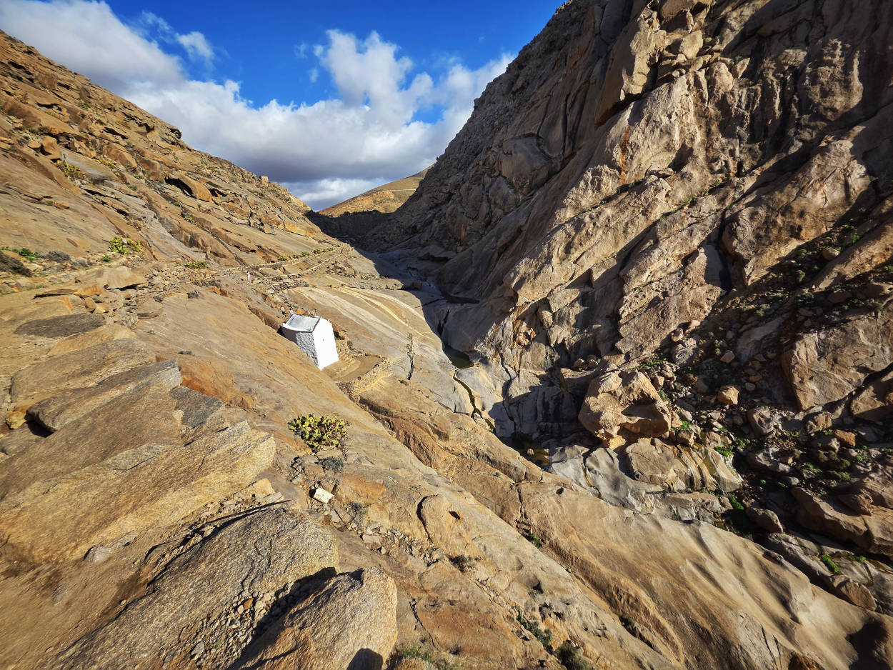
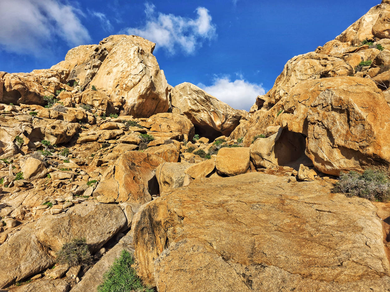
The wild, deeply carved gorge of Barranco de Las Peñitas is one of Fuerteventura's most stunning corners, where the rugged volcanic landscape gives way to an oasis nestled in the shade of palm trees. This entire area is made up of the island's oldest geological structures, whose fiery orange and light-colored rocks were born from the ocean floor over 70 million years ago, before the archipelago even emerged from the Atlantic. Over millions of years, the constant action of wind and sporadic, torrential rains have sculpted the minerals, creating fanciful rock formations suspended high above the canyon floor.
Walking along the dried-up riverbed of the former river, you come across the massive Presa de las Penitas dam, built in the 40s from local stone. The dam was intended to store precious water for local farmers, but today the reservoir remains almost completely buried under sediment and sand. Nearby, carved into the white walls of the canyon, stands the small chapel of Our Lady of the Rocks. A legend connects this modest church, according to which Franciscan monks supposedly found a small statue of the Virgin Mary (the patron saint of Fuerteventura) in a cave.
The gorge's extraordinary landscape has captured Hollywood's attention. The stark walls of the Barranco de Las Peñitas served as a natural setting for the 2021 Marvel blockbuster "Eternals," directed by Chloe Zhao. The film crew utilized this majestic terrain to create shots depicting ancient Babylon and the characters' desert retreats.
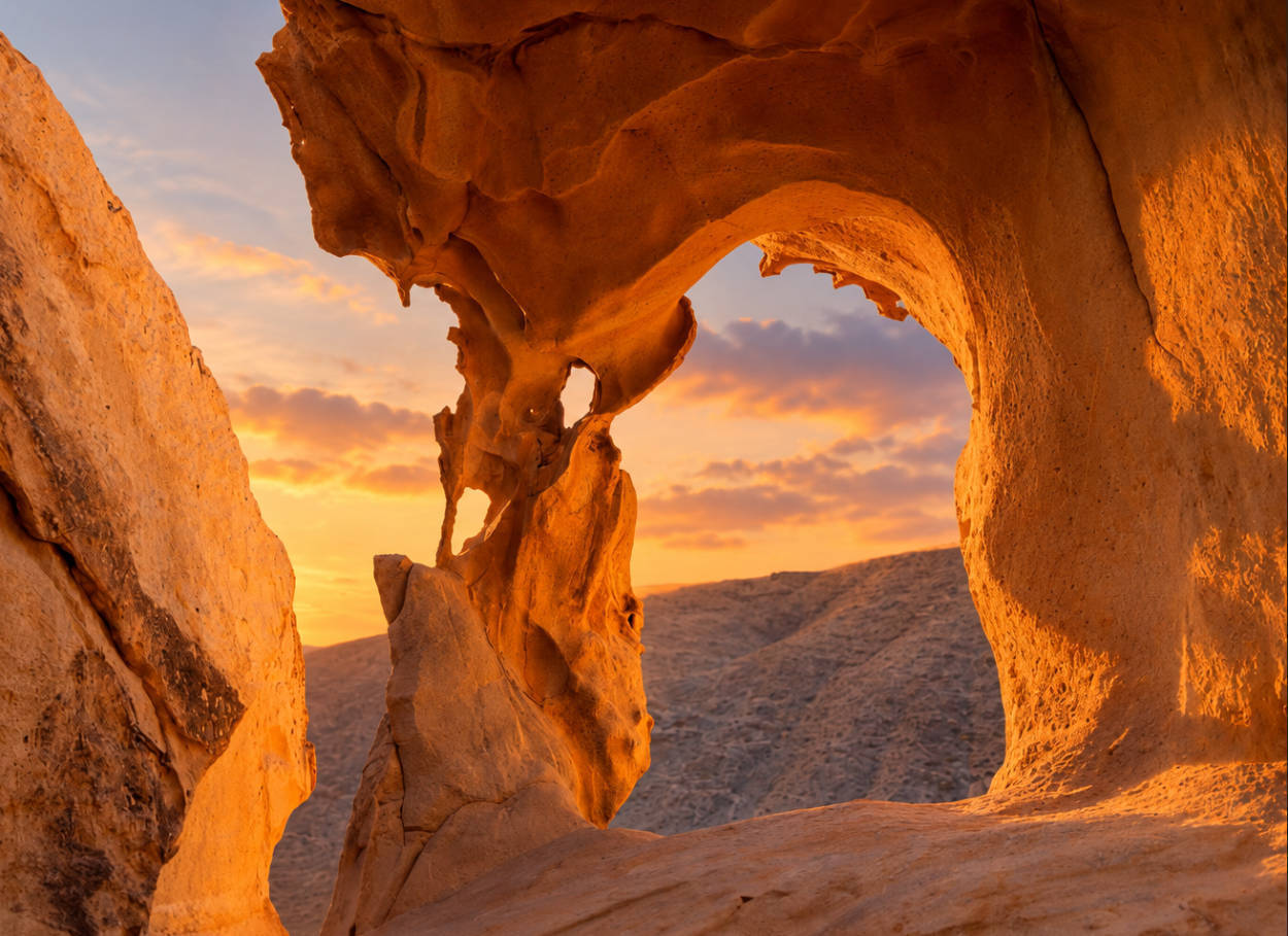
Right next to the gorge is one of the most photogenic rock formations on the island: Arco de las Penitas. While information about this approach is scarce, I'll add from personal experience that the route to the arch appears very short on the map (and in navigation). However, in reality, reaching it is neither short nor easy. The climb is steep, there's no single designated path (everyone finds the most convenient option), and you often have to scramble over tall boulders. Without using your hands, this is often impossible. Reaching the formation itself requires considerable strength and vigilance. Therefore, this is a route more for adventure seekers than for casual hikers.
Interesting facts
The massive Presa de las Penitas dam turned out to be a hydrological blunder. Due to an incorrect estimation of the rate of erosion of the surrounding rocks, the reservoir filled with silt and sand within a dozen years of its completion.
During the filming of "Eternals", motor vehicles were not allowed in the Betancuria Rural Park, which meant that cameras, props and decorations had to be transported exclusively on the backs of camels and crew members.
The misleading "Window" on the trail: hikers heading to the arch often confuse it with a lower, smaller formation called La Ventana (The Window), causing many to turn back, convinced they've reached their destination. Frankly, I'd wager that some of them are tired of climbing and would rather believe they've reached it than have it turn out to be the wrong rock and need to continue.
Opening hours
The gorge and trail are open to the public, with unlimited, free access. For safety reasons, the trail should not be used before sunrise or after sunset. Limited visibility is particularly dangerous.
The Ermita de la Peña (chapel in the ravine) is opened occasionally, mainly during religious holidays and the annual pilgrimage (Romería de la Pena on the third weekend of September).
Some of my tips
The Barranco de Las Penitas gorge, and especially the hillside you climb to the Arco de las Penitas rock arch, faces southwest. If you enter in the second half of the day, expect direct sun (there's no shade) and heat buildup from the rocks and gorge. It can get quite hot. Be sure to bring a hat and plenty of drinking water (there are no food options).
Comfortable and stable hiking shoes with good grip are absolutely essential (sandals, flip-flops, or street shoes are out of the question). Fingerless gloves will be useful when approaching the arch, as they make it easier to grip sharp rocks.
For a leisurely walk through the gorge, past the dam, up to the Arco de las Peñitas and back, you should set aside about 3 hours.
Parking at the beginning of the trail to Las Penitas Gorge, GPS coordinates:
28°23’08.9″N 14°06’21.8″W
28.385792, -14.106045 - click and route
The Ermita de la Pena chapel in the ravine, GPS coordinates:
28°23’19.9″N 14°06’10.1″W
28.388861, -14.102806 - click and route
To experience the most beautiful views in the gorge, follow the path leading towards the chapel. The path doesn't take the shortest route straight, but rather zigzags gently uphill.
Arco de las Penitas rock arch, GPS coordinates:
28°23’30.8″N 14°06’15.0″W
28.391885, -14.104157 - click and route
The coordinates indicate the arch's location, but you might need a bit of time to find it. This isn't your typical, clearly marked attraction where all roads lead. Go, search, and observe where (or rather, from where) others return. If in doubt, simply ask the returning visitors for directions, or something like, "Is it far yet?"
15. Ajuy
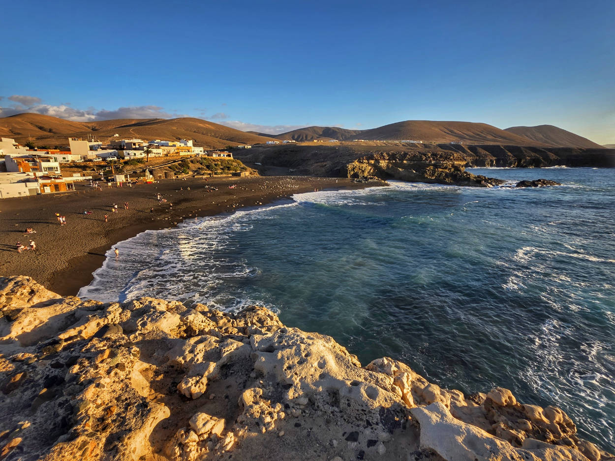
The conquest of Fuerteventura began in Ajuy. The small, windswept bay of Ajuy became the gateway for the conquistadors to conquer the entire island. From here, the conquerors moved inland to found the archipelago's first capital, Betancuria.
Today, there is a small fishing settlement, the pitch-black volcanic beach of Playa de Ajuy, and a fabulously beautiful trail carved into the rocks above a steep cliff, leading towards the dark caves of Cuevas de Ajuy.
Walking along the well-worn path through the limestone deposits, you'll also pass ancient stone lime kilns. For centuries, the extraction and export of limestone and black basalt rock was the main source of income for the locals, with the finished material loaded onto ships using massive wooden structures and cranes mounted on the cliffs.
Interesting facts
The rocks that form the cliffs and caves in Ajuy are the oldest exposed fragment of the Earth's crust in the entire Canary Islands, estimated to be over 100-150 million years old.
In the 19th century, Ajuy was Fuerteventura's main export port. Lime produced here was transported to other islands in the archipelago, but the development of newer construction technologies led to a sudden decline in this traditional industry.
The area of the caves and surrounding cliffs was formally protected in 1994 as the Monumento Natural de las Cuevas de Ajuy (Natural Monument of the Ajuy Caves).
Opening hours
The beach, trail and caves of Cuevas de Ajuy are accessible 24 hours a day, but for safety reasons, entering the caves and cliffs is only recommended from sunrise to sunset.
Some of my tips
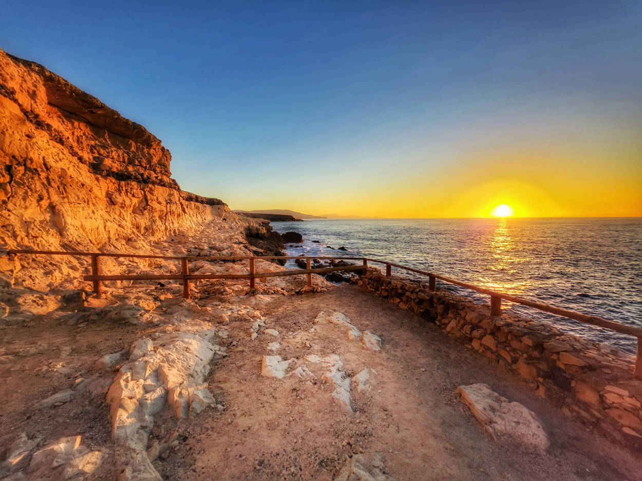
If you're planning to visit the beach and hike the trail to the dark caves (and I can't imagine not), plan your arrival so you can return from your walk for sunset. The beach is geographically located due west, and sunsets look incredible from there.
It is worth setting aside about 2 hours to walk along the cliffs into the caves, see the old limestone kilns and spend a few moments on the beach.
Parking at Playa de Ajuy beach, GPS coordinates:
28°24’02.1″N 14°09’22.0″W
28.400584, -14.156116 - click and route
Second parking lot near the town (200 m from the beach), GPS coordinates:
28°23’57.5″N 14°09’15.9″W
28.399306, -14.154417 - click and route
16. Mirador Astronomico de Sicasumbre
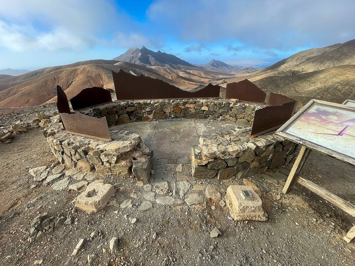
photo: Mike Peel (www.mikepeel.net) on the terms CC BY-SA 4.0
source: wikipedia.org
As darkness falls, the rugged, mountainous landscape of southern Fuerteventura transforms into one of the most spectacular natural planetariums on Earth. Almost entirely devoid of large urban centers and the light pollution of its coastline, the island offers a velvety black sky with crystalline clarity.
The Astronomico de Sicasumbre viewpoint, designed not only for admiring mountain panoramas by day, but primarily for astronomy enthusiasts and night sky observers. This site is an official site of the Starlight Reserves network, which could be more figuratively called dark sky reserves (Reserva Starlight is a certification awarded to areas with exceptionally clear skies protected from artificial light).
The observation deck was designed with attention to educational and functional details. It is equipped with sundials and special auxiliary installations. You'll find small architectural elements here: a compass clock, direction indicators, and a small star clock (nocturlabio – an ancient navigational device used to determine time at night based on the position of the Polaris and constellations). The observation deck's designers also considered professionals and night photography enthusiasts. Stable stone pedestals with special mounts for their own telescopes and camera tripods were provided, protecting equipment from gusty winds (additionally, stone walls were built here to create aerodynamics that mitigate air movement at the observation deck).
Interesting facts
The entire island of Fuerteventura was declared a UNESCO Biosphere Reserve in 2009, and in 2015 the designated area was awarded the prestigious title of Starlight Reserve for the luminous purity of its atmosphere.
At the viewpoint, special metal boards with silhouettes of the surrounding peaks and cut-out lines of constellations have been placed, making it easier for beginners to find the most important stars in the sky without having to use mobile apps.
Access to the point is unlimited 24 hours a day.
Parking at the astronomical viewpoint, GPS coordinates:
28°17’17.8″N 14°09’44.1″W
28.288278, -14.162250 - click and route
Astronomico de Sicasumbre Viewpoint, GPS coordinates:
28°17’16.2″N 14°09’35.4″W
28.287829, -14.159839 - click and route
17. Punta Guadalupe and La Pared
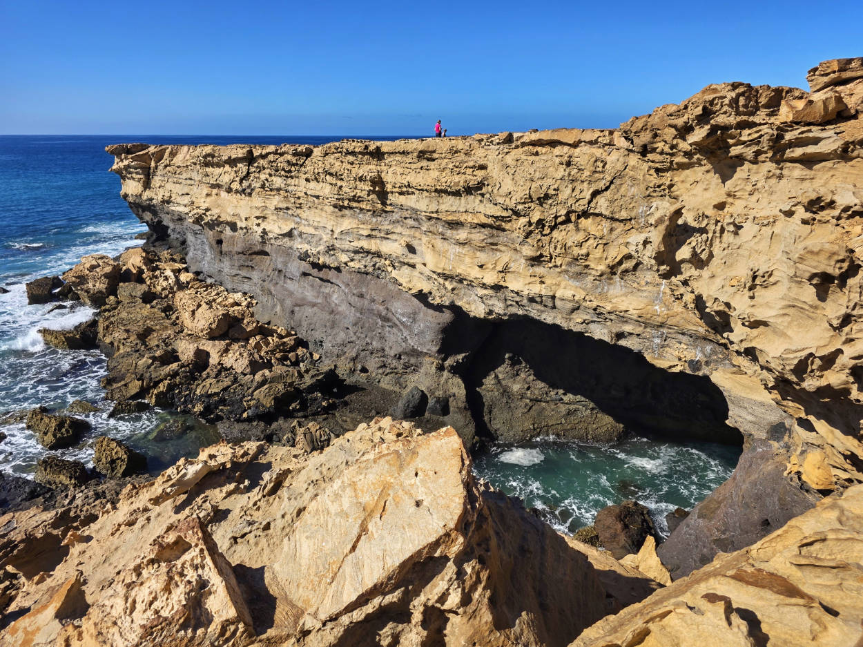
In 1493, when Christopher Columbus commanded his second voyage to the New World, fervent prayers for deliverance from a raging Atlantic storm erupted aboard his flagship caravel. The admiral swore an oath that if his fleet survived the elements and reached shore safely, he would name the first piece of land he sighted after the Spanish sanctuary, the Real Monasterio de Santa María de Guadalupe in Extremadura. A reminder of those oceanic events and the profound religiosity of those early navigators are the numerous sites scattered along ancient Spanish sea routes, marking historic landmarks and navigational bastions on rugged, rocky coastlines. Punta Guadalupe is one such striking, jutting headland, where the power of the ocean clashes with the silent testimony of an ancient history of navigation and conquest.
The headland's geometric, almost flat shape is incredibly impressive, and while most guidebooks don't lead you there, mine definitely does. For me, it was a wonderful surprise and a place I spent far more time on than I had planned.
The place is available without restrictions 24 hours a day.
Parking near Punta Guadalupe, GPS coordinates:
28°13’04.8″N 14°13’08.6″W
28.217988, -14.219043 - click and route
18. Playa del Viejo Rey at La Pared
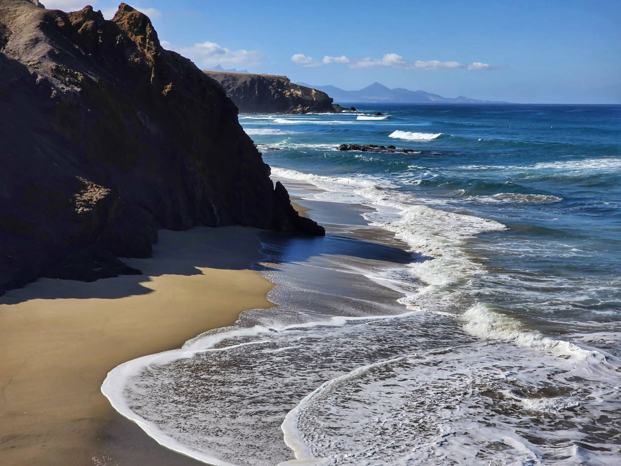
Just a few hundred meters from Punta Guadalupe lies the small village of La Pared. This name means "wall" in Spanish, and it's easy to guess that it's not a coincidence. At this precise spot stood a massive stone defensive wall, stretching from the island's west to east coast for over six kilometers (at this point the island is narrowest). It was built without mortar, piling up the raw, dark basalt and local volcanic rock. The wall was intended to act as a barrier against raids for livestock, and over time, it became a significant landmark, referenced by the first French and Spanish chroniclers of the conquest of the archipelago.
Today, La Pared is an oasis of peace, and just driving through it feels like stepping into a deserted resort town from decades ago. The former, extensive infrastructure, designed for a vibrant holiday life, seems to have been frozen in time and remains so to this day, thoroughly eroded by the ravages of time and buried under windblown sand and dust.
The sound of the ocean clashes with enormous cliffs of sandstone and solidified lava, and at their feet stretches the phenomenal black sand beach of Playa del Viejo Rey (Old King's Beach). A powerful undertow and the lack of a reef protecting the shore allow the ocean to demonstrate its true power. Layered cliffs, tinged with gold and red, tower above the black sand. Carved over millions of years by wind and sea salt, they reveal fascinating geological cross-sections of ancient dunes and volcanic sinter.
Interesting facts
The Isthmus of La Pared is only about 4,5 kilometres wide at its narrowest point, making it the narrowest point in all of Fuerteventura.
Playa del Viejo Rey beach is considered one of the most dangerous for bathers due to treacherous underwater currents.
Thanks to the westward orientation of the cliffs, La Pared is considered by photographers to be one of the best places on the island to observe sunsets.
The beach is often flooded, and the access road is closed for safety reasons. The access road then serves as a viewing point.
Parking near the entrance to Playa del Viejo Rey, GPS coordinates:
28°12’52.0″N 14°13’18.9″W
28.214447, -14.221923 - click and route
19. Sotavento Beach
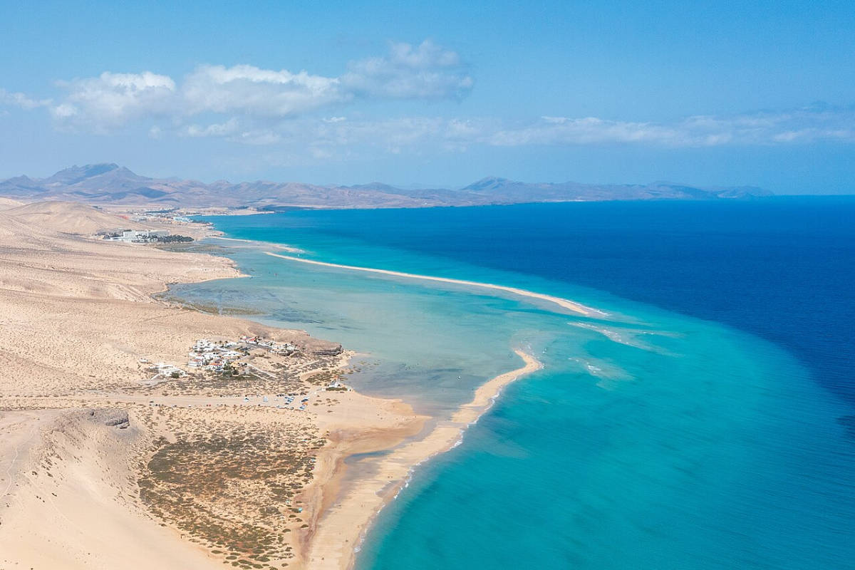
photo: dirkvorderstrasse on the rules CC BY-SA 2.0
source: wikipedia.org
Stretching for nearly nine kilometers, Playa de Sotavento is no ordinary beach. The gentle, almost flat terrain creates a gigantic, shallow lagoon when the tide reaches high water. A barely visible sandy embankment separates the calm, crystalline waters of the lagoon from the open Atlantic, creating a natural, shallow lake rarely exceeding a meter in depth. In the sunlight, the color palette shifts from emerald green, through turquoise, to the honey-like hue of the golden sand, brought to the island by the wind from the Sahara, less than a hundred kilometers away.
Interesting facts
The endless dunes and shallows here served as the setting for key scenes in the 2018 blockbuster "Solo: A Star Wars Story." The deserted, windswept beach perfectly embodied the remote, harsh planet Savareen, where the heroes recovered precious coaxium fuel.
The beach is accessible without restrictions.
Parking at the southern end of Playa de Sotavento, GPS coordinates:
28°06’41.7″N 14°15’49.7″W
28.111572, -14.263802 - click and route
Parking at the northern end of Playa de Sotavento, GPS coordinates:
28°08’14.5″N 14°14’38.7″W
28.137360, -14.244070 - click and route
20. Casa Winter
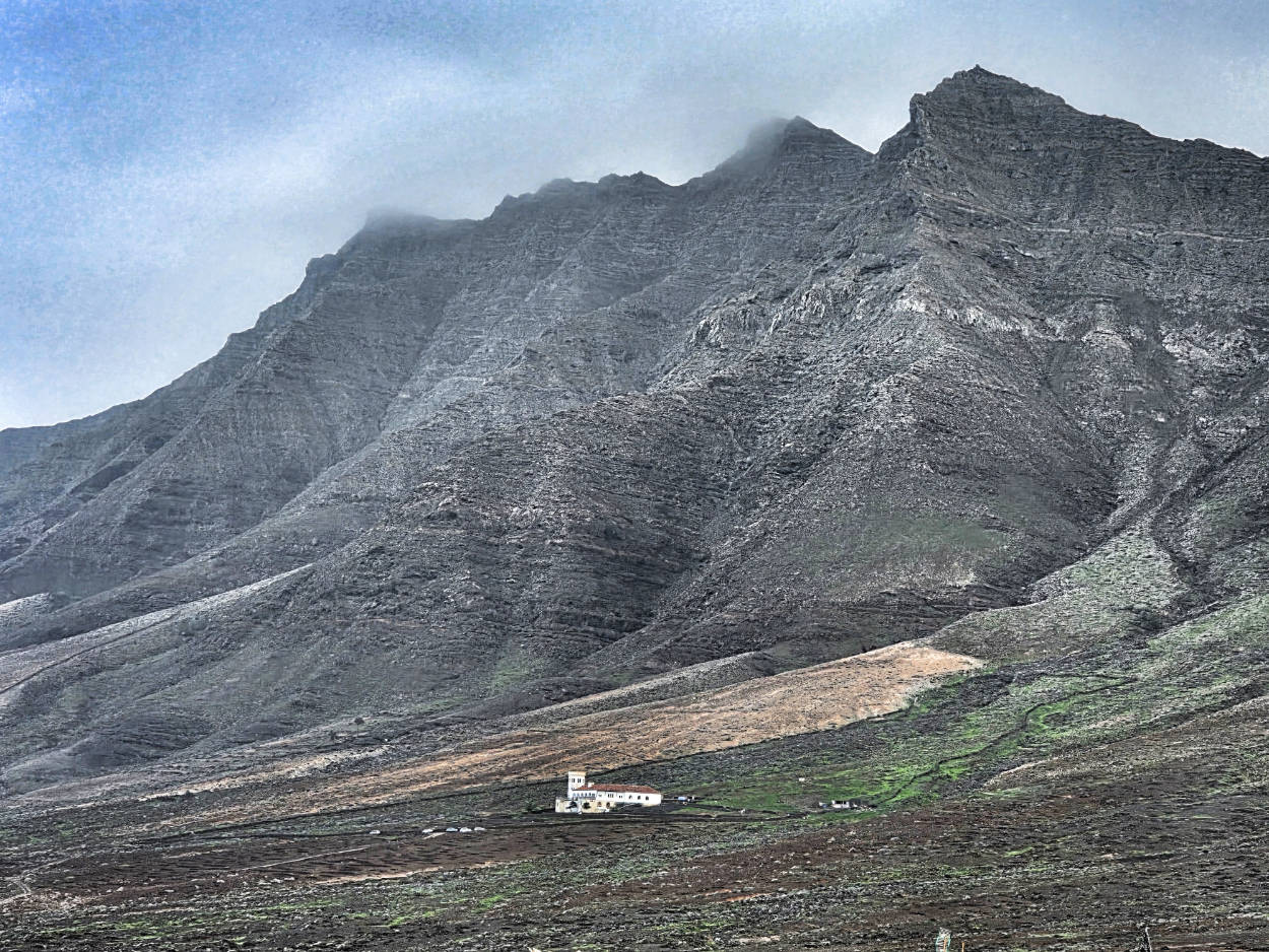
When German engineer Gustav Winter saw the rugged, completely isolated coast of the Jandía Peninsula in the late 30s, he knew he had found the perfect location for his enigmatic project. Built on the slopes of the volcanic Jandía Massif, almost at the tip of Fuerteventura, the two-story Casa Winter residence has evoked powerful emotions for decades, providing fodder for some of the most astonishing stories from World War II. The building, with its distinctive, round tower resembling a lighthouse, was designed as a closed quadrangle with an internal courtyard. Local dark basalt, cement imported by sea, and dark, hardwood were used to construct such a massive structure in this isolated area. The result is a structure that resembles a solitary fortress rather than a traditional Canarian estate.
The villa's legend is so intricately interwoven with official historical records that it's incredibly difficult to separate fact from fiction. During the war, the southern part of the island, where the house stands, was closed to public traffic and declared a strictly controlled military zone. The building's underground levels (massive concrete cellars equipped with thick defensive doors and ventilation systems) have spawned thousands of speculations. The most popular (though, in my opinion, more detached from reality) claim that a secret tunnel was carved beneath the house, leading directly to the ocean, intended to serve as a hidden supply base for German submarines (U-boats) operating in the Atlantic. Another, even darker and more common hypothesis suggests that after 1945, the residence served as a secret staging point and plastic surgery facility for high-ranking Nazi German dignitaries escaping to South America after the lost war.
Although Gustav Winter's family has consistently denied the allegations, claiming the estate was intended solely for the agricultural and livestock development of the peninsula, the site's infrastructure seems to tell a completely different story. Remnants of underground rails used to transport heavy equipment, large power generators, and rooms for laboratory and medical purposes are found here. There is ample room for conjecture and speculation, and no reasonable explanation has yet emerged.
Interesting facts
Despite repeated surveys and explorations, the flooded submarine tunnel has never been found, although local residents swear that during the war years they saw flashes of light beamed from the tower towards the ocean.
Near the estate, on the sandy plains of Cofete Beach, the engineer had marked out makeshift runways for use by small military and courier planes.
The basement kitchens were equipped with large steel countertops and disinfection areas, which was (to put it mildly) very different from the home standards of the period and strongly supports the theory of an underground hospital and plastic surgery for Nazis fleeing Europe to South America.
Some of my tips
Entry to Casa Wintera is subject to the presence and current consent of the property's owners. I cannot determine when or how visitors can visit the interior.
Getting to Casa Winter is a real challenge for drivers. It's a narrow, winding, and bumpy gravel mountain road from Morro Jable (no paving), with a long section overlooking cliffs. Car rental companies exclude this section from their insurance. Therefore, if you damage your car while driving this road, the repairs will be entirely at your own expense. Therefore, I recommend driving with extreme caution.
The gravel road alone (from Morro Jable to Cofete is about 21 km) takes about 60 minutes each way. On-site time to explore the house, cellars, and surrounding area is approximately 1,5 to 2 hours.
The place is extremely isolated. Bring plenty of food and drink. There are no food and drink options on the route or at the site. Be sure to bring a hat and sunglasses.
Winter's Villa, GPS coordinates:
28°06’06.5″N 14°22’31.0″W
28.101812, -14.375286 - click and route
21. Playa de Cofete
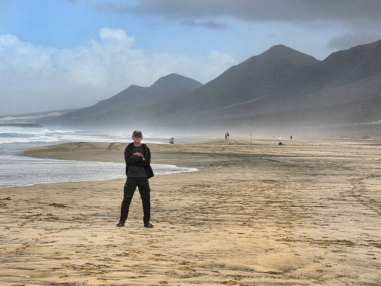
Stretching over twelve kilometers, Playa de Cofete is undoubtedly the most austere, monumental, and isolated strip of land in the entire Canary Islands archipelago. A gigantic ribbon of honey-colored, fine sand, blown by wind and ocean, is washed on one side by the powerful, untamed waves of the foaming Atlantic, and on the other, sheltered by the dark, jagged cliffs of Pico de la Zarza (the island's highest peak, 807 meters above sea level). Bleak, foreboding walls of solidified lava and black basalt cut this beach off from the rest of the world, creating an atmosphere of absolute isolation and heightening the sense of the force of the elements.
As for how to get there and all the practical tips, they are identical to the previous point, i.e. Villa Wintera, because it is located right next to Cofete beach.
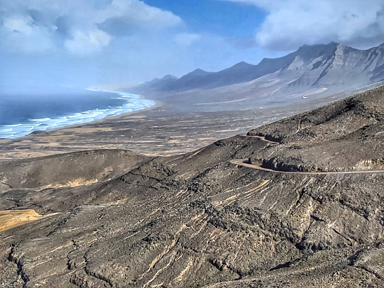
Interesting facts
The beach cemetery "Cementerio de Cofete" was established in the 19th century because transporting the bodies of deceased residents across the high mountains to the remote parish of Pajara was too long and cumbersome. Instead, the deceased were buried in the sand next to the ocean, secured only with local basalt stone.
On the sandy plains near the beach you can still see the remains of a flat area that served as a makeshift landing strip for small military and liaison planes in the 40s.
Parking at the beach and Cofete cemetery, GPS coordinates:
28°06’37.0″N 14°23’17.5″W
28.110283, -14.388184 - click and route
22. Faro de Jandia
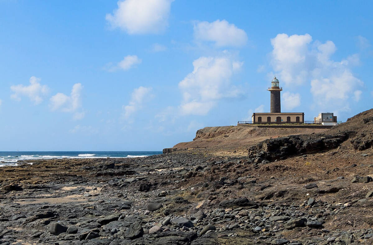
photo: H. Zell on the principles GNU Free Documentation License
source: wikipedia.org
When the walls of Faro de Jandía, carved from local volcanic basalt, were being built in 1864 under the direction of engineer Mario Samper, the Punta de Jandía headland was still a remote area. The lighthouse was designed to meet an urgent navigational need. The island's treacherous western coast, dotted with underwater reefs and shallows, had already contributed to the destruction of dozens of ships sailing the route between Europe, Africa, and South America. The desert landscape, dark basalt rock, and 19-meter-high cylindrical tower created a classic example of 19th-century Canarian public architecture. At the heart of the tower was a powerful Fresnel lens imported from Paris, initially fueled by olive oil and later by kerosene, which transmitted a light signal over a distance of several nautical miles.
For decades, the lighthouse keeper and his family lived here in complete isolation from the rest of the island. Water and food supplies were brought to them every few months on camelback or by sea. During World War II, due to the lack of civilian control on the southern tip of the archipelago, the ocean waters surrounding Punta de Jandía became silent witnesses to clandestine naval operations. Today, the former lighthouse keeper's quarters have been converted into a museum (Centro de Interpretación del Parque Natural de Jandía), showcasing the richness of the local volcanic geology and endemic fauna and flora.
Interesting facts
A few hundred meters from the cape, on the ocean floor, lie the remains of the steamship Majestic, which ran aground on the local rocks during a dense fog in the early 20th century.
Punta de Jandía is considered one of the sunniest spots in all of Fuerteventura. Annual rainfall rarely exceeds 50 millimeters.
In the inner courtyard of the lighthouse keeper's house, an underground rainwater tank was built, which collected every drop of rain that ran off the flat roof.
Opening hours
Lighthouse Museum:
Tuesday - Saturday: 10:00 - 18:00
Sundays and Mondays: closed
Some of my tips
Getting there from Morro Jable requires driving about 20 kilometers on a winding, unpaved gravel road. Standard rental cars don't come with insurance for this road. Rental companies exclude this section of the road from their insurance. Therefore, if you damage your car while driving, the repairs will be entirely at your own expense. Therefore, I recommend driving with extreme caution.
For a leisurely one-way drive along a gravel road, allow about 60 minutes. On-site viewing of the lighthouse, exhibitions, and cliffs takes about an hour.
Parking at the Faro de Jandía lighthouse, GPS coordinates:
28°03’57.9″N 14°30’27.0″W
28.066083, -14.507500 - click and route
23. Playa del Matorral
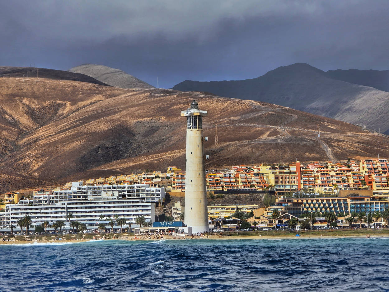
When, in the second half of the 20th century, the southern tip of Fuerteventura was becoming a mecca for tourists seeking respite from the European cold, the small fishing village of Morro Jable bore little resemblance to the sandy paradise we know today. The island's oceanfront was bordered by marshy, salt-laden marshes, constantly flooded by high tides. Today, this unique ocean ecosystem forms the heart of Playa del Matorral. A golden ribbon of fine sand, several hundred meters wide, stretches for over four kilometers along the Morro Jable resort.
The central and most recognizable point on the beach is the sixty-meter-high Faro de Morro Jable lighthouse, which was commissioned in 1996. Next to the lighthouse, a wooden walking platform is built directly into the sand dunes.
Interesting facts
Right next to the promenade running along the beach, at the height of the lighthouse, stands a monumental, full-size skeleton of a sperm whale (Physeter macrocephalus), found on the shores of the island in 2005, which is a reminder of the presence of large marine mammals in the waters surrounding the archipelago.
A modern pedestrian and bicycle path runs along Playa del Matorral, connected by special wooden footbridges, designed to ensure that tourist traffic does not in any way disturb the natural breeding habitat of seabirds.
Some of my tips
The only problem I encountered while staying here was… the lack of parking. And it's not that there aren't any spaces. There are plenty, and the free parking along the beach stretches quite a distance, but all the spaces are constantly occupied. I was here in winter and drove past the vast parking lots several times without success. So I have to mention this, because what happens in summer, when there are even more people willing to park?
Playa del Matorral is known for its clear and customary division of beach space. The area closer to the settlement of Morro Jable is intended for families with children, while the wide sandy areas around the lighthouse constitute one of the most well-known and accepted naturist areas.
It is forbidden to stray from the specially designated wooden footbridges and enter the Saladar de Jandía salt marshes. Doing so may result in a hefty fine.
Landmark for the parking lot near the lighthouse, GPS coordinates:
28°02’55.7″N 14°20’00.4″W
28.048806, -14.333444 - click and route
To find a parking spot, simply drive along the beach and look out. The parking lot stretches along the beach.
24. Pico de la Zarza
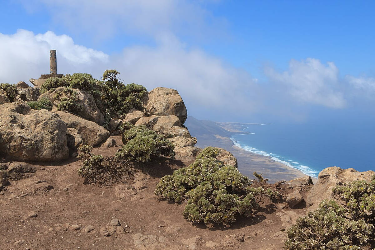
photo: H. Zell on the principles GNU Free Documentation License
source: wikipedia.org
It's hard to believe that the rugged Jandía Massif was once part of a vast, perfectly conical volcano. Over 14 million years ago, as a result of a colossal geological cataclysm, the southern half of the mighty crater collapsed and slid into the ocean, creating a monumental, 800-meter-high cliff that plunges vertically toward the endless sandy plains of Cofete. The highest point of this majestic remnant of a bygone world is Pico de la Zarza, Fuerteventura's highest peak. Due to the distinctive profile of its two neighboring peaks, this peak is known locally as Orejas de Asno (Donkey's Ears). Rising to 807 meters above sea level, it is the highest observation deck on the island.
Interesting facts
Although Fuerteventura is the driest of the Canary Islands, the summit of Pico de la Zarza is almost constantly shrouded in clouds and fog, creating a unique microclimate with annual rainfall several times higher than on the coast. This constantly humid microclimate has given rise to a sky-high, endemic botanical garden. It is the only place on Earth where the rare Argyranthemum winteri shrub (a variety of the Canarian butterwort named after engineer Gustav Winter) and the endangered Cyperus capitatus grow naturally. The entire population of Argyranthemum winteri consists of only a few dozen wild specimens. To protect them from feral goats, the Jandía Natural Park authorities have fenced the summit with a special protective cage.
Access to the trail and the summit is unrestricted (except for the summit, where there are caged bushes)
Some of my comments
The trail (marked PR-FV 54) begins at the roundabout in the upper part of Morro Jable (at the end of Calle Dulcinea). There, you'll find a free gravel parking lot where you can leave your car.
The Pico de la Zarza trail is the most demanding hike on the island (approximately 15 km round trip). Plan on about 5 to 6 hours to complete the entire route, rest at the summit, and photograph the views of Cofete from there.
You don't have to hike the entire trail. The first interesting viewpoints appear after about 750 meters.
Comfortable and stable hiking shoes with a hard sole are absolutely essential (sandals, flip-flops, or street shoes are extremely dangerous). It's hot at the bottom, but at the top there's a strong, cool wind, and dense fog often settles in. Be sure to bring a windbreaker or softshell jacket, a hat, a sun hat, and sunscreen with high UV protection.
There are no water sources, shade, or food stalls along the entire route. Be sure to bring plenty of water and high-energy snacks.
Trail profile: PR-FV 54: Morro Jable – Pico de la Zarza
Parking at the trailhead on PR-FV 54 to Pico de la Zarza, GPS coordinates:
28°03’33.6″N 14°19’42.2″W
28.059338, -14.328401 - click and route
25. Faro de la Entallada
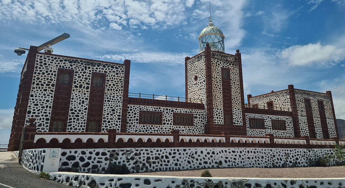
photo: Jens Kunstfreund on the principles CC BY-SA 4.0
source: wikipedia.org
Built at an altitude of almost 200 meters above sea level, Faro de la Entallada is an architectural landmark in the entire archipelago. Its U-shaped structure, with a charming interior courtyard, was created using an unusual material: a rare, red volcanic stone called cantería de puš. The dark, rust-red blocks blend seamlessly with the snow-white plaster, creating geometric, Moorish patterns.
A modern, wood-and-steel observation deck clings to the cliff's edge, suspended directly above a sheer drop into the churning Atlantic. In the sunlight, the lighthouse's stark, pumice-clad walls create a striking contrast against the deep blue ocean.
The interior of the lighthouse is not accessible to tourists.
Some of my comments
Access from the town of Las Playitas is via a winding mountain road, approximately 6 kilometers long. The final section is very narrow and single-lane, with passing lanes on the shoulders, requiring extreme caution and slow driving, especially given the spectacular views outside the car windows.
The lighthouse sits on a completely exposed, high promontory, subject to strong sea winds. A windbreaker or softshell jacket and sunglasses are essential.
It is worth spending about 1 to 1,5 hours on the access road in both directions, walking around the viewpoint and taking souvenir photos.
Parking at the Faro de la Entallada lighthouse, GPS coordinates:
28°13’49.2″N 13°56’53.7″W
28.230319, -13.948247 - click and route
26. Poblado de La Atalayita
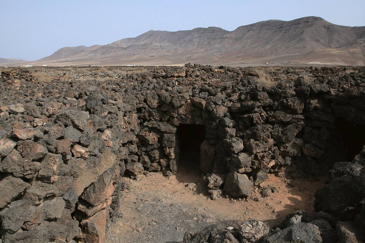
photo: Frank Vincentz on rules CC BY-SA 3.0
source: wikipedia.org
La Atalayita Bay is one of the most important and fascinating archaeological sites in Fuerteventura. Located in the Pozo Negro Valley, surrounded by a rugged, volcanic landscape, it offers a glimpse into the lives of the island's original inhabitants (Majos) before the Spanish conquest in the 15th century. The settlement has survived almost intact thanks to its unique location within a solidified lava flow.
The heart of this prehistoric settlement are the so-called casas hondas, literally "deep houses." The island's original inhabitants did not build traditional buildings above ground. They utilized natural basalt depressions and collapsed lava tubes, which they then expanded by stacking raw, unworked blocks of volcanic rock without the use of any mortar. The roofs of these semi-subterranean structures were made of overlapping, flat basalt slabs, covered with earth and fine gravel. This provided excellent thermal insulation, protecting them from the scorching sun by day and the chilly desert wind at night.
The settlement functioned for centuries as a pastoral and agricultural settlement. At its peak, it had over 100 different structures. In addition to residential houses, the Poblado de La Atalayita area also contained stone goat pens (which were the basis of the Majos economy) and defensive and observation posts.
Today, Poblado de La Atalayita functions as an open-air archaeological museum. Walking along designated paths amidst the raw, volcanic lava, you can get a close-up look at the interiors of houses hidden beneath the earth.
Admission to the entire archaeological site and to the small museum is free.
Opening hours
The open-air archaeological site itself is open to visitors at any time. However, if you'd like to enter the small museum building with its multimedia exhibition, it's open Tuesdays through Saturdays from 10:00 a.m. to 17:00 p.m. (closed Sundays and Mondays).
Note: the local museum office sometimes has shorter opening hours (e.g. until 14:00 p.m.) depending on the season, so it's best to aim for the morning hours.
Interesting facts
Archaeological excavations have shown that the settlement continued to be in use long after the Spanish conquest in the 15th century. Local shepherds continued to use the prehistoric stone chambers as shelter for themselves and their goats until the 20th century.
The archaeological zone has a small museum, but most of the exhibits and structures have remained in their natural location in the open air, constituting one of the few "living" open-air museums of the Stone Age on the archipelago.
Some of my comments
Navigating the settlement requires walking on uneven, very sharp, solidified lava flows. Comfortable hiking shoes or sturdy, thick-soled athletic shoes are absolutely essential (flip-flops and sandals can cause cuts on the sharp basalt edges).
The entire area is completely exposed, with no shade whatsoever. Be sure to bring a hat, sunglasses, sunscreen with a high UV protection factor, and plenty of drinking water.
It is worth spending about 1 to 1,5 hours walking among the stone houses, entering some of the reconstructions and visiting the small museum.
Parking at Poblado de La Atalayita, GPS coordinates:
28°19’25.8″N 13°55’39.7″W
28.323833, -13.927694 - click and route
27. Museo de las Salinas del Carmen
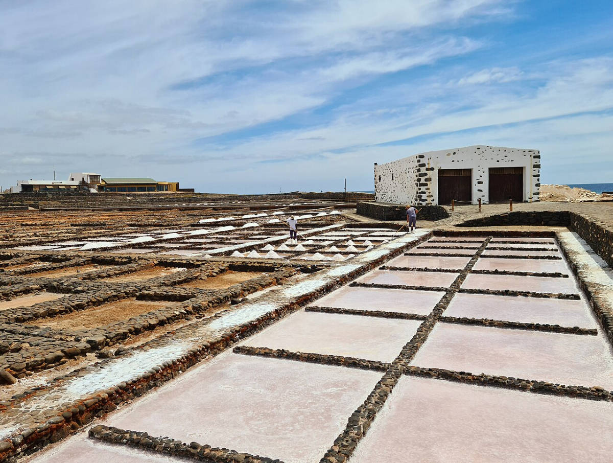
photo: Jens Kunstfreund on the principles CC BY-SA 4.0
source: wikipedia.org
The Salinas del Carmen are the only traditional salt pans in Fuerteventura that have stood the test of time and continue to produce salt exactly as they were two centuries ago. The choice of this location on the island's eastern coast was a deliberate one. The flat, rocky shore allowed for the excavation of a system of shallow pools, known in Spanish as tajos (flat, rectangular troughs for brine evaporation). The key to the salt pans' operation is harnessing natural elements: the ocean, wind, and the scorching sun. Seawater accumulates during high tides in a special storage basin. From there, through a network of wooden and stone channels, it is distributed by gravity to hundreds of shallow pools. Dry trade winds and intense solar radiation cause the water to evaporate, leaving a crispy layer of crystalline salt on the surface. Salt workers hand-harvest the crystals using wooden scrapers, creating characteristic white pyramids at the pools' edges. The most prized product here is Flor de Sal (flower of salt – the delicate, outer layer of crystals collected from the surface of the water at the beginning of the crystallization process), considered a culinary delicacy due to its richness in minerals.
Interesting facts
The shallow, salty pools create a unique habitat for migratory birds; it is one of the few places on the island where you can observe the rare Kentish Plovers and Stilts.
The local Flor de Sal contains significantly less sodium chloride than factory-made salt, but is rich in natural magnesium, calcium and potassium, which gives it a more delicate, less bitter taste.
Opening hours
Summer season (May to October): Monday - Sunday: 10:00 - 18:00
Winter season (November to April): Monday - Sunday: 09:30 - 17:30
Some of my comments
The white salt flats act as a natural mirror, magnifying the sun's rays. Sunglasses, a hat, sunscreen, and a windbreaker are essential (due to the constant ocean breeze).
Parking lot at the Museo de las Salinas del Carmen, GPS coordinates:
28°22’03.2″N 13°52’17.0″W
28.367556, -13.871389 - click and route
28. Puerto del Rosario
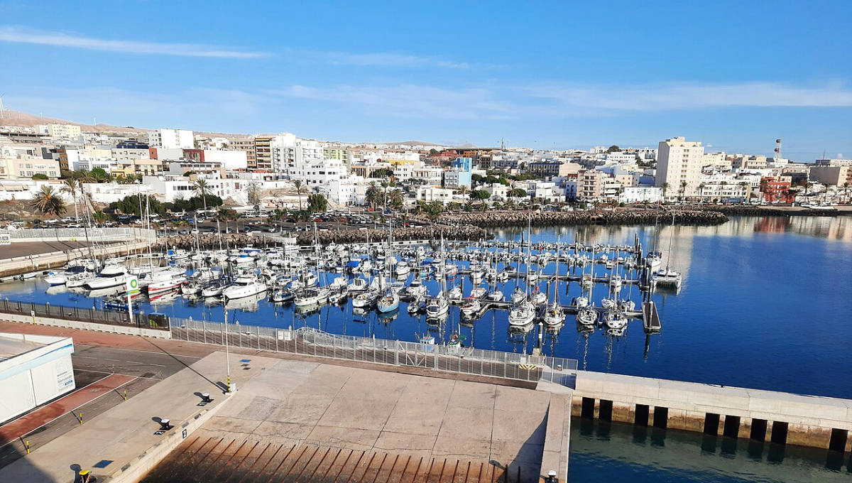
photo: Bybbisch94, Christian Gebhardt on the principles CC BY-SA 4.0
source: wikipedia.org
In the second half of the 18th century, Fuerteventura's current capital was still a modest trading and fishing settlement called Puerto de Cabras, or Goat Port. Shepherds from the interior brought their flocks here, and the modest bay served as a natural watering hole and a transshipment point for livestock. The real turning point came in 1795, when the first granaries and stone warehouses for the export of agricultural produce began to sprout along the shores. Its sheltered location from the powerful Atlantic waves led to the settlement becoming the island's main trading hub, and in 1860, it stripped historic Betancuria of its status as Fuerteventura's capital. Only in 1956 did local authorities, deeming the previous name too plebeian, rename the town Puerto del Rosario in honor of Our Lady of the Rosary, the patron saint of the local parish.
The focal point of the historic site is the Iglesia de Nuestra Señora del Rosario, built in stages between 1824 and 1835. It was constructed from classic volcanic materials: raw, dark basalt for the window frames and corners, whitewashed limestone for the facade, and weather-resistant Canary Island pine. Right next door stands the Casa Museo Miguel de Unamuno. In 1924, this housed a modest hotel, where the renowned Spanish writer and philosopher Miguel de Unamuno spent four months in exile, exiled for his criticism of General Primo de Rivera's dictatorship.
Contemporary Puerto del Rosario also strives to be an outdoor art space. Over a hundred installations are located along the seafront promenade and in the city's squares as part of the Sculpture Park. Works in brass, steel, and dark volcanic rock evoke maritime and pastoral traditions. Historic, conical lime kilns also survive along the shores.
I wasn't enchanted by the city's atmosphere, or rather, I should say I didn't like it (I definitely prefer the old capital, Betancuria), but it's always worth seeing for yourself.
Church of Iglesia de Nuestra Senora del Rosario, GPS coordinates:
28°29’56.1″N 13°51’38.3″W
28.498924, -13.860643 - click and route
Parking near the marina and seaside promenade, GPS coordinates:
28°29’49.3″N 13°51’33.0″W
28.497030, -13.859159 - click and route
29. Lobos (Isla de Lobos)
Just two kilometers off the northern coast of Fuerteventura lies Isla de Lobos, a small volcanic island measuring just over four square kilometers, whose history is intertwined with the fates of conquerors and the ocean's ancient inhabitants. Its name comes from the Mediterranean monk seals, known to Spanish sailors as lobos marinos (sea dogs), which once inhabited the local beaches and bays in large numbers. When Jean de Bethencourt organized the conquest of Fuerteventura in 1402, it was from this uninhabited island that he obtained provisions for his men, hunting these gentle marine mammals, which eventually led to their complete extinction in the region.
The islet is formed by the volcanic cone Montaña de la Caldera, rising 127 meters above sea level and the highest landmark in the area. Dark basalt, volcanic ash, and vast lava fields dominate the landscape.
Surrounded by rugged basalt, there are only two traces of 19th- and 20th-century human presence. On the northern promontory stands the stone Faro de Martino lighthouse, dating from 1865, built of dark rock and white limestone. Here, in the lighthouse keeper's house, the renowned Paraguayan writer and poet Josefina Pla was born in 1903. To the south lies the miniature fishing village of Puertito de Lobos, composed of several single-story white houses with blue doors, clustered around a natural pool with crystal-clear turquoise water.
Interesting facts
When the lighthouse became fully automated in 1968, the last lighthouse keeper, Antonio Hernández Páez, left the island; since then, no one has permanently inhabited it.
The island's highest peak, Montaña de la Caldera, is actually half of an ancient volcanic cone. The other half fell into the ocean in a massive landslide during an eruption thousands of years ago.
The island's sandy floodplains are home to the Canary Island Sea Lagoon (Limonium ovalifolium canariense), a rare species of halophyte plant found nowhere else in the world in the wild.
Practical tips
Access to the island is closely tied to ferry schedules. For conservation reasons, admission is divided into two daily times: morning (10:00 AM – 14:00 PM) and afternoon (14:00 PM – 18:00 PM).
Entry to the reserve is limited to 400 people per day and requires a free permit issued by the island authorities and the purchase of a ferry ticket, so booking in advance is absolutely essential (the official Ferteventura website recommends booking 5 days in advance).
The only way to reach Isla de Lobos is by sea from the port in Corralejo. You can choose between traditional passenger ferries (the crossing takes about 15 minutes) or faster inflatable boats.
There are no trees, natural shade, or shops on the island. Be sure to bring a hat, sunglasses, sunscreen with high UV protection, and plenty of drinking water and food.
It is worth setting aside about 3,5 to 4 hours for a loop walk around the island, a hike to the top of the volcano, and a swim in the turquoise bay of Puertito.
check out: current prices for connections from Corralejo to Lobos – [click]
(if the page does not open in your language, change it at the top of the page)
30.Lanzarote
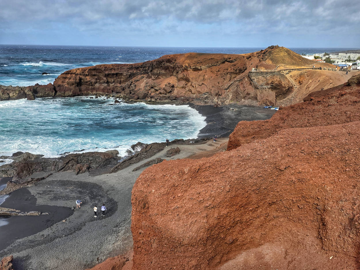
You can see a lot on Lanzarote even in a single day. If you have a car in Fuerteventura, it's possible to take the ferry with your car to Lanzarote. A ticket covering people and the car was cheaper than sailing without a car and renting a car in Lanzarote. Therefore, the decision was simple: we sailed to Lanzarote with the car.
check out: current prices of ferry connections Fuerteventura (Corralejo) – Lanzarote (Playa Blanca) – [click]
(if the page does not open in your language, change it at the top of the page)
Before you embark on this idea, be sure to check whether your chosen rental company allows you to take their car on the ferry. The most popular rental company on the island, Cicar, has no problem with this, and its customers can often even count on discounts from ferry operators (e.g., Fred. Olsen or Líneas Armas). In either case, simply inform the rental company when you rent a car.
check and compare: Current Cicar prices with other rental companies in Fuerteventura – [click]
(if the page does not open in your language, change it at the top of the page)
see: a simple guide to renting a car in Fuerteventura – [click]
Visiting Lanzarote will be the subject of a separate guide, so here I am only pointing out such a possibility, provided you have enough free time and energy.
Important to me!
Give the article a good rating (5 stars welcome 😀)!It's free, a for me it is very important! The blog lives on visits and thus has a chance to develop. Please do it and ... thank you in advance!
If you like my guides, you will certainly find the one I created useful guide catalog - [click]. There you will find ready-made ideas for your next trips, descriptions of other tourist destinations and an alphabetical list of guides divided into countries, cities, islands and geographical regions.
I also post link to Facebook profile - [click]. Come in and press "Follow"then you will not miss new, inspiring posts.
Unless you prefer Instagram. I'm not a social media demon, but you can always count on something nice to look at on my instagram profile - [click]. The profile will gladly accept any follower who likes it.
I read ALL the comments (and many times). Under each of them I could write that Thank you very much, because you are real fantastic. I often come back to comments because they give me motivation and energy. For me this is invaluable a treasure trove of good emotions!
Thank you for this here (I don't want to clutter the comments with repeated thanks). Know that by leaving a kind word here, you are doing a really good job for me!
I make the content I create available free of charge with copyright, and the blog survives from advertising and affiliate cooperation. So, automatic ads will be displayed in the content of the articles, and some links are affiliate links. This has no effect on the final price of the service or product, but I may earn a commission for displaying ads or following certain links. I only recommend services and products that I find good and helpful. Since the beginning of the blog's existence, I have not published any sponsored article.
Some of the readers who found the information here very helpful, sometimes ask me how you can support the blog? I do not run fundraisers or support programs (type: patronite, zrzutka or "buy coffee"). The best way is to use links. It costs you nothing, and support for the blog is self-generating.
Pozdrawiam