Coronavirus - Map: Poland, Europe, World. Coronavirus map for your phone.
Current COVID-19 data
Below you will find the data that is updated live. Under these data, I provide additional information on data sources and other alternative applications that allow you to control the current state of the situation.
I know publishing coronavirus data on a travel website is like a shot in the knee, but I also know that there is such a thing as liability. I know that nobody is going on a trip today, but I hope that in the near future the problem will start to disappear and we will start living normally again. This is when it will be worth checking what the situation looks like where we want to go on vacation. Let's enjoy travels and the world responsibly!
For some time (just like everyone else) I have been following reports about the development of the epidemic in Poland and in the world. However, I like to have access to current information, provided in an orderly manner and without unnecessary comments. So I was looking for convenient sources containing proven, reliable and at the same time easily accessible information. After a few days of using different sources, I chose the best three, allowing me to check what interests me the most at the moment. Those are:
- the best and most readable coronavirus map you can use easily on your phone
- map of the coronavirus in Poland
- coronavirus map in the world
None of the maps require anything to be installed, they are available online and regularly updated.
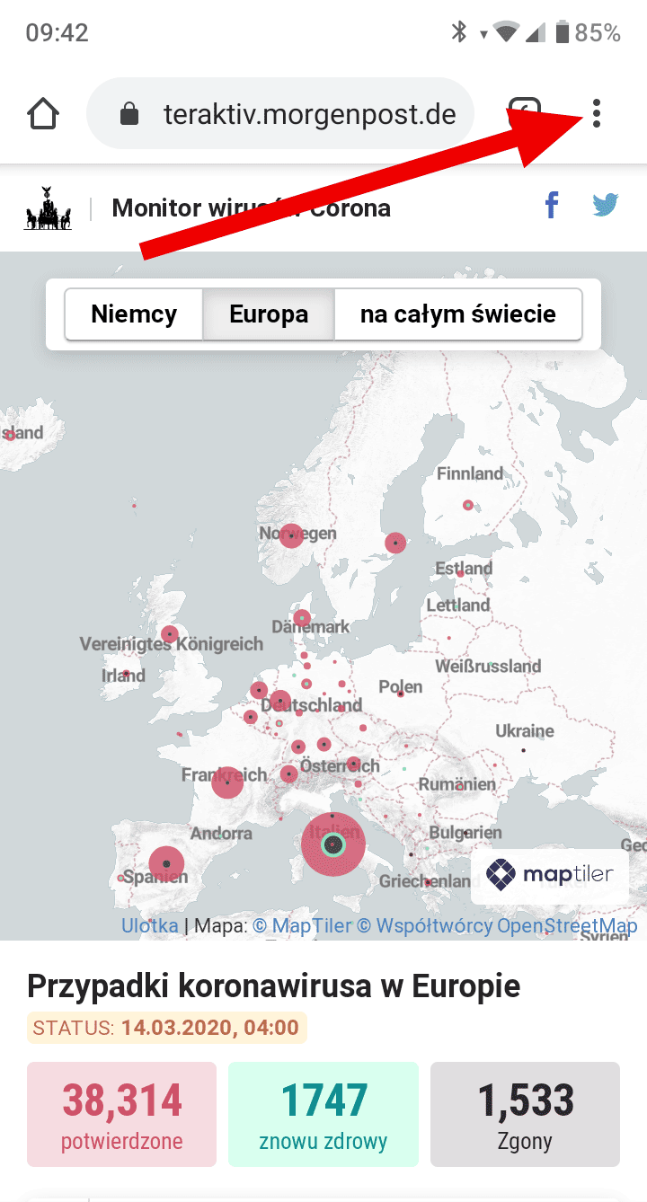
Coronavirus map for your phone
In the version for the phone, I definitely rate the map available on the website of the German daily highest Berliner Morgenpost. Works perfectly on the phone, is extremely readable and easy to use.
After opening coronavirus map pages - [click] it will open in German.
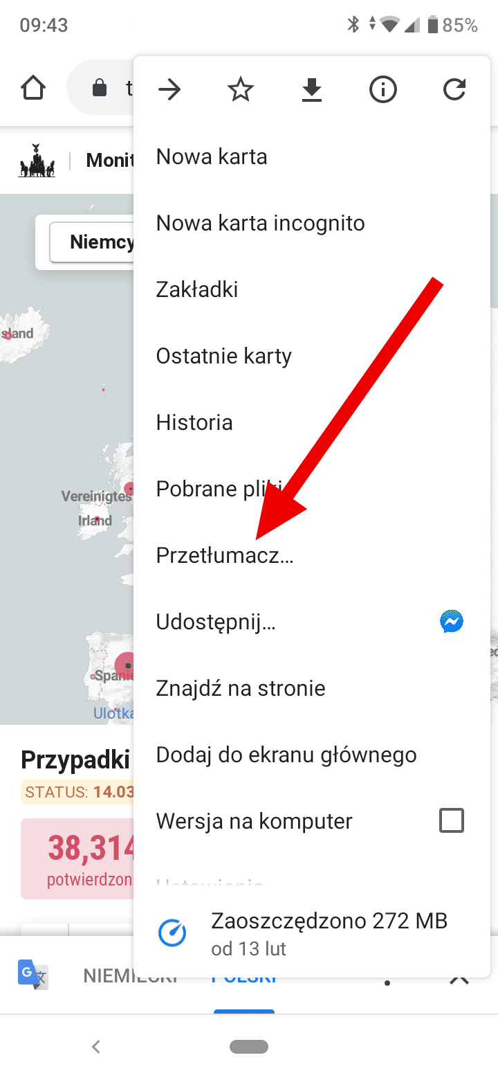
The map is easy to translate into any language. Just click on the three dots in the upper right corner of your phone's browser, as shown in the picture below.
Then select: Translate (as indicated by the arrow in the graphic below):
And finally, choose the language to which the page is to be translated:
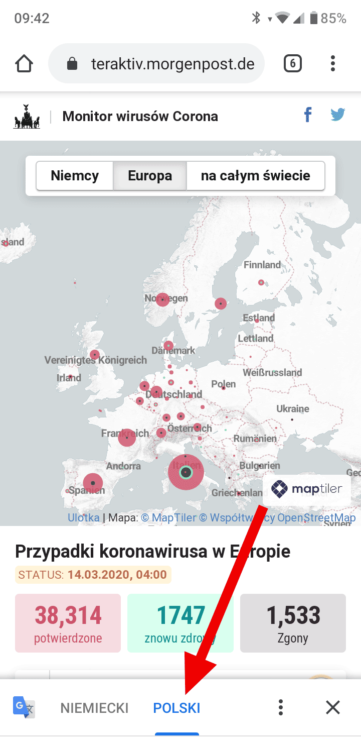
The map can be scaled and map elements are active. By touching the colored circles, you will get additional information about the area represented by the circle.
Map of the coronavirus in Poland
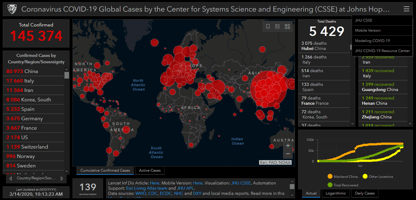
The map I recommend is not an official map provided by the Ministry of Health. The map of the coronavirus in Poland, made available by the Ministry of Health, is simply not as readable as I would expect. I like the initiative much more coronavirus maps in Poland - [click] using the company's tools ESRI, provided by the Center for Systems Science and Engineering at Johns Hopkins University, Baltimore. The map is based on official data received from health centers. The data is updated every few to several minutes.
The map contains a large amount of detailed data and is great for viewing on a computer screen.
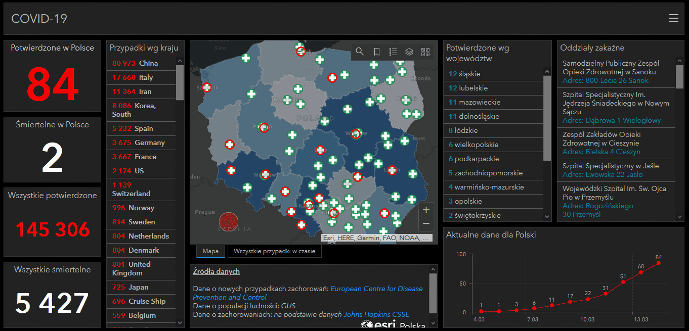
On the phone, due to the large amount of data on the screen, it is basically impossible to view (you can see it in the image below). You have to switch it to mobile mode.
In the menu in the upper right corner you will find a shortcut to the mobile version of the website (indicated by the red arrow in the picture below).
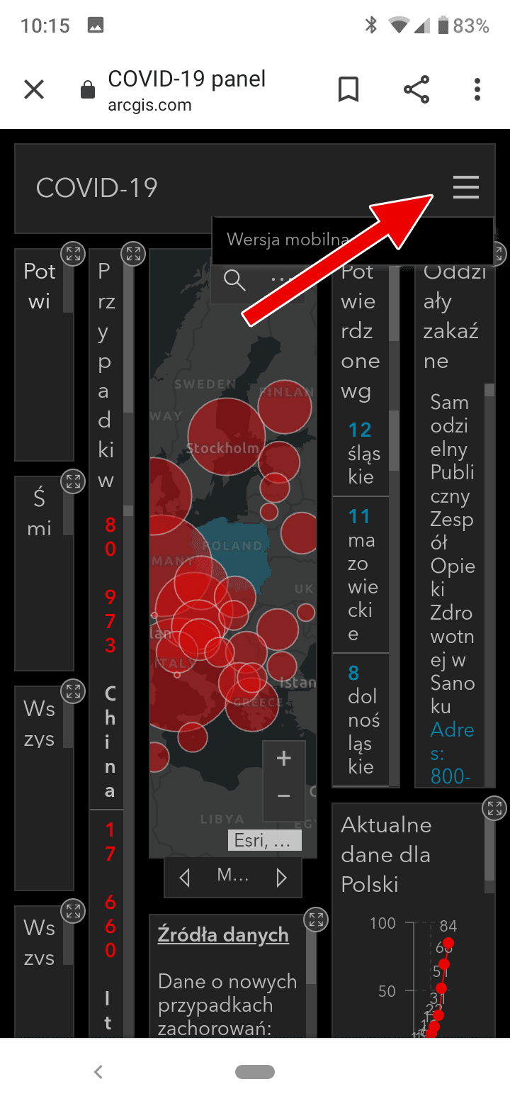
After switching to the mobile version, the application screen changes radically and looks like below (the current number of confirmed cases of coronavirus in Poland is presented by default). At the bottom of the screen, there are left and right arrows to view detailed additional information (red arrows indicate it in the picture).
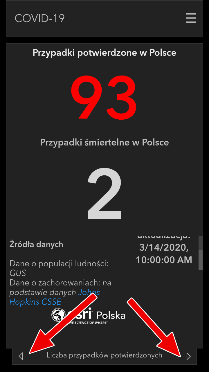
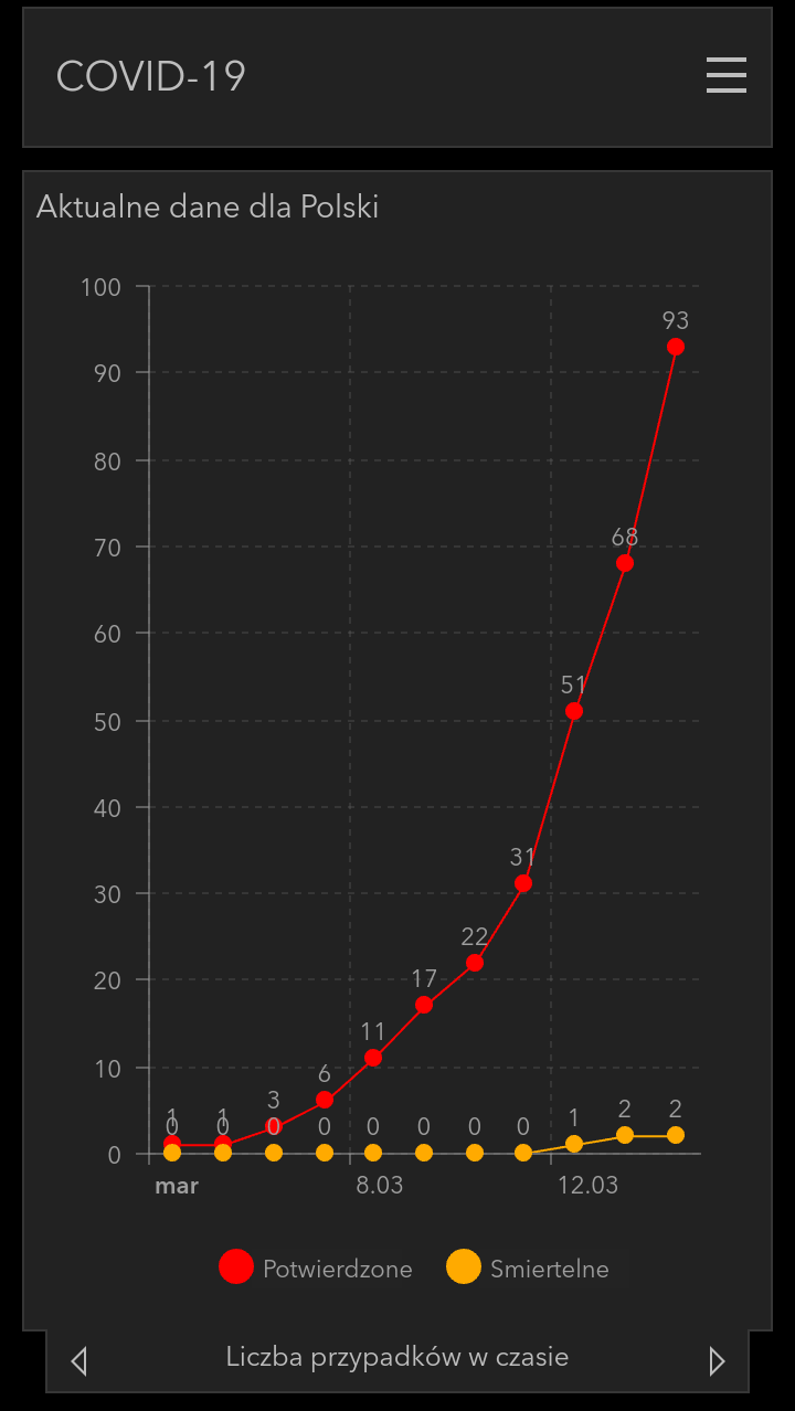
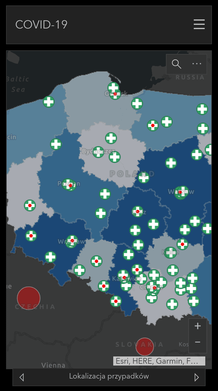
By going through individual screens, we can obtain information about:
- the number of confirmed cases of infections in Poland in the form of a graph
- locations of confirmed infections on the map
- a map of the number of infections broken down by voivodships
- the location of hospital infectious wards
Two example screenshots are provided below.
Map of the coronavirus in Europe and the world
Coronavirus map in the world - [click] it's exactly the same map from Hopkins University, only based on data from around the world.
Similarly to the map of Poland, it is possible to switch to mobile mode in the menu in the upper right corner of the screen.
Stay healthy and take care of yourself!