Solina and Lake Solińskie - accommodation, beaches, attractions. Where is the best place to stay at Solina? Map, routes, guide.
The map of Solina must be there!
... in fact, this is a map of the Solińskie Lake area, because without a map you can't move! Choosing the perfect vacation spot without a map is impossible!
Searching blindly offers is a waste of time, and it is not certain if the shot will be hit. Unfortunately, in order to choose the best solution, which is exactly what suits you best, you need to do some work. Check prices, quality and location of accommodation, location and distance from the beaches, the possibility of renting water equipment, the availability of other attractions: trails, walking paths, viewpoints, museums ... A lot of it.
Once I did this job and it occurred to me that maybe it will be useful to someone else. So I will try to remember everything again, collect it and present it in a form that will help you plan your dream vacation in this beautiful region. So let's go!
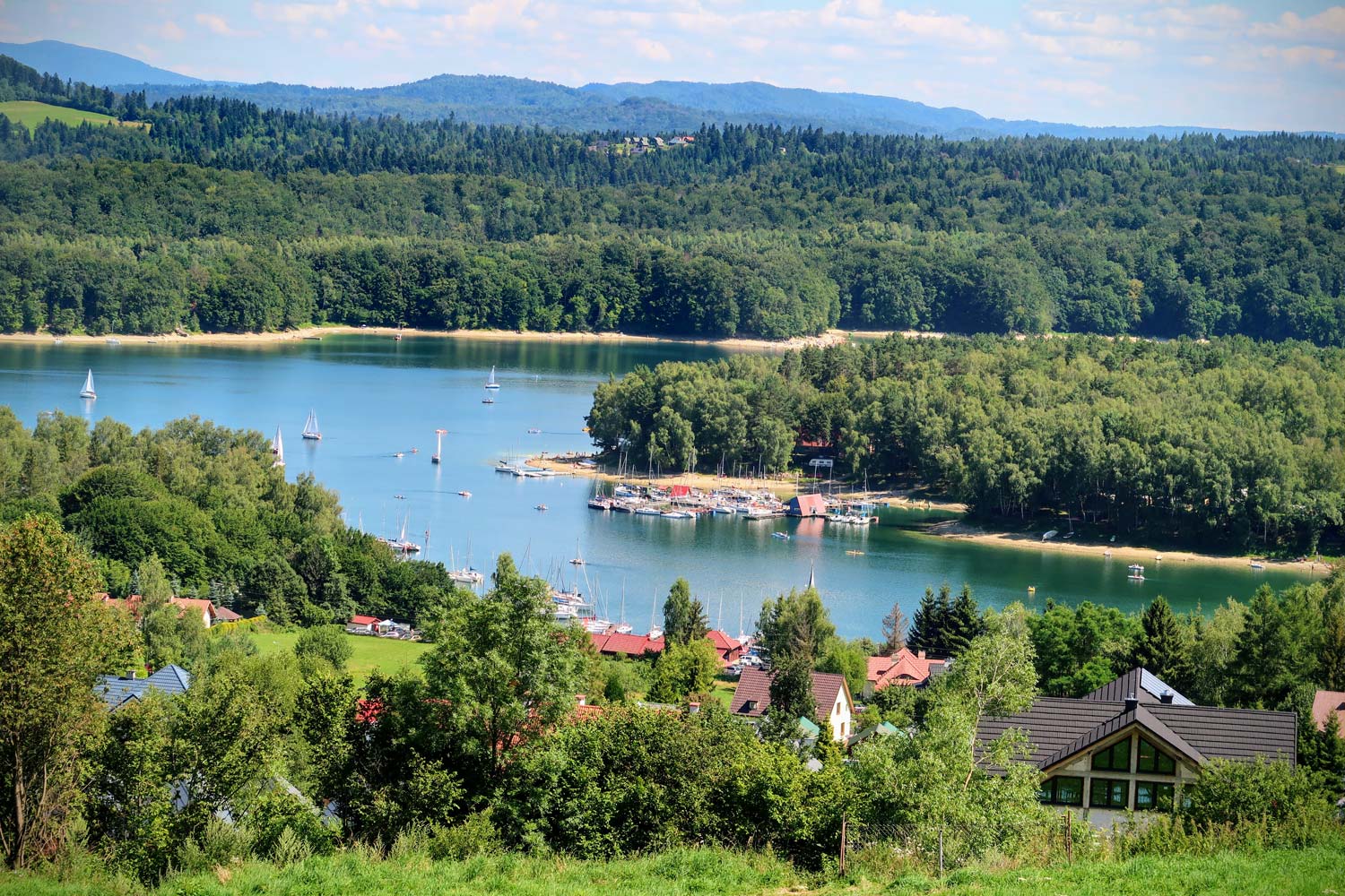
Lake Solina
I have already described some interesting information about the lake itself, the way it was created, the unusual shape of the reservoir, the dam and a few other things. It was by the way a separate entry about Solina (that is, a small village that is currently sunk at the bottom of the lake). A new village called Solina was established in a new place after the old one had been flooded.
Here I will not describe everything anew, but I invite you to read the earlier one entry about Solina - [click].
Here we will mainly deal with the map that will help us plan the trip.
Map of the Solińskie Lake and the surrounding area
Let's start with the basic map, on which we will mark the location of the town around Lake Solina. They include the most famous and popular ones, as well as those that are less popular.
Take a look below at the map of the Solińskie Lake area prepared by me:
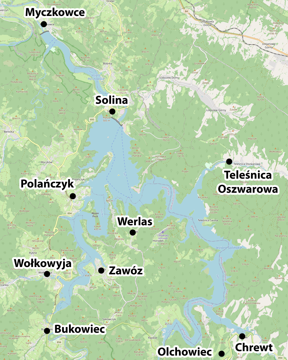
background map source: openstreetmap.org
The division of the towns visible on the map into well-known and popular towns and those less crowded is one of the key information. It allows you to choose the best accommodation depending on your preferences.
Two definitely The most popular tourist destinations on Lake Soliński are: Polanczyk i Solina. Wherein Polanczyk is definitely number 1.
Smaller than them and less popular are: Wołkowyja, Bukowiec, Zawóz and Myczkowce.
The most secluded and isolated from the rest of the world are: Werlas, Olchowiec, Chrewt and Teleśnica Oszwarowa.
The size and popularity of the town is not only a problem of a much larger or smaller number of people who make it difficult to rest. These are also more prosaic issues. As an example, I will give e.g. availability of an ATM. There are many places in the Bieszczady Mountains it is impossible to pay by card. I even have the impression that there are more places where you cannot pay with a card than those that accept an electronic form of payment. Imagine that you are resting away from people in complete peace and quiet in the area of Verlas. Suddenly it turns out that you need to do some small shopping in the grocery store in Werlas (of course, payable only in cash). You missed that you have no cash in your wallet. And what? It will take you at least an hour's drive to get money from the nearest ATM !!! Not a very comfortable prospect, unless you are prepared for it from the beginning and know that you need to take care of your living cash.
On the other hand, popular towns offer (apart from more crowds and noise) a greater catering base, better beaches, access to water equipment, more amenities (such as the ATM), a wider choice of hotels, etc.
In this post you will find all this information and choose the best place for you to relax.
Beaches on Lake Solina
The beaches on Lake Solina are a bit different than those we are commonly used to. When we think about a beach by a lake, we usually see a sandy stretch of water that slopes down slightly into the water, creating a pleasant swimming area. Unfortunately, this is not the case at Solina. The reason for this is simple to explain. It is enough to remember how Solińskie Lake was created and everything will become clear.
Lake Solińskie was created by damming the waters of two rivers: San and Solinka. The waters of these rivers were stopped by a dam. When the water level rose, it flooded the surrounding areas. The former slopes of the mountains became the shores of the lake. Thus, the bottom of the lake has the shape of a mountain slope flooded with water, with a rocky character, until recently completely covered with forest. For many years the tips of flooded trees stuck out from under the water.
As you can easily guess, the bottom of such a lake is very unpredictable, often steep and very dangerous. The rocky ground formed pebble beaches. Additionally, due to the function of the reservoir, the water level fluctuates greatly (even by 10-15 meters), which results in the fact that the natural beaches in a large area are muddy.
In recent years, the commune has created four artificial, sandy beaches (they are about 100 m long), as well as regulated and guarded, and thus safe swimming areas. The sandy part of the beaches is located above the area of water table fluctuations, so that no muddy and silty sediments are formed on them.
My guess is that in the tourist season, the power plant's staff tries to regulate the power plant's operation in such a way as to ensure the greatest possible stability of the water surface, guaranteeing tourists the maximum comfort of rest on artificial, sandy beaches.
WARNING! Swimming in Lake Solina outside the designated areas is extremely dangerous. It is therefore absolutely forbidden to swim in these areas.
Two of the four beaches are located in Polańczykone in Solina and one in Wołkowyi. I am presenting them below:
Solina: beach and swimming pool "Biała Flota", GPS coordinates:
49°23’28.2″N 22°27’28.6″E
49.391156, 22.457936 - click and route
Polańczyk: beach and bathing area "Cypel", GPS coordinates:
49°22’58.3″N 22°27’00.6″E
49.382849, 22.450162 - click and route
Polańczyk: beach and bathing area "Patelnia", GPS coordinates:
49°22’03.2″N 22°26’15.0″E
49.367557, 22.437492 - click and route
Wołkowyja: beach and bathing area "Green Beach", GPS coordinates:
49°19’52.4″N 22°25’19.5″E
49.331222, 22.422074 - click and route
Harbors and water equipment rentals
You can search for water equipment rentals in the vicinity of the beaches, which are listed above. In addition, rentals (kayaks, boats, sailboats, pedal boats) are located in: Solina, Myczkowce, Polańczyk, Jawor, Teleśnica Oszwarowa, Chrewta, Rajskie, Zawóz and Wołkowyja.
There are many rentals (in some places there are several of them) so giving all the information here does not make sense. You will find specific information about rentals in the further part of the text, with short descriptions of each town. Here are just a few of the most famous.
Bieszczadzka Fleet
If you do not want to swim on the lake on your own, you can always take advantage of the tourist cruises offered by the Bieszczady fleet. The ships of the fleet depart from the marina in Solina and Polańczyk. You will find information on them below in the descriptions of each town.
Port of Solina, GPS coordinates:
49°23’36.6″N 22°27’25.2″E
49.393488, 22.457008 - click and route
reservations: +48 530 159 311 or +48 693 373 866
Solina - "Komandor" water haven, GPS coordinates:
49°23’22.0″N 22°27’40.0″E
49.389455, 22.461114 - click and route
reservations: +48 607 829 214
Solina "White Fleet", GPS coordinates:
49°23’31.3″N 22°27’26.7″E
49.392040, 22.457404 - click and route
reservations: +48 600 496 689
Polańczyk, TRAMP ship, GPS coordinates:
49°22’18.6″N 22°26’19.2″E
49.371834, 22.438652 - click and route
reservations: +48 603 860 234 or +48 604 484 715
Polańczyk, Passenger Ship "Bryza", GPS coordinate:
49°22’52.5″N 22°27’03.2″E
49.381246, 22.450879 - click and route
reservations: +48 721 08 08 08
ATMs
There can be a bit of a hassle with ATMs in the area (as I mentioned). Generally, cash rules in the Bieszczady Mountains, so you should always have an adequate supply of cash with you. In the vicinity of Lake Solińskie, you will find an ATM in two towns: in Polańczyk and Solina. In Solina, there is a non-bay entrance to the dam, right next to tourist parking lots. There is no ATM on the other side of the dam (from the village, beach and marina side). Below are the exact locations of ATMs.
Polańczyk - ATM (New Bank BFG SA), GPS coordinates:
49°22’10.4″N 22°25’11.8″E
49.369561, 22.419955 - click and route
Polańczyk - ATM (PKO Bank Polski SA), GPS coordinates:
49°22’15.7″N 22°25’37.0″E
49.371035, 22.426935 - click and route
Polańczyk - ATM (Bank Nowy BFG SA), GPS coordinates:
49°22’27.8″N 22°26’04.7″E
49.374401, 22.434626 - click and route
Solina - ATM (PBSbank), GPS coordinates:
49°23’54.3″N 22°26’58.7″E
49.398418, 22.449640 - click and route
Summary of what we know
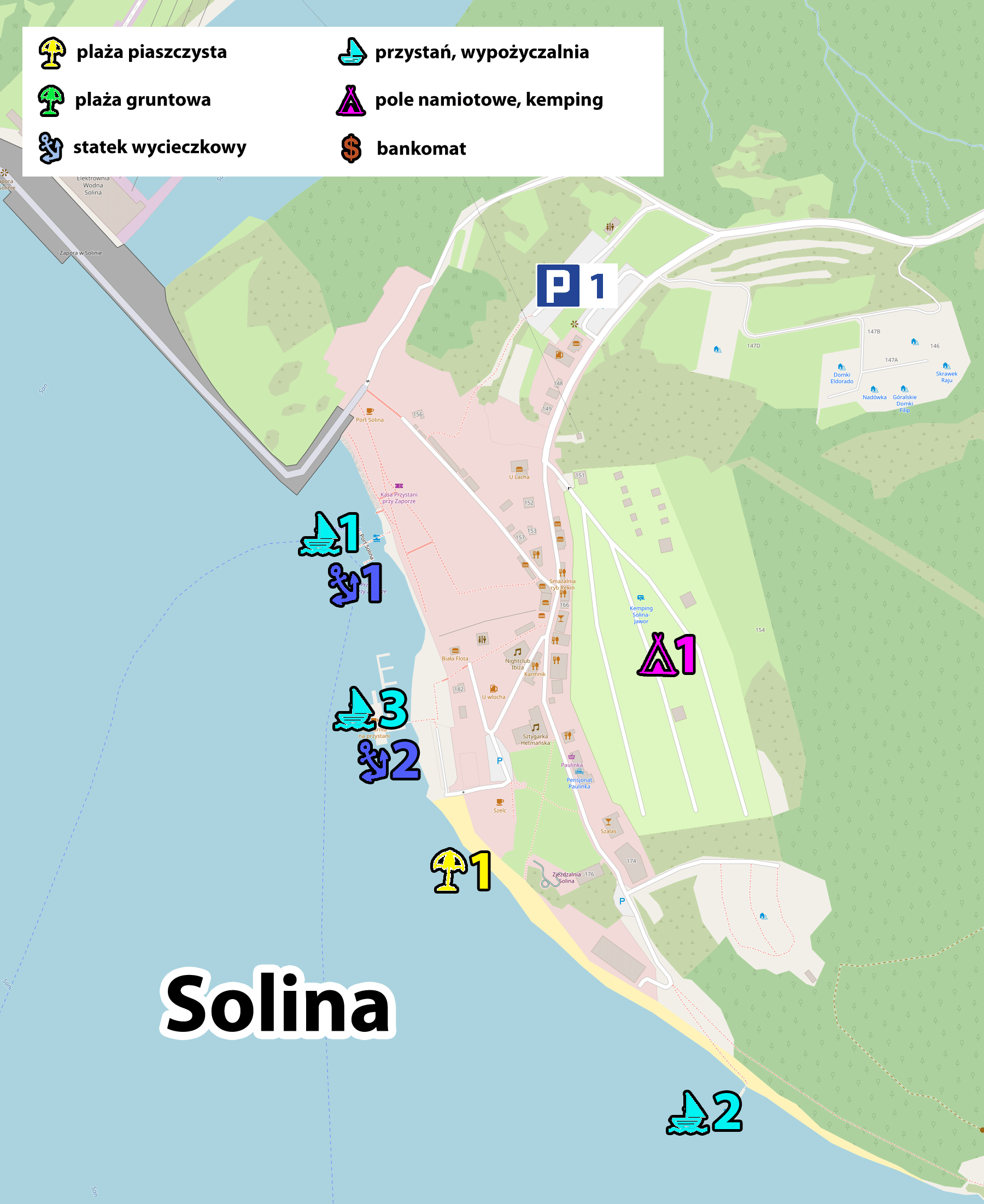
The best summary of the information gathered will be a map again. Below I present a map of the village near Solina Lake, known to you, with additional information marked. There are marked sandy beaches, marinas with water sports equipment rentals, marinas with cruise ships, and ATMs.
In addition, under the map you will find short descriptions characterizing each town along with information about important tourist objects in it.
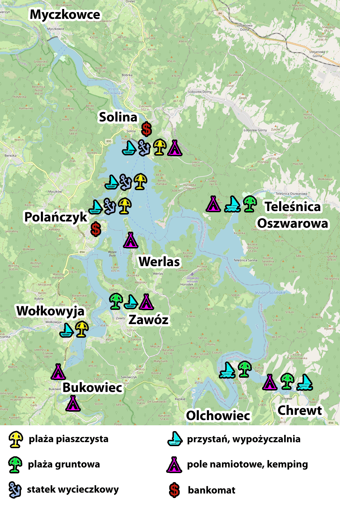
background map source: openstreetmap.org
Detailed descriptions of the towns around Lake Solina
Here is a large set of information prepared for each town separately. You will find information on the amenities available in them, detailed information on most of them and maps to help you orientate yourself, on which I have marked the location of interesting points.
The numbering on the maps corresponds to the numbering that appears next to the descriptions placed under the maps, with GPS coordinates for specific locations.
Polanczyk
The most famous and largest resort town in the area of Lake Solina. Since 1999, it has had the status of a health resort. It has the largest and most diversified hotel base, the most amenities, two sandy beaches with bathing areas, and a very rich gastronomic base. It is the tourist center of the region.
It is perfect as a starting point for local walking routes, as many of them start and end here.
Unfortunately, it is not the best place for a starting point to the Bieszczady National Park. One-way access to the most popular trails leading to the Bieszczady mountains takes about 1 hour.
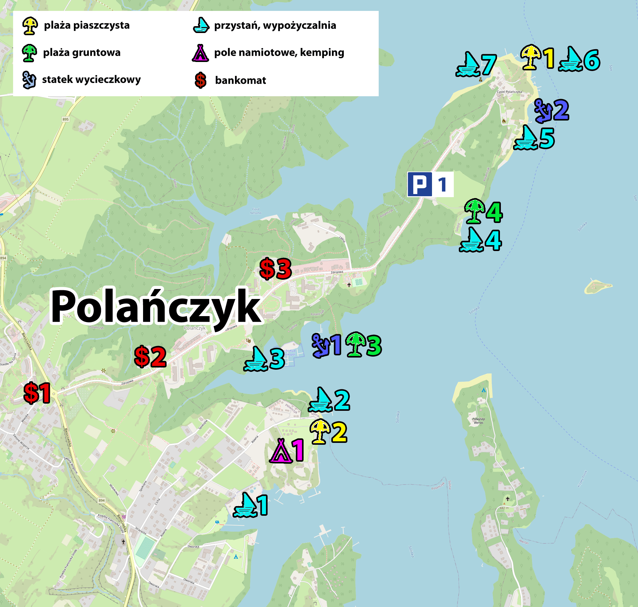
background map source: openstreetmap.org
ATMs
1. Polańczyk - ATM (New Bank BFG SA), GPS coordinates:
49°22’10.4″N 22°25’11.8″E
49.369561, 22.419955 - click and route
2. Polańczyk - ATM (PKO Bank Polski SA), GPS coordinates:
49°22’15.7″N 22°25’37.0″E
49.371035, 22.426935 - click and route
3. Polańczyk - ATM (New Bank BFG SA), GPS coordinates:
49°22’27.8″N 22°26’04.7″E
49.374401, 22.434626 - click and route
Boat trips
1. Polańczyk, TRAMP ship, GPS coordinates:
49°22’18.6″N 22°26’19.2″E
49.371834, 22.438652 - click and route
reservations: +48 603 860 234 or +48 604 484 715
2. Polańczyk, Passenger Ship "Bryza", GPS coordinate:
49°22’52.5″N 22°27’03.2″E
49.381246, 22.450879 - click and route
reservations: +48 721 08 08 08
Beaches and bathing areas
1. Polańczyk: beach and bathing area "Cypel", GPS coordinates:
49°22’58.3″N 22°27’00.6″E
49.382849, 22.450162 - click and route
2. Polańczyk: beach and bathing area "Patelnia", GPS coordinates:
49°22’03.2″N 22°26’15.0″E
49.367557, 22.437492 - click and route
3. Beach at the pier of the ship "Tramp", GPS coordinates:
49°22’18.8″N 22°26’19.6″E
49.371901, 22.438766 - click and route
4. Beach on the headland next to the city parking lot, GPS coordinates:
49°22’35.8″N 22°26’47.4″E
49.376598, 22.446510 - click and route
Water equipment rentals
1. The UNITRA marina, GPS coordinates:
49°21’55.4″N 22°26’00.2″E
49.365375, 22.433395 - click and route
Possibility to rent pedal boats and boats, yachts and sailboats independently or at the helm.
contact: +48 691 944 266 or +48 601 591 020
2. Harbor SAN, GPS coordinates:
49°22’07.7″N 22°26’15.2″E
49.368816, 22.437565 - click and route
possibility to rent pedal boats and boats
contact: +48 500 518 738
3. Port of Polańczyk, GPS coordinates:
49°22’16.1″N 22°26’01.8″E
49.371135, 22.433832 - click and route
possibility to rent pedal boats and boats
reservations: +48 693 373 866 or +48 530 159 311
4. A marina at the city car park on the headland, GPS coordinates:
49°22’35.8″N 22°26’47.4″E
49.376598, 22.446510 - click and route
possibility to rent water bikes
5. Polańczyk Laguna harbor, GPS coordinates:
49°22’52.3″N 22°27’01.2″E
49.381197, 22.450329 - click and route
possibility to rent water bikes
reservations: +48 885 535 271
6. Keja Promontory, GPS coordinates:
49°22’56.6″N 22°27’01.6″E
49.382379, 22.450443 - click and route
possibility to rent boats and pedal boats
reservations: +48 515 109 870
7. Polanczyk Promontory, GPS coordinates:
49°22’59.3″N 22°26’57.4″E
49.383129, 22.449264 - click and route
possibility to rent water bikes
Campsites and campsites
1. Campsite and camping site, GPS coordinates:
49°22’08.0″N 22°26’12.7″E
49.368894, 22.436865 - click and route
Other
1. City parking on the headland, GPS coordinates:
49°22’39.8″N 22°26’40.2″E
49.377726, 22.444494 - click and route
Accommodation in Polańczyk
The accommodation base in Polańczyk is very large, but depending on the moment of searching and due to the great popularity, the availability of accommodation may be temporarily limited. I recommend that you start by browsing the accommodation base that brings together proven offers. The prepared links show, first of all, available offers from the Polańczyk area, and only secondly, offers from the nearest vicinity. I will also post some specific, interesting offers under the links.
Check the accommodation offer in Polańczyk:
- on page booking.com - [click]
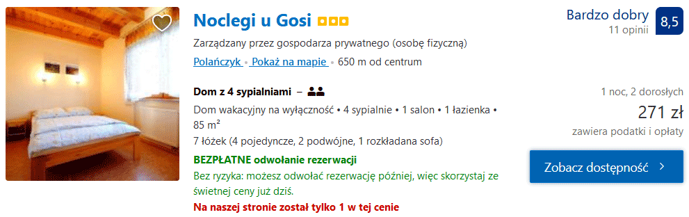
Accommodation with Gosia - [click]
Solina
Solina is definitely number 2 when it comes to popularity. It has an extensive accommodation offer, giving you the freedom to choose your holiday. It is worth noting that Solina is divided into two parts, located on both sides of the dam. One of these parts (the one in the immediate vicinity of the tourist car parks and the promenade leading to the dam) has no direct access to the lake or beaches. The second one, located at the other end of the dam (see the map below), has a sandy beach by the lake's waters, marinas with water equipment rentals and ships with tourist excursions.
background map source: openstreetmap.org
ATMs
Solina - ATM (PBSbank), GPS coordinates:
49°23’54.3″N 22°26’58.7″E
49.398418, 22.449640 - click and route
Boat trips
1. The port of Solina, GPS coordinates:
49°23’36.6″N 22°27’25.2″E
49.393488, 22.457008 - click and route
reservations: +48 530 159 311 or +48 693 373 866
2. Solina - "Komandor" water haven; GPS coordinates:
49°23’22.0″N 22°27’40.0″E
49.389455, 22.461114 - click and route
reservations: +48 607 829 214
3. Solina "Biała Flota", GPS coordinates:
49°23’31.3″N 22°27’26.7″E
49.392040, 22.457404 - click and route
reservations: +48 600 496 689
Beaches and bathing areas
Solina: beach and swimming pool "Biała Flota", GPS coordinates:
49°23’28.2″N 22°27’28.6″E
49.391156, 22.457936 - click and route
Rentals
1. The port of Solina; GPS coordinates:
49°23’35.7″N 22°27’25.2″E
49.393260, 22.457010 - click and route
possibility to rent water bikes
reservations: +48 530 159 311 or +48 693 373 866
2. The Biała Flota Harbor, GPS coordinates:
49°23’31.2″N 22°27’26.4″E
49.392007, 22.457324 - click and route
possibility to rent boats and pedal boats
reservations: +48 600 496 689
3. Komandor waterfront, GPS coordinates:
49°23’32.1″N 22°27’26.7″E
49.392241, 22.457405 - click and route
possibility to rent kayaks and pedal boats
reservations: +48 607 829 214
Other
1.Parking, GPS coordinates:
49°23’42.6″N 22°27’33.5″E
49.395165, 22.459315 - click and route
Accommodation in Solina
Accommodation offer in Solina is a bit smaller than in Polańczyk, but still gives you the opportunity to choose and find a satisfactory offer. I encourage you to search the accommodation base. By doing it a little in advance, you can find really interesting proposals.
Check the accommodation offer in Solina:
- on page booking.com - [click]
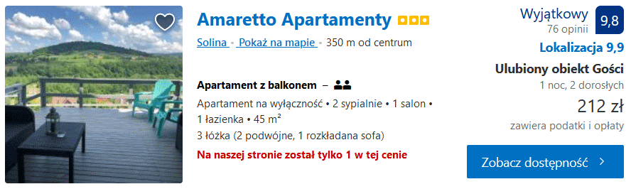
Amaretto Apartments - [click]
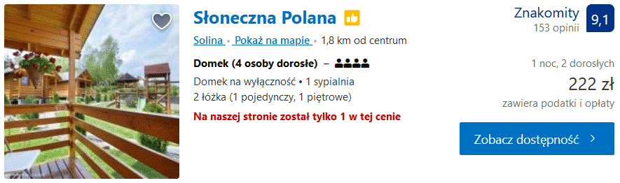
Sunny Glade - [click]
Wołkowyja
There is definitely less tourist traffic in Wołkowyja than in Polańczyk or Solina. At the same time, it is already so large that the commune decided to establish in Wołkowyja an artificial sandy beach and a guarded bathing area. Not far from the beach and bathing area there is a marina with a boat and pedal boat rental. There is a car park for cars next to the beach.
Wołkowyja (compared to the most popular holiday resorts on Lake Solina) is quite favorably located in terms of possible access to the Bieszczady National Park. One-way travel time to the routes leading to the most beautiful highlands of the Bieszczady Mountains is about 40-50 minutes. Within this time range there are, among others Wetlina, Brzegi Górne, Przełęcz Wyżnia and Przełęcz Wyżniańska, from which you can start your walk in many different directions, including on: Połonina Wetlińska, Połonina Caryńska or Little and Big Rawka.
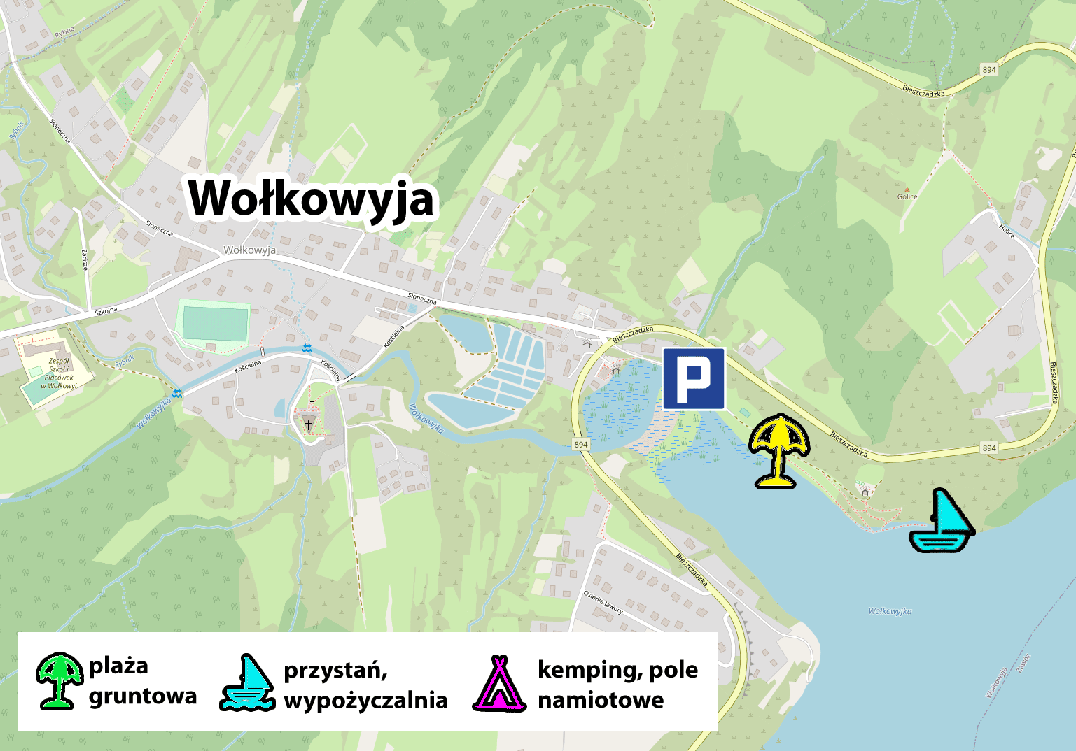
background map source: openstreetmap.org
ATMs
None
Boat trips
None
Beaches and bathing areas
Wołkowyja: beach and bathing area "Green Beach", GPS coordinates:
49°19’52.4″N 22°25’19.5″E
49.331222, 22.422074 - click and route
Rentals
"Skałki" water equipment rental, GPS coordinates:
49°19’52.7″N 22°25’24.9″E
49.331295, 22.423576 - click and route
Other
Parking by the beach in Wołkowyja, GPS coordinates:
49°19’59.4″N 22°25’07.9″E
49.333165, 22.418860 - click and route
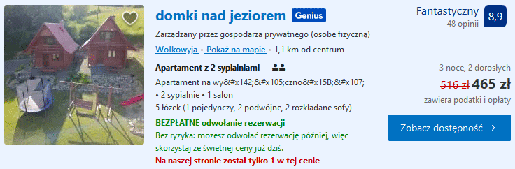
Wołkowyja accommodation
The accommodation base in Wołkowyja is based mainly on agritourism farms, cheap private accommodation and guest rooms. Below I present a link to a proven search engine, which is prepared in such a way that the search results should be limited to Wołkowyja and its immediate surroundings (they can later be extended to other towns). You will also find examples of interesting offers I have found under the links.
Click and check available accommodation in Wołkowyja on booking.com - [click]
Cabins by the lake - [click]
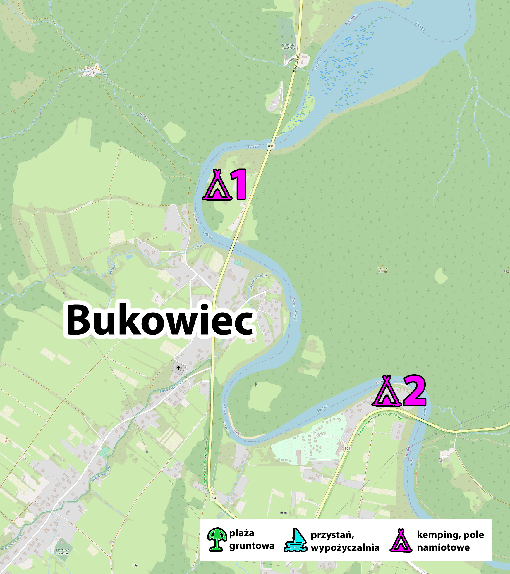
Beechwood
Bukowiec is a small holiday village where we can find an offer of agritourism farms, summer houses, accommodation rooms, a campsite and a campsite.
There is a grocery store and a bar in the village. During the tourist season, additional food outlets open up.
The undoubted advantage of Bukowiec is its location, because despite the fact that it is located in the vicinity of Lake Solina, it is relatively close to the most beautiful parts of the Bieszczady Mountains. The travel time to the most popular starting points in the Bieszczady Mountains is about 40 minutes. My guess is that this is the main reason why Bukowiec is popular as a place to stay. It combines two in one: rest on the Bieszczady Sea with the ability to quickly reach the most beautiful parts of the Bieszczady National Park. Overnight in Bukowiec can be a really good solution for people who do not plan to walk in the mountains every day, but only want to go out to the Bieszczady Wysokie for 2-3 days. The 40-minute journey should not be particularly burdensome in this situation.
background map source: openstreetmap.org
ATMs
None
Boat trips
None
Beaches and bathing areas
None
Water equipment rentals
None
Other
Campsite in Bukowiec, GPS coordinates:
49°18’32.8″N 22°25’16.1″E
49.309102, 22.421146 - click and route
Campsite in Bukowiec, GPS coordinates:
49°18’32.8″N 22°25’16.1″E
49.309102, 22.421146 - click and route
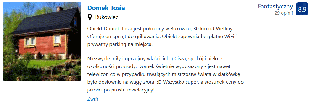
Bukowiec accommodations
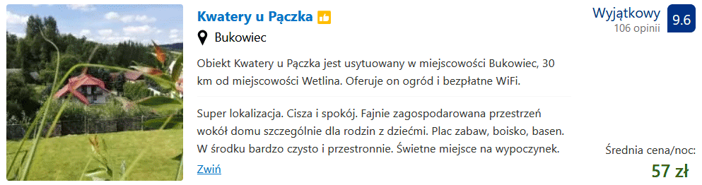
House Tosia - [click]
House on Horb - [click]
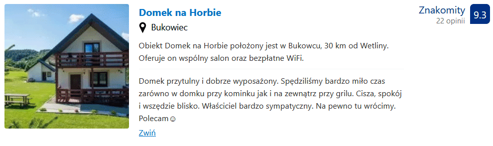
Lodging at Pączka - [click]
The carriage
The picturesquely situated Zawóz has seen a huge increase in popularity in recent years. Interest in this village goes hand in hand with changes in the village itself. Many new and interesting places to stay have been built here in recent years. Mobile homes are especially popular. In season, there is a bar on the lake shore, popular among tourists. Zawóz is a great place for a quiet holiday. The travel time from Zawóz to the most popular trails in the Bieszczady National Park is about 50 minutes.
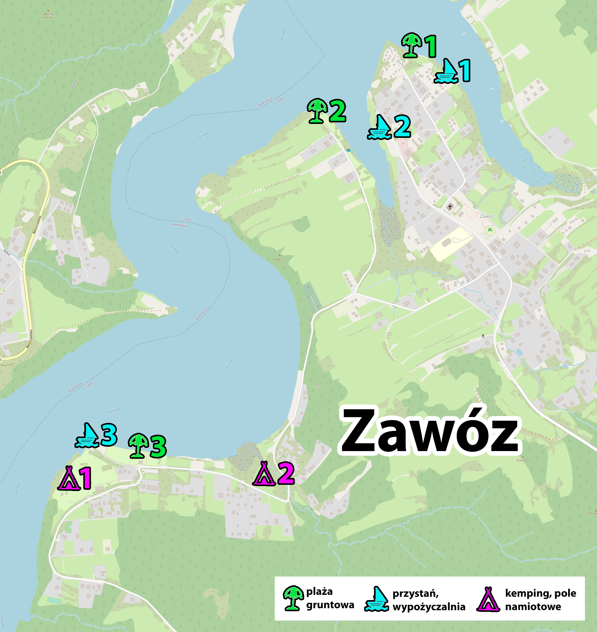
background map source: openstreetmap.org
ATMs
None
Boat trips
None
Beaches and bathing areas
1. The grass and soil beach in Zawóz, GPS coordinates:
49°20’21.1″N 22°26’22.6″E
49.339189, 22.439618 - click and route
2. The grass and soil beach in Zawóz, GPS coordinates:
49°20’20.3″N 22°26’16.3″E
49.338982, 22.437847 - click and route
3. The grass and soil beach in Zawóz, GPS coordinates:
49°19’47.8″N 22°25’46.8″E
49.329942, 22.429658 - click and route
Water equipment rentals
1. The marina in Zawóz, GPS coordinates:
49°20’24.1″N 22°26’35.1″E
49.340026, 22.443092 - click and route
possibility to rent pedal boats and kayaks
2. The marina in Zawóz, GPS coordinates:
49°20’18.4″N 22°26’23.6″E
49.338444, 22.439887 - click and route
possibility to rent water bikes
3. The marina in Zawóz, GPS coordinates:
49°19’47.8″N 22°25’49.8″E
49.329938, 22.430496 - click and route
possibility to rent water bikes
Other
1. Campsite in Zawóz, GPS coordinates:
49°19’47.1″N 22°25’49.1″E
49.329749, 22.430315 - click and route
2. Campsite in Zawóz, GPS coordinates:
49°19’46.5″N 22°25’59.6″E
49.329578, 22.433223 - click and route
Find accommodation
First of all, a link that filters offers from Zawóz area first, and only then offers from the nearest vicinity. Here are some specific, interesting offers.
Check the offers of accommodation in Zawóz on:
- booking.com - [click]
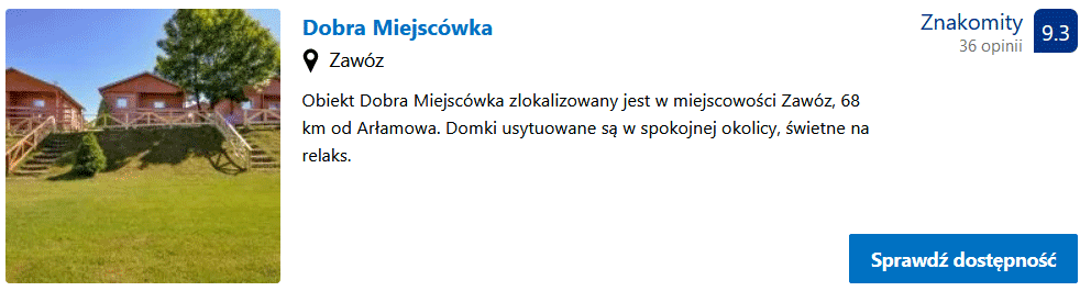
Cottages "Dobra Miejscówka" - [click]
Myczkowce
Myczkowce is, above all, an excellent starting point for hiking trails. Probably the largest number of hiking, walking and Nordic walking routes in this area passes through Myczkowce. There are over a dozen of them in total and they lead to interesting places, viewpoints, interesting creations of nature. The trails vary in difficulty, but most of them have a moderate degree of difficulty and can be treated as not too strenuous walk to interesting places. Right next to the dam in Myczkowce there are several information boards presenting all the routes available in the area. There is also one collective information board with 19 suggested walks along marked paths.
Below is a panoramic photo showing the location of boards with maps of the trails. You can zoom in and out of the photo and rotate it around its axis. Below the map you will find the GPS coordinates of the place with the boards shown in the photo.
Information boards with maps of trails in the vicinity of MyczkowceGPS:
49°25’54.0″N 22°24’43.6″E
49.431664, 22.412119 - click and route
So if you want to take a walk in the beautiful surroundings, but the High Bieszczady are too strenuous for you, then Myczkowce and the trails around them will be an excellent alternative.
Of course, the proximity of Lake Solina and the most popular tourist destinations such as Solina and Polańczyk, creates an excellent opportunity for people vacationing in Myczkowce for a varied holiday.
Accommodation in Myczkowce
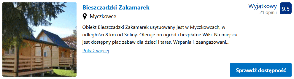
Bieszczadzki Zakamarek - [click]
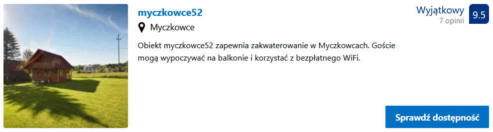
Domki Myczkowce 52 - [click]
Sunny Hill - [click]
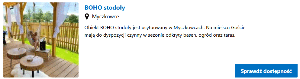
BOHO barn - [click]
Verlas
Werlas, to put it bluntly and bluntly, is a deep rump (this applies to all the places described in the further part of the post). It is definitely a place for those who want to cut themselves off from all civilization and want maximum peace and quiet. Even the Israeli special forces would have a hard time finding you here. If you're looking for a secluded place, Werlas might be the right address.
There is a campsite at the very end of the peninsula (I'm not sure, but it is most likely a wild campground).
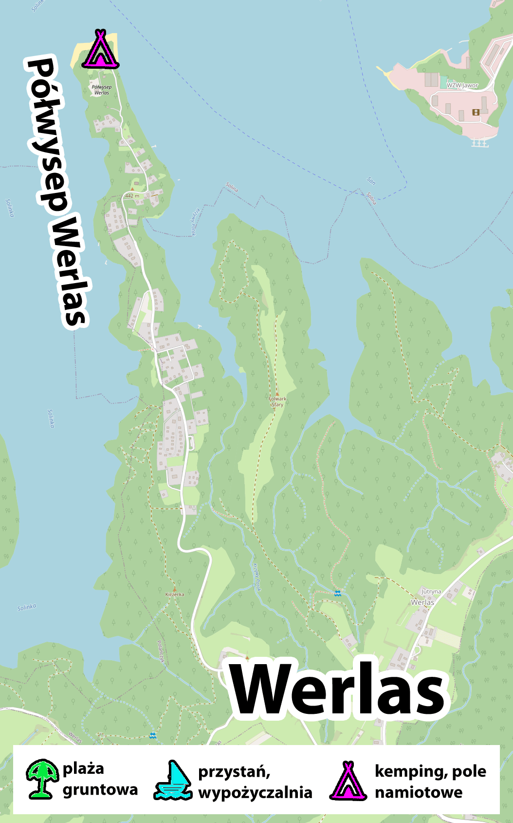
background map source: openstreetmap.org
ATMs
None
Boat trips
None
Beaches and bathing areas
None
Water equipment rentals
None
Other
Campsite on Cape Werlas (possibly wild), GPS coordinates:
49°22’08.2″N 22°26’49.3″E
49.368937, 22.447029 - click and route
Werlas accommodations
The posted link filters the results to show the offer from Werlas at the beginning, and then others nearby.
Check the current offers of accommodation in Werlas on:
- booking.com - [click]
Alder
Olchowiec is a typical Bieszczady retreat. If you run away from the noise of civilization and are looking for a place where the watch moves a little slower, think about Olchowiec. Here you will have a great time doing nothing 🙂… you can use a little wood for planing boats (because you have to do something).
From Olchowiec to the most popular trails in the Bieszczady Mountains you need to drive about 50 minutes.
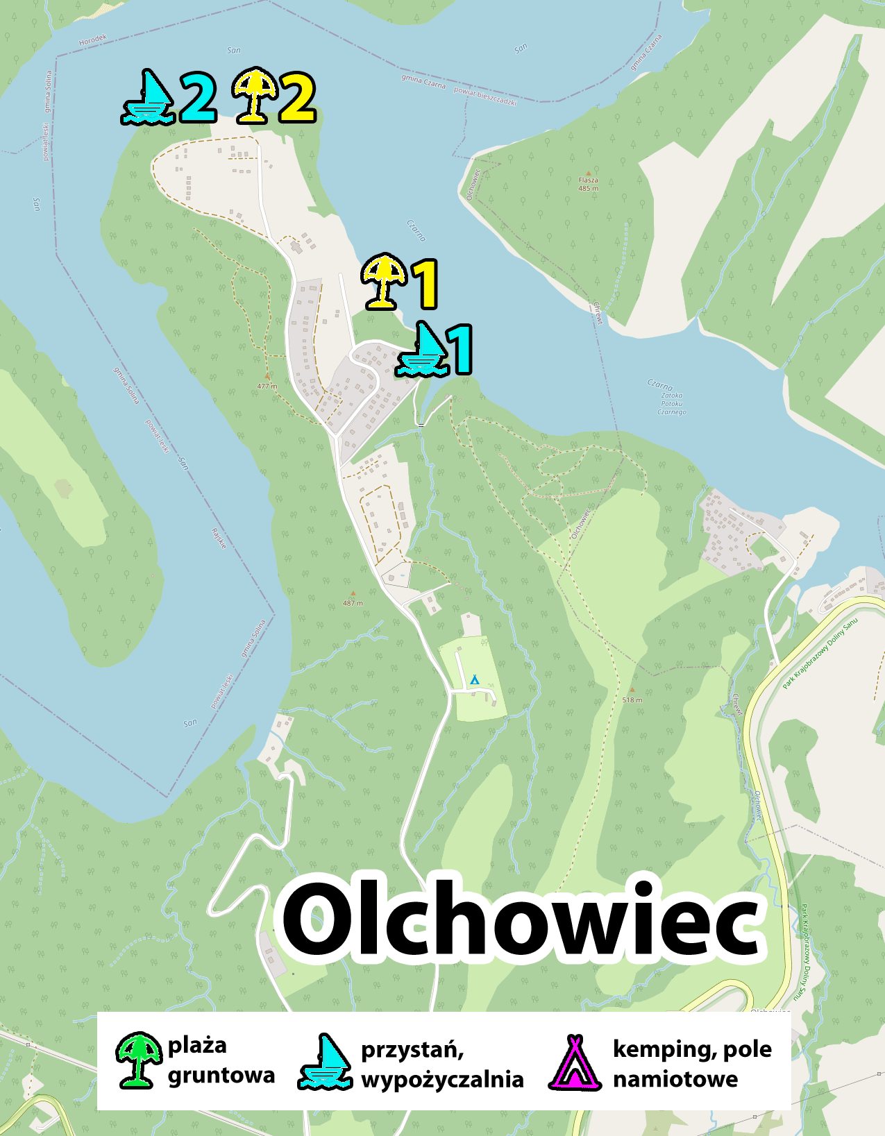
background map source: openstreetmap.org
Beaches and bathing areas
1. Olchowiec Beach, GPS coordinates:
49°19’02.0″N 22°30’35.2″E
49.317230, 22.509764 - click and route
unpaved beach without bathing area
2. Beach at the end of the peninsula, GPS coordinates:
49°19’18.8″N 22°30’07.3″E
49.321901, 22.502030 - click and route
unpaved beach without bathing area
Water equipment rentals
1. Olchowie Harborc, GPS coordinates:
49°18’60.0″N 22°30’38.7″E
49.316657, 22.510761 - click and route
possibility to rent water bikes
2. A harbor at the end of the peninsula, GPS coordinates:
49°19’18.7″N 22°30’08.1″E
49.321846, 22.502256 - click and route
Accommodation in Olchowiec
The link first displays accommodation from Olchowiec, and then from the immediate vicinity.
Check available accommodations in Olchowiec on:
- bookig.com - [click]
Cottages by Solina - [click]
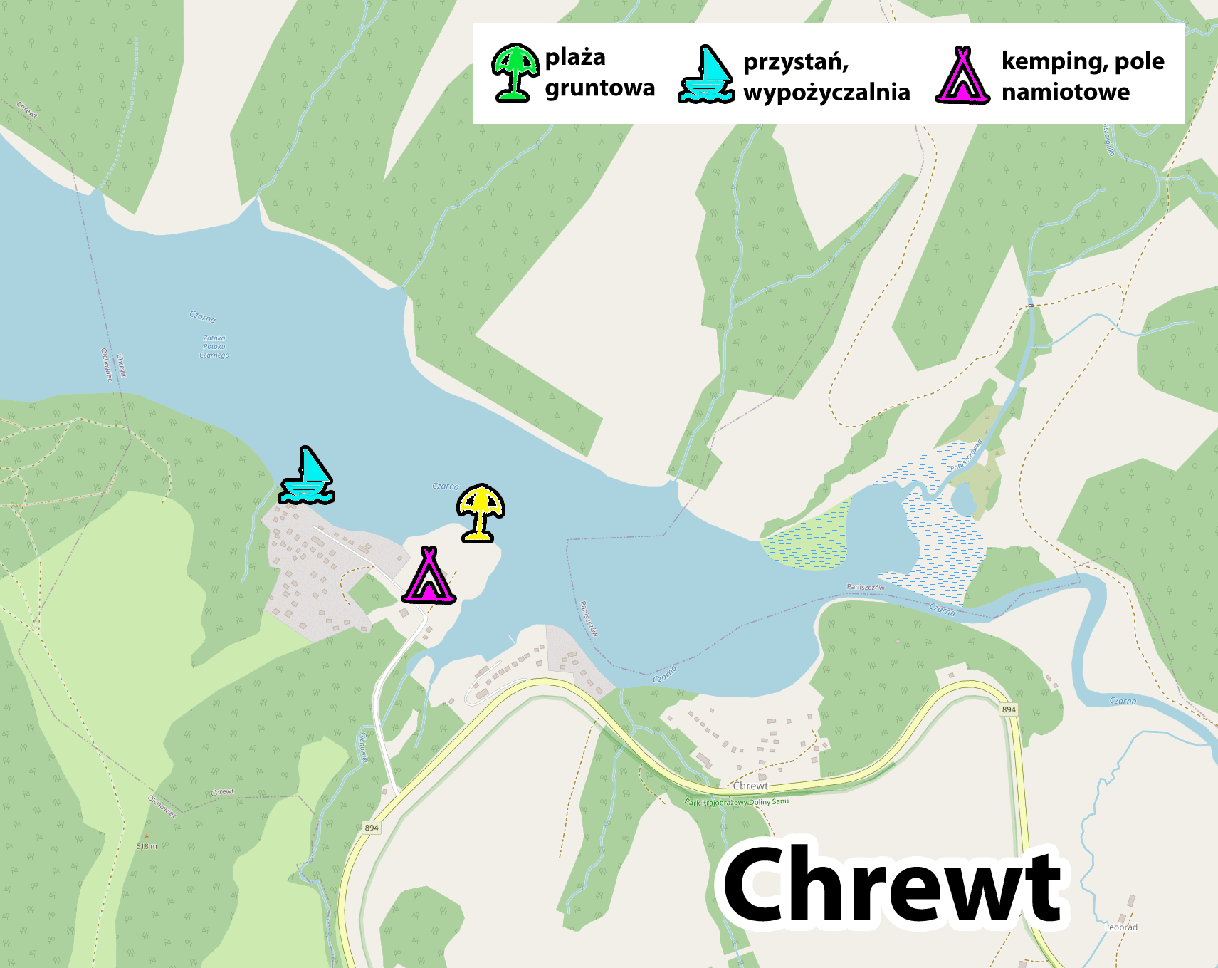
Chrewt
A mini town with its own sandy beach, marina and campsite. Life here goes at its own pace. Another place for people looking for peace and seclusion. From Chrewt to the most popular trails in the Bieszczady Mountains you need to drive about 50 minutes.
background map source: openstreetmap.org
Beaches and bathing areas
Chrewt Beach, GPS coordinates:
49°18’45.2″N 22°31’29.0″E
49.312549, 22.524707 - click and route
unpaved beach without bathing area
Water equipment rentals
Chrewt Harbor, GPS coordinates:
49°18’44.7″N 22°31’23.4″E
49.312410, 22.523166 - click and route
Chrewt accommodations
Cottages by Solina - [click]
Teleśnica Oszwarowa
I present the Area Telescope with the assumption that it is a proposition for real Orthodox people when it comes to holiday isolation from civilization. Imagine a clearing with a campsite, campsite, next to a beach with a marina and the possibility of renting a yacht or pedal boat. In the same field, a bar and a shop ... and all this at the very end of the world with one narrow, uncomfortable and not necessarily level access road.
Hide here for a week or two and you won't want to go back to civilization. This is Teleśnica Oszwarowa.
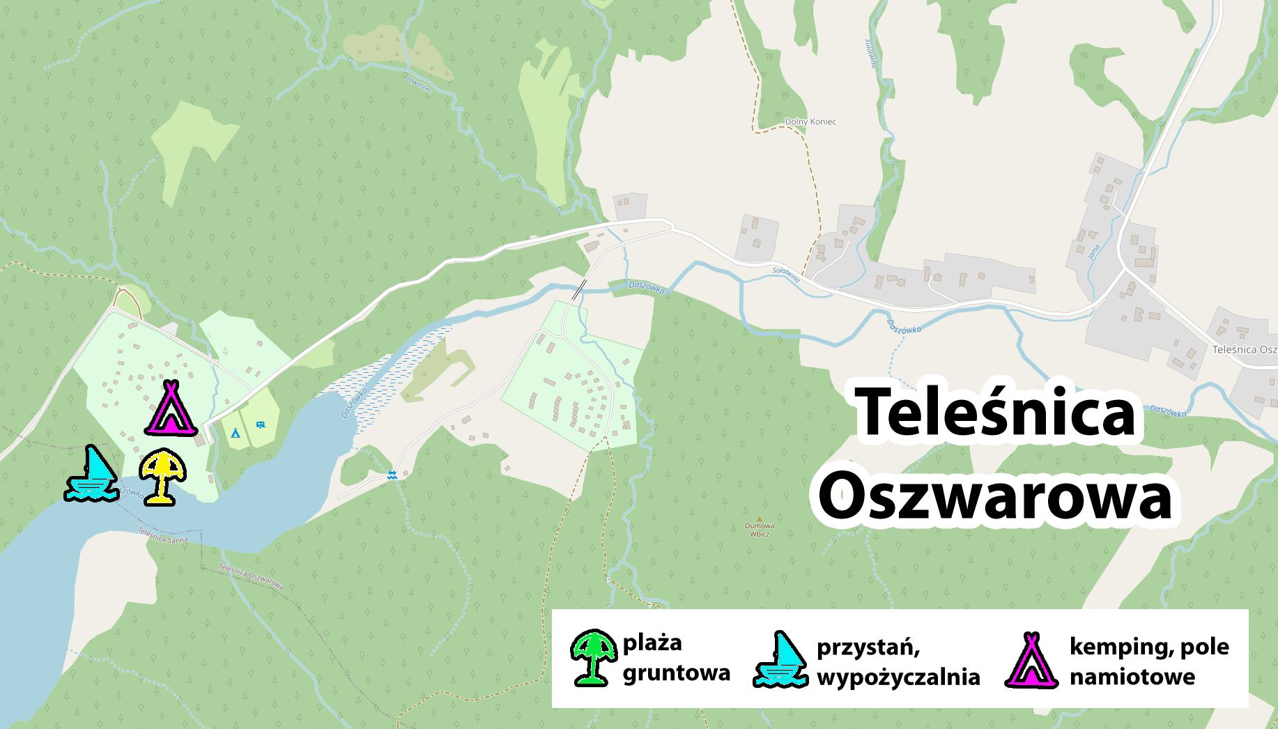
background map source: openstreetmap.org
Beach, marina, campsite, shop and bar ... and all this using one GPS coordinate:
49°22’36.5″N 22°30’35.3″E
49.376806, 22.509791 - click and route
Important to me!
Give the article a good rating (5 stars welcome 😀)!It's free, a for me it is very important! The blog lives on visits and thus has a chance to develop. Please do it and ... thank you in advance!
If you like my guides, you will certainly find the one I created useful guide catalog - [click]. There you will find ready-made ideas for your next trips, descriptions of other tourist destinations and an alphabetical list of guides divided into countries, cities, islands and geographical regions.
I also post link to Facebook profile - [click]. Come in and press "Follow"then you will not miss new, inspiring posts.
Unless you prefer Instagram. I'm not a social media demon, but you can always count on something nice to look at on my instagram profile - [click]. The profile will gladly accept any follower who likes it.
I make the content I create available free of charge with copyright, and the blog survives from advertising and affiliate cooperation. So, automatic ads will be displayed in the content of the articles, and some links are affiliate links. This has no effect on the final price of the service or product, but I may earn a commission for displaying ads or following certain links. I only recommend services and products that I find good and helpful. Since the beginning of the blog's existence, I have not published any sponsored article.
Some of the readers who found the information here very helpful, sometimes ask me how you can support the blog? I do not run fundraisers or support programs (type: patronite, zrzutka or "buy coffee"). The best way is to use links. It costs you nothing, and support for the blog is self-generating.
Pozdrawiam

A very good article for those who are going to Bieszczady 1x. This is what I was looking for - what to expect in various places, not everything shows on the map, and here I found a beach,
what type of village - thank you very much.
Great information. Thanks. I give you *****. I am going to visit these areas in August.
Nice holiday!
Great article! I read with due attention and seriousness until I reached Werlas and the first sentence made me laugh until the end of the day. I like peace and quiet, but I don't think I want to plan a boat in Olchowiec. 🙂 🙂 35 years ago I lived in the then wild Smerek, now I will stay with my children in this crowded and kitschy Solina, criticized by everyone. :-)
Three trips to the High Bieszczady within two weeks, it can even be treated as an additional attraction. It will be fine!
Happy weather and have a nice rest!
Great site. I'm going to the Bieszczady Mountains for the first time and I didn't know what to see. And here everything in one place - maps, detailed descriptions, practical advice. I have read all the articles and now I know what I want to see and how to handle it logistically. Thanks again - 5 plus