Solina, Polańczyk - attractions, accommodation, houses, map, routes, weather. Guide.
I'm going to Solina
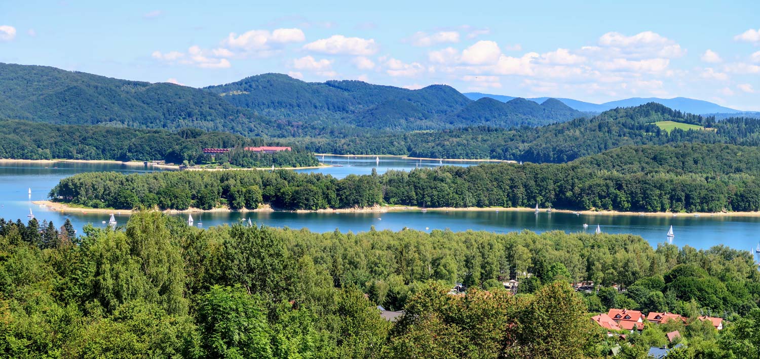
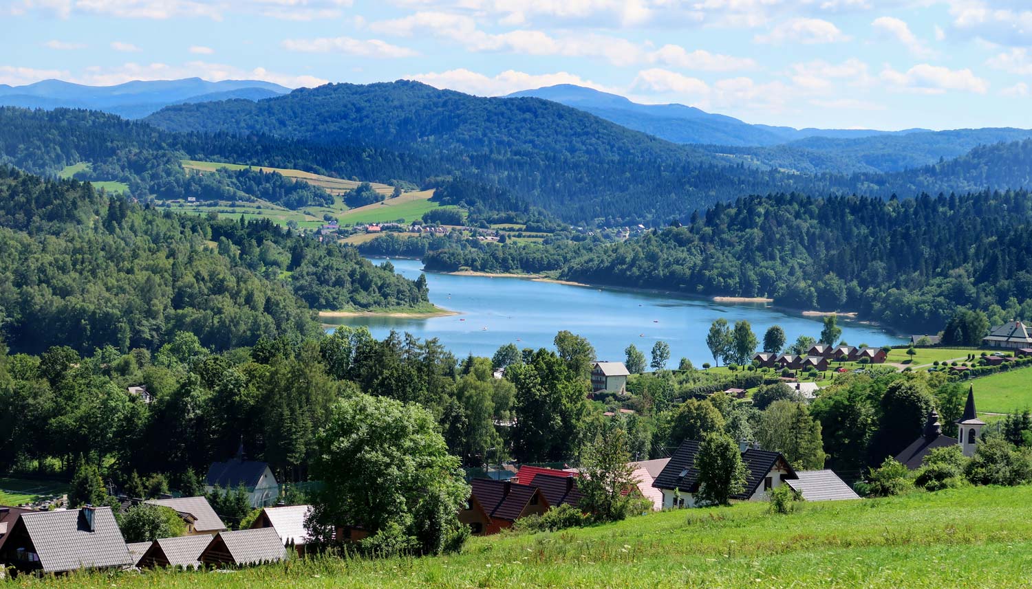
Saying "Solina'we usually don't mean a small town with that name. By the term "Solina", we mean it has enjoyed great popularity in recent years the area around the Solińskie Lake. The area where the tourist life of the region is flourishing today is often called the "Bieszczady Sea". Today it is difficult to imagine this place without Lake Solina, but 60 years ago the lake and the numerous water centers surrounding it did not exist yet. The lake was created artificially as a result of the construction of a dam on the San River, just below the place where, near the village of Solina, the Solinka River merged with the San.
Dragon from Bieszczady
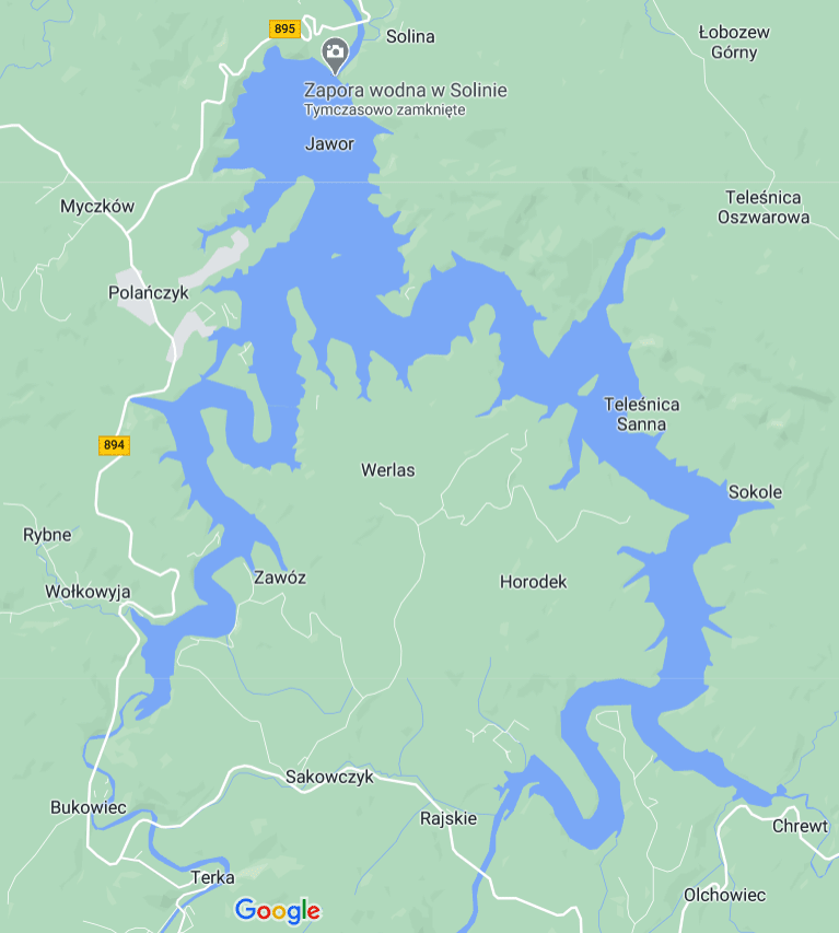
Looking at the map below, you can clearly see the unusual shape of Lake Solina. I always associate it with a Chinese dragon or a snake. The lake owes this shape to the way it was created. After the dam was built and closed, the waters of the rivers flowing into the dam were dammed up to the level of the dam blocking their flow. Their waters filled the interior of the valleys, the bottom of which so far flowed freely. The lake thus created took the shape of the walls of the hills surrounding it.
The real Solina is no more
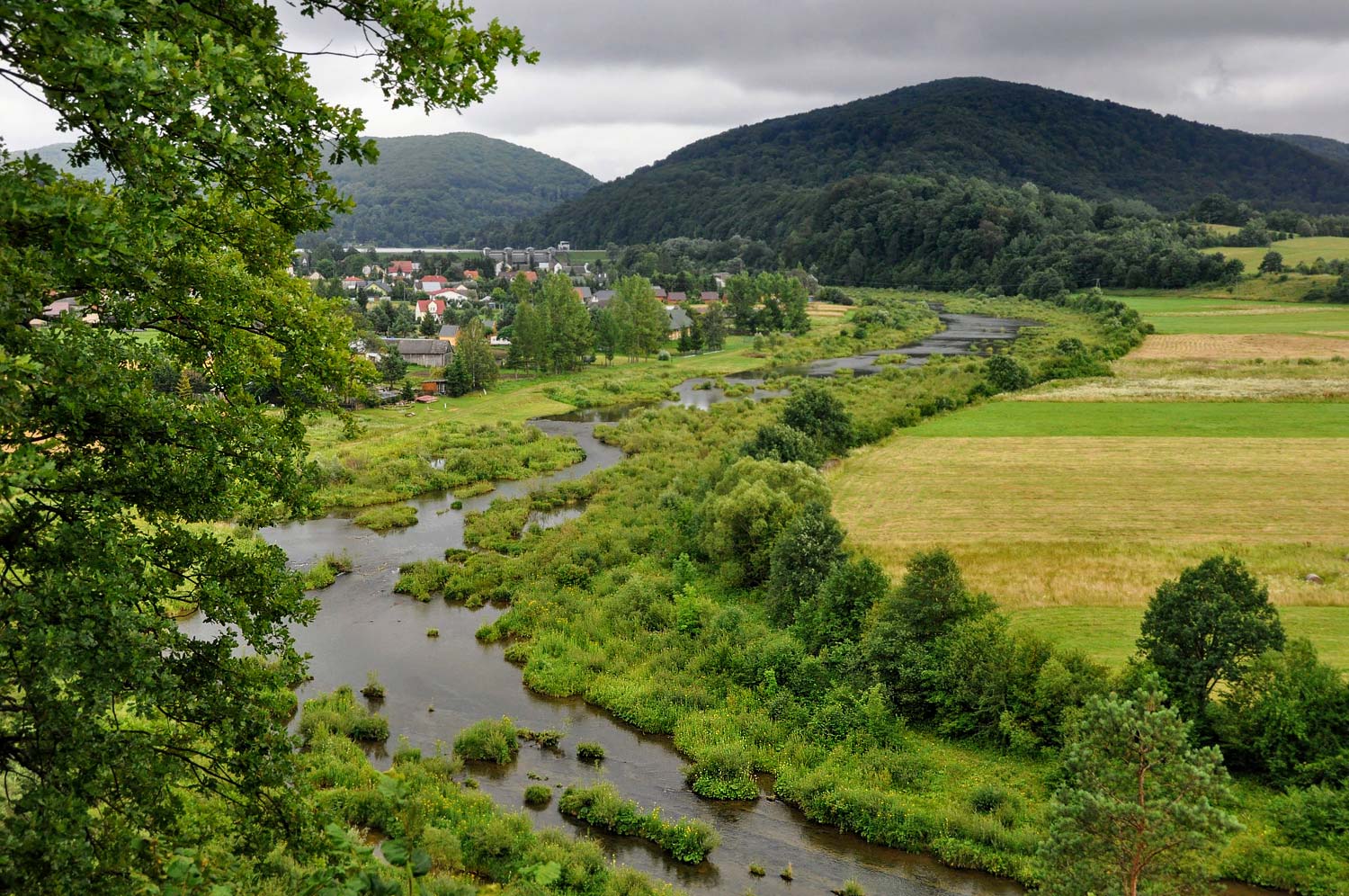
The construction of the dam was necessary due to the preservation of the San river. The river flooded regularly, causing widespread flooding. Regular flooding caused a lot of damage each time, and this situation could not last. River regulation has become a necessity. Unfortunately, the construction, and thus the creation of an artificial lake, always involves flooding and submerging a part of the area in the immediate vicinity of the dam. The higher the dam, the greater the range of the area that will be underwater forever. One of the victims of the construction of the dam on Solina was ... Solina. The village was entirely under the waters of an artificial lake (which was obviously known from the very beginning of the dam construction project). There was no other option because Solina was located near the deepest bottom of the present lake. The village was built from scratch in a new location. Solina, which we visit today, is this new village, founded in the 60s and the XNUMXth century.
Solina was not the only village flooded by the waters of the lake. Her fate was shared by several other towns (Działiał, Polana, Łęg, Paraszczakówka, Wągliska, Jutrynia, Sokole, Zawóz). All villages flooded with the waters of the artificial lake remain in the state in which they were left before being flooded. I imagine how strange such underwater villages must look ...
Two dams
When traveling around the area, you will surely come across not one, but two dams. Why are there two dams here?
On the map below I illustrated the location of both dams and tried to approximate the course of the rivers: Solinka and San before their waters in this area were dammed by the dam.
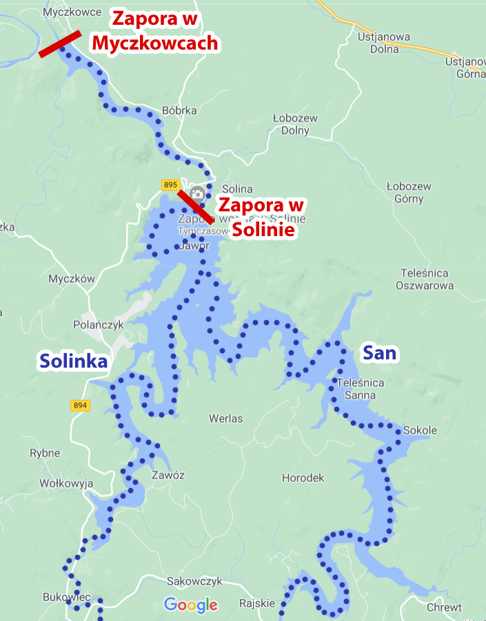
The dam in Myczkowce
The first and the smaller of the two dams is the dam in Myczkowce. It is the result of the first project to regulate the waters of the San River, the concept of which was created as early as 1921. In the years 1936 - 1937, even the first works were undertaken, but they were effectively interrupted by the outbreak of World War II.
The design of the San river regulation was returned in the 50s, when a new concept for the development of the valley was created. In this concept, the dam in Myczkowce was to be an auxiliary dam, creating the so-called "Daily equalization tank" for the main reservoir in Solina. The reservoir at the dam in Myczkowce is therefore an important buffer and reservoir for the main reservoir, allowing for quite comfortable regulation and maintenance of an appropriate water level. For this reason, the water level in the reservoir in Myczkowce fluctuates greatly (it is easy to observe when looking at the tracks on its steep banks).
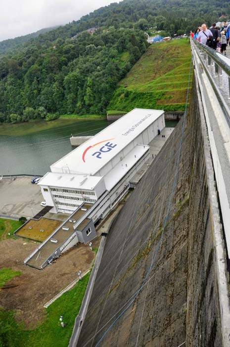
The dam in Solina
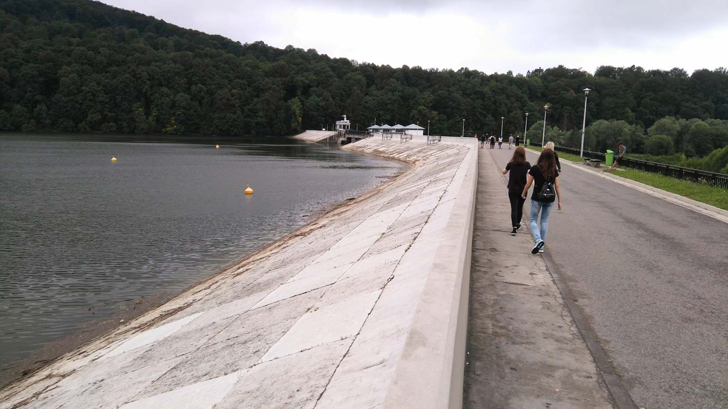
The main Solina dam was built for over 8 years, and it was put into use in 1968. It is the largest in Poland. The dam is 81,8 m high and 664 m long. The reservoir reaches a maximum depth of 60m. The deepest place is right next to the dam (and close to this place was once a flooded village: Solina).
Below the dam, there is a 200 MW hydroelectric power plant.
The dam in Solina is a heavy dam (the so-called gravity dam), which in practice means that it resists the pressure of water mainly using its own, gigantic mass (constructional features are secondary). Being on the Solina Dam, it is worth imagining how 760 m000 of reinforced concrete struggles with the pressure of water from a huge lake. A real battle of giants right under our feet.
The dam can be visited. Sightseeing takes place in organized groups at equal hours from 7.00 to 14.00. Tickets must be purchased at least 10 minutes before the visiting time in the building of the Renewable Energy Center (located at the main gate of the Solina power plant). The ticket price for an adult is PLN 18, and for school youth and students PLN 13.
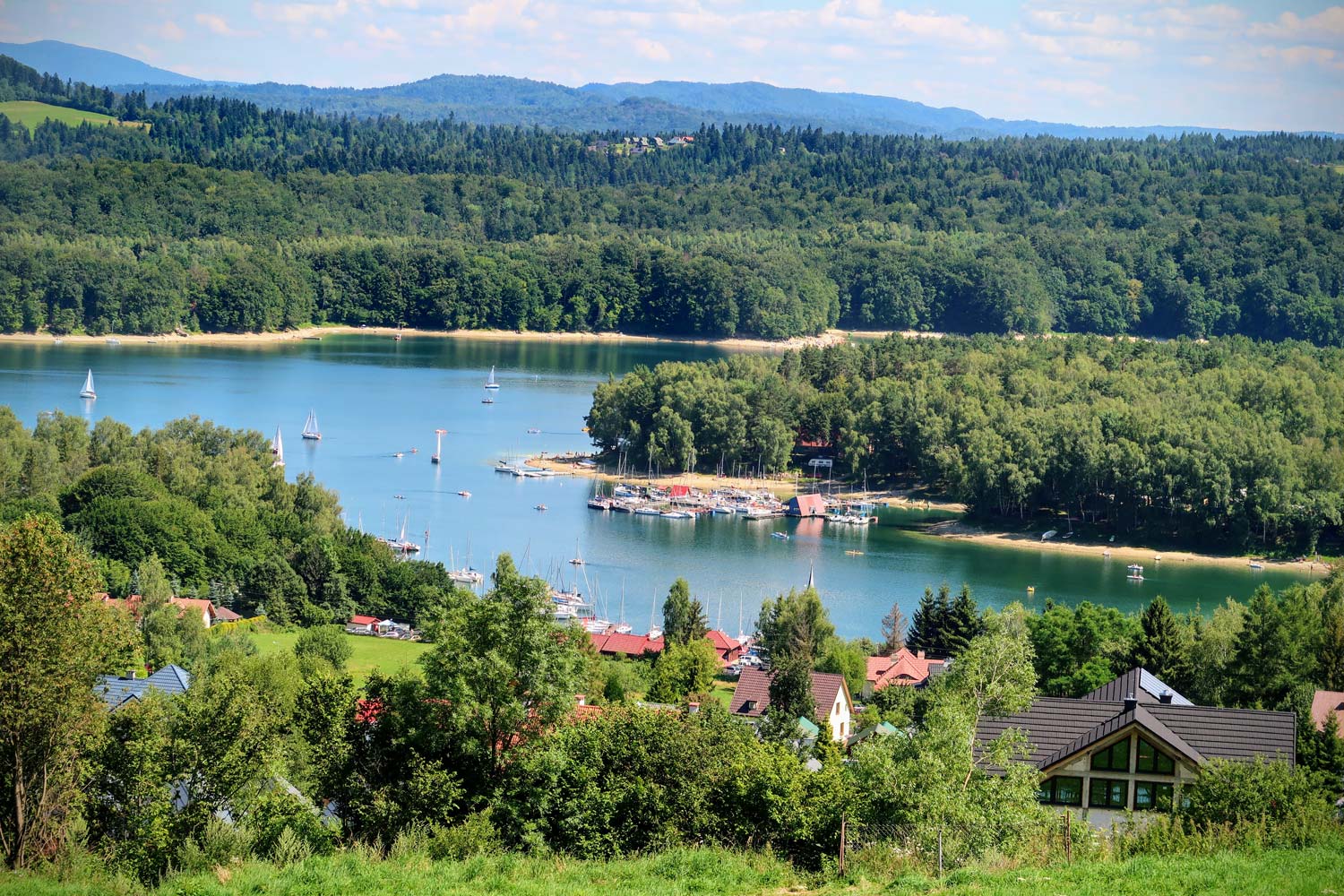
Lake Solina
It is no accident that Solińskie Lake is called the "Bieszczady Sea". It is the largest artificial water reservoir in Poland (its capacity is 472 million m3). It is assumed that the water table is at an altitude of 420 meters above sea level, but it should be remembered that due to the nature of the reservoir, fluctuations in the height of the water table can be very fast and large (up to 10-15 meters).
The lake has a very varied shoreline, creating countless peninsulas, coves, headlands and has many mouths for streams. It would take over 160 km to go around the lake (the total length of the shoreline is about 166 km).
During the several decades of the existence of Lake Solina, many resorts, marinas and beaches were built around it, and local towns were populated with tourists.
The most popular tourist destinations around Lake Solina are: Polańczyk, Solina and Wołkowyja. Equally interesting, especially for those looking for a more secluded vacation, are also less known ones, such as: Zawóz, the vicinity of Olchowiec or Teleśnica Oszwarowa. I describe some of these places in terms of possible rest, availability of beaches and attractions in a separate, very extensive one an entry about Lake Solina - [click].
Solina - where to park?
It depends whether you want to park near the dam or the village center.
If you are looking for a parking lot close to the Solina dam, there are several of them.
Below I will give you details of the four car parks in the order from the closest to the farthest. Of course, the parking lots are paid.
Parking lot no. 1 at the Solina dam, GPS coordinates:
It is impossible to park closer. The car park is quite large so there is a good chance of a free spot.
Distance from the dam: 240 m
49°23’56.2″N 22°27’00.5″E
49.398947, 22.450140 - click and route
Parking lot no. 2 at the Solina dam, GPS coordinates:
Distance from the dam: 350 m
49°23’58.5″N 22°26’54.2″E
49.399570, 22.448383 - click and route
Parking lot no. 3 at the Solina dam, GPS coordinates:
Distance from the dam: 400 m (a bit uphill)
49°23’57.8″N 22°27’04.5″E
49.399391, 22.451245 - click and route
Parking lot no. 4 at the Solina dam, GPS coordinates:
Distance from the dam: 700 m (a bit uphill)
49°24’00.1″N 22°27’13.4″E
49.400039, 22.453717 - click and route
If you want to park in the village of Solinathen the choice is simple. I have provided information on the parking lot below.
49°23’41.7″N 22°27’32.0″E
49.394923, 22.458896 - click and route
Accommodation - Solina
When looking for accommodation, I most often use: booking.com. I choose this website because, apart from the fact that they have a wide selection of accommodation, they also verify and control the quality and compliance with the description of the proposed accommodation. Offers that do not match the descriptions, to which customers have comments and evaluate them poorly, are quickly ejected from the website. It is not enough that the owner of the facility pays the service for his offer to hang here. It still has to meet and maintain the appropriate quality of services. In short, the probability that you will find a shady offer when using this database is small.
Below is a link that has been prepared so that it automatically filters offers for Solina. After clicking on it, the offers you are interested in should be on the list with the results.
- see accommodation in Solina: Booking - [click]
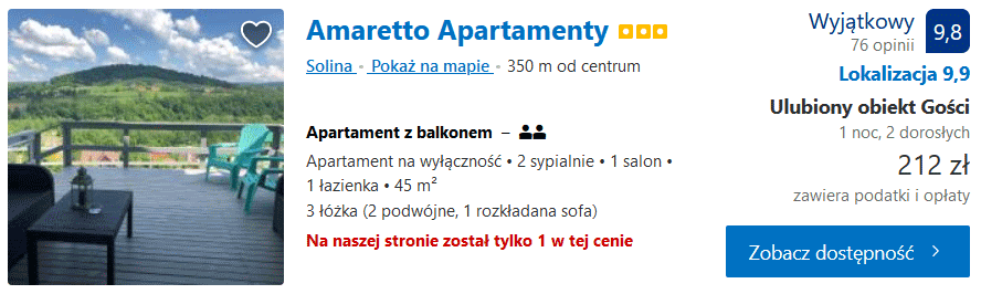
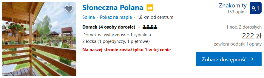
In addition, below I allowed myself to post a few (in my opinion) interesting offers from specific accommodation facilities. Perhaps you will like them.
Amaretto Apartments - [click]
Sunny Glade - [click]
Beaches - Solina
There is a long but not too wide beach in Solina. The wider part is adjacent to the marina "White Fleet"And towards the marina"Commander"The beach narrows. It is rocky along its entire length.
Below is a panoramic photo of the wider part of the beach. You can zoom in and rotate the photo:
Weather - Solina
Below you will find information about the current weather in Solina and the weather forecast for the next 7 days.
Other attractions in Solina and the surrounding area
The area around Solina is full of interesting attractions for everyone. Below you will find several suggestions for both people who like to be active and for those who prefer other ways of rest.
Walking path - Perła Polańczyk (yellow trail)
Walking time: 1,5 - 2h
Trail color: yellow
The path starts in Polańczyk next to the Health Resort and Tourist Information Center, ul. Zdrojowa 1b and is marked with yellow trail signs.
From the tourist office, take the first steps towards the roundabout and turn right at the roundabout. The difficulty of the route is easy, and at the same time it is one of the most beautiful hiking routes in the area.
A detailed description of the route provided by the Solina commune you will find here - [click]
Health Resort and Tourist Information Center in Polańczyk, GPS coordinates:
49°22’10.7″N 22°25’18.5″E
49.369628, 22.421814 - click and route
Walking path - Green hills above Solina (red trail)
Walking time: 5h
Trail color: red
The path starts near the PKS Polańczyk Uzdrowisko stop. You should follow the road between the shops and the MSWiA center "Jawor" to a deep ravine, towards a long narrow bay on the Solina lake, called Nelson's Fort. The further direction of the march leads left, along the shore.
The route is not difficult, but it is quite long, so it is worth having a supply of food and drink with you.
It is also possible to go halfway along the route near the Solina dam. From there, you can return to Polańczyk by PKS bus (there are many additional courses in the season).
The route can also be started in Solina (e.g. near the beginning of the promenade to the dam) and go to Polańczyk and back in full, or halfway (this time in Polańczyk) and return to Solina by bus.
A detailed description of the route provided by the Solina commune you will find here - [click]
WARNING!!! On this route, there will be several streams to cross that must be crossed. It is worth taking care of appropriate footwear.
Bus stop Polańczyk Health resort, GPS coordinates:
49°22’19.7″N 22°25’51.9″E
49.372137, 22.431078 - click and route
Walking path - Blue Teardrop (blue trail)
Walking time: 5h - 6h
Trail color: blue
The path runs around Lake Myczkowskie, and its difficulty level can be described as medium. It is also worth paying attention to the considerable length of the route and taking with you a supply of food and drink. A walk along this trail is an excellent choice for everyone who wants to spend a day on a pleasant, long, but not too intense activity, with beautiful views.
A detailed description of the route provided by the Solina commune you will find here - [click]
Bus stop in Solina, GPS coordinates:
49°23’58.4″N 22°26’59.5″E
49.399558, 22.449865 - click and route
Beginning of the trail: asphalt road next to the "Halicz" center, GPS coordinates:
49°24’04.5″N 22°26’53.1″E
49.401257, 22.448085 - click and route
Pontoon rafting on the San River
It is always interesting to see your surroundings from a different perspective. For those who would like to look at the San area a bit differently, pontoon rafting is an interesting alternative. I will add right away that the canoeing trips are very easy and do not provide any extreme experiences. Rather, they focus on enjoying the surroundings from the river's perspective and soaking up the enjoyment of the surrounding nature.
There are several organizers of such kayaking trips and there are different kayaking programs. Some of them include stops and visits to nearby attractions on land.
Below are some links to specific offers:
Family trips - bieszczady actively
Family trips - wild bieszczady
Family rafting with sightseeing - Following the trail of Lemek and Boyk
Family trips - green inflatable boat
Viewpoints in Polańczyk
Being in Solina, it is worth traveling a few kilometers to the viewpoint, or actually two viewpoints in Polańczyk.
Viewpoint on Mount Sawin
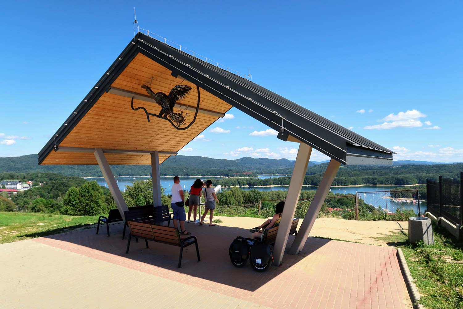
The view of Lake Solińskie from this place is really impressive.
To reach the viewpoint, the most convenient way is to park in the parking lot next to the Tourist Information Center in Polańczyk, and then go along the road (some 200m), slightly up the hill, directly to the viewpoint.
Health Resort and Tourist Information Center in Polańczyk, GPS coordinates:
49°22’10.7″N 22°25’18.5″E
49.369628, 22.421814 - click and route
Viewpoint on Mount Sawin, GPS coordinates:
49°22’05.4″N 22°25’29.8″E
49.368158, 22.424947 - click and route
Viewing point at the Osiedle na Górce estate
The second viewpoint is slightly less exposed, but the views available from it are equally beautiful. It is located in the immediate vicinity of the cottage estate. You have to leave your car in a specially prepared parking lot and go to the point on foot, about 200 m, which is quite close. Traditionally, the coordinates of the necessary locations are listed below.
Parking at the vantage point at the Osiedle na Górce estate, GPS coordinates:
49°22’15.3″N 22°25’07.3″E
49.370902, 22.418694 - click and route
Viewing point at the Osiedle na Górce estate, GPS coordinates:
49°22’14.0″N 22°24’58.0″E
49.370542, 22.416103 - click and route
Boyko Culture Museum in Myczków
Established in 2013, the museum collects memorabilia related to the largest group of Ruthenian highlanders. The collected exhibits are a testimony to the life and culture of people who chose a very difficult and demanding area for their place of existence (people began to settle here only around the XNUMXth century).
A great place to get to know this fascinating culture and the best way to get into the atmosphere of the Bieszczady Mountains.
Boyko Culture Museum in Myczków, GPS coordinates:
49°22’47.1″N 22°24’46.6″E
49.379746, 22.412946 - click and route
Orthodox church in Górzanka
On the way from Wołkowyja to Baligród, among old oaks, on a small hill, there is the Orthodox Church in Górzanka. The oldest mentions about it come from 1599, but the one we can see here today was built in 1838 (the previous church burned down).
In 1912 it was renewed and continues in this condition until today.
Since 1948, it has served as the Roman Catholic Church.
Orthodox church in Górzanka, GPS coordinates:
49°19’40.3″N 22°22’35.2″E
49.327866, 22.376449 - click and route
The interior of the church in Górzanka (panoramic photo, you can rotate it around the axis, zoom in and out):
Ship cruises on Lake Solina and equipment rental
There is something to describe here. If you want to go sailing on the lake by boat, kayak or pedalo, there is nothing to wait for!
Below I am providing information on two centers / marinas in Solina.
Biała Flota Water Service Center, GPS coordinates:
49°23’32.3″N 22°27’26.4″E
49.392310, 22.457323 - click and route
Komandor Water Harbor, GPS coordinates:
49°23’22.1″N 22°27’40.2″E
49.389469, 22.461154 - click and route
Important to me!
Give the article a good rating (5 stars welcome 😀)!It's free, a for me it is very important! The blog lives on visits and thus has a chance to develop. Please do it and ... thank you in advance!
If you like my guides, you will certainly find the one I created useful guide catalog - [click]. There you will find ready-made ideas for your next trips, descriptions of other tourist destinations and an alphabetical list of guides divided into countries, cities, islands and geographical regions.
I also post link to Facebook profile - [click]. Come in and press "Follow"then you will not miss new, inspiring posts.
Unless you prefer Instagram. I'm not a social media demon, but you can always count on something nice to look at on my instagram profile - [click]. The profile will gladly accept any follower who likes it.
I make the content I create available free of charge with copyright, and the blog survives from advertising and affiliate cooperation. So, automatic ads will be displayed in the content of the articles, and some links are affiliate links. This has no effect on the final price of the service or product, but I may earn a commission for displaying ads or following certain links. I only recommend services and products that I find good and helpful. Since the beginning of the blog's existence, I have not published any sponsored article.
Some of the readers who found the information here very helpful, sometimes ask me how you can support the blog? I do not run fundraisers or support programs (type: patronite, zrzutka or "buy coffee"). The best way is to use links. It costs you nothing, and support for the blog is self-generating.
Pozdrawiam

Comprehensive information, thank you now I know how and where to move 😊
I'm going to Polańczyk and I wanted to find out where it is worth going and what natural and landscape attractions can be seen. Thank you very much for the interesting article.
Great tips for beginners in the Bieszczady Mountains. They helped me a lot.
Thank you! 👍