Madeira levadas, hiking and trekking routes - map, descriptions, information
Trails or levadas?
In Madeira, the names "trails" and "levada" are often used interchangeably, but if we go into details, not every trail is a levada and not every levada is a trail.
There is no need to explain what the trail is, but a few words about what a levada is will be useful.
Madeira is covered with a system of channels or, in other words, open, small channels used to transport rainwater from the north to the south of the island. Levadas were created in the XNUMXth century and were used to irrigate fruit (mainly banana) and sugar cane crops not in the south. The cool water from the north of the island is perfect for this.
In total, about 200 levadas with a total length of 2500 km were created.
Along the levadas there are paths that help to maintain the technical condition and patency of the channels. Levads transport water using only gravity drops and are in no way supported by additional devices. They are still used as an irrigation system until today.
Some of the paths along the levadas are additionally used for tourist purposes and can be safely walked along. Hence, the trails are often called levadas, and levadas - trails.
How many trails are there in Madeira?
Currently, 30 routes are marked and marked in Madeira (some of them are closed periodically). Some follow paths along levadas, and some run independently. The routes are numbered and marked with wooden plates.
It is worth paying attention to the numbering of the routes. Some of them have double-digit numbers separated by a period. So there is the route number PR 1 and the routes number PR 1.1, PR 1.2 and PR 1.3. Does this numbering matter? Yes of course!
If some trails have the first digit in common, it means that they all start in the same place. So they have one node in common.
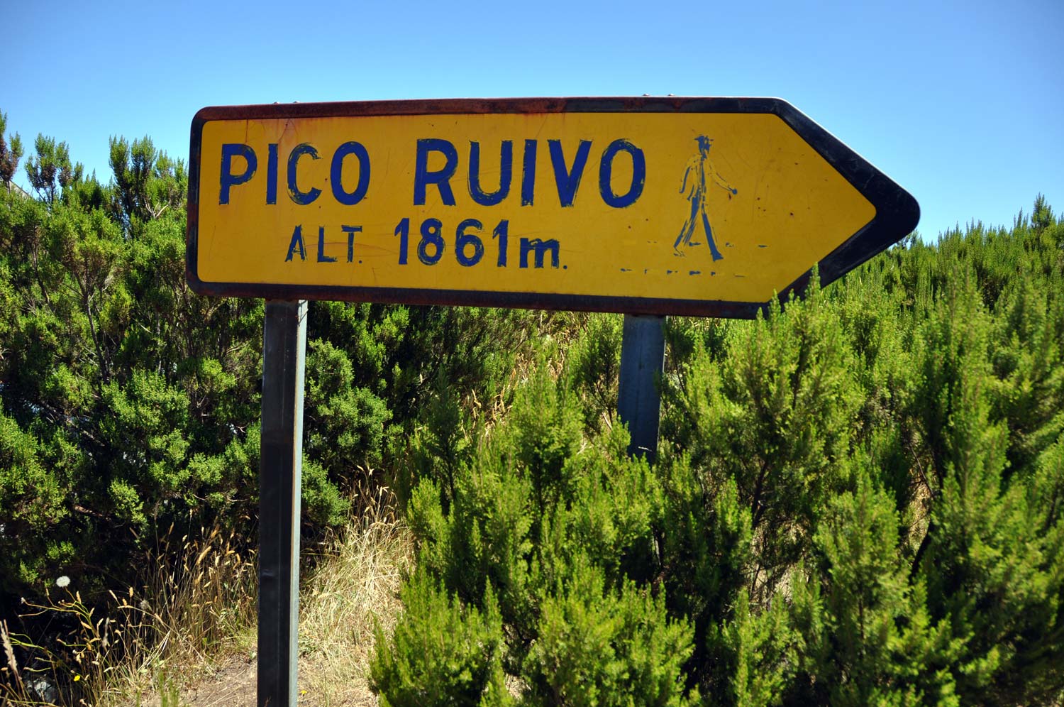
In the cases listed above, the common point is Madeira's highest peak, Pico Ruivo.
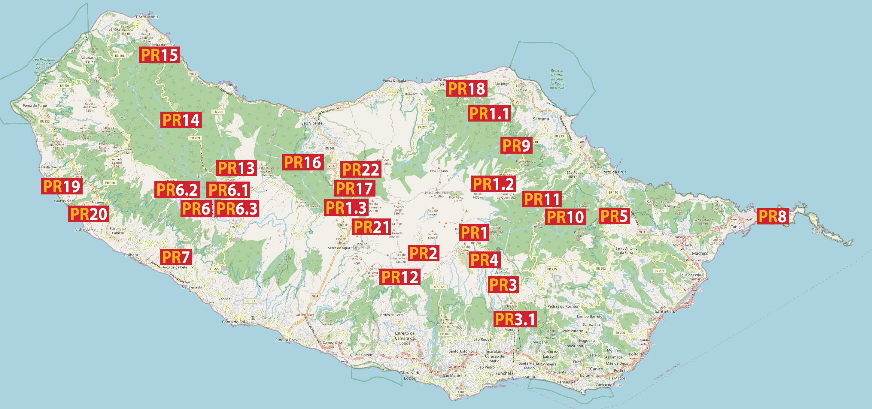
Map of the Madeira trails
Below is a map of Madeira with the approximate location of the routes. If you want to check the location of one, just find its number on the map below.
Knowing the approximate location of the trails will allow you to easily plan the order in which to visit the attractions you are interested in. It will also make it easier to choose the right place to stay, located near the routes you are interested in.
More detailed maps of the levadas and all the trails can be found in the short descriptions later in the text.
Some of the trails (the most popular ones) are described in more detail, with separate entries with photos devoted to them. Links to such entries (if any) can be found in the content below.
Descriptions of the trails
Below I present a short description all official trails and levadas available in Madeira.
Of course, there are many more levadas on the island, but they are not marked in any way and are not adapted to tourist traffic. I also do not have such knowledge about them that I can describe it in any meaningful way.
So I will limit myself to proposing only those marked, described with official maps and maintained in a technical condition suitable for tourist traffic.
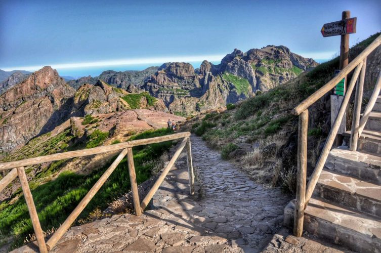
PR 1 - Vereda do Pico do Areeiro
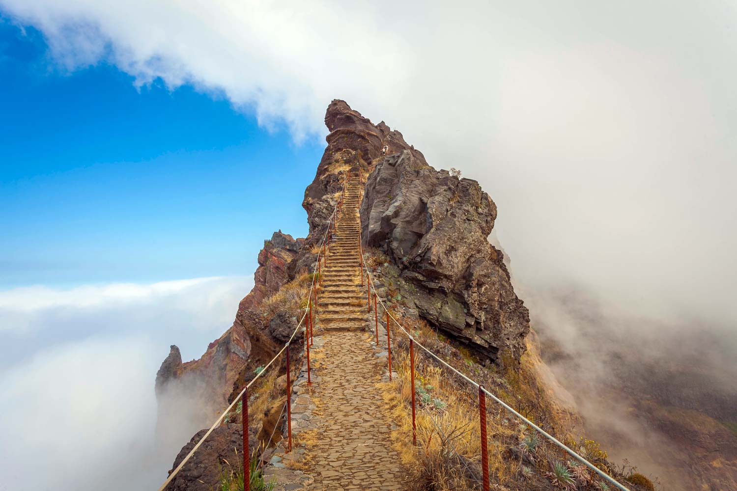
photo: Filipe Gomes
According to many, the most beautiful trail in Madeira. It connects the three highest peaks on the island. It leads along picturesque mountain paths, rock ledges and tunnels. A detailed description of the trail can be found in a separate entry: Trail from Pico do Arieiro to the highest peak of Madeira Pico Ruivo (PR1 Vereda do Areeiro) - map, description, directions, parking
Beginning of the trail: parking at the top Arieiro Peak
Coordinates of the beginning of the trail:
32°44’05.8″N 16°55’43.2″W
32.734936, -16.928672 - click and route
End of the trail: Pico to Ruivo
End of trail coordinates:
32°45’32.0″N 16°56’33.1″W
32.758883, -16.942525 - click and route
Trail Length: 5,6 km (west path), 7 km (east path)
Walking time: 3 h 30 min (one way)
Level of difficulty: above average
Official Map: PR trail 1 - [click]
(map source: ifcn.madeira.gov.pt)
PR 1.1 - Vereda da Ilha
Quite a long but picturesque trail from the small village of Ilha to the highest peak of Madeira Pico Ruivo. The official materials mention the mountain shelter at Pico Ruivo as the starting point of the trail, but it is a bit illogical for me. It is impossible to get to the shelter by any means of transport (you have to get here a few kilometers, e.g. by a different route). So it's hard to consider this place as a starting point.
A better starting point is the village of Ilha, which can be reached by car, and is stated in the official brochures as the end of the trail.
So I will reverse the order and for me the trail starts at Ilha and ends at Pico Ruivo. In this arrangement, the entire length of the trail from Ilha to Pico Ruivo runs uphill.
Beginning of the trail: Ilha village
Coordinates of the beginning of the trail:
32°48’21.4″N 16°54’42.0″W
32.805950, -16.911656 - click and route
End of the trail: Pico Ruivo peak
End of trail coordinates:
32°45’32.2″N 16°56’34.9″W
32.758951, -16.943026 - click and route
Trail Length: 8,2 km (one way)
Walking time: 3 hours (one way)
Level of difficulty: average
Official Map: PR trail 1.1 - [click]
(map source: ifcn.madeira.gov.pt)
PR 1.2 - Vereda do Pico Ruivo
This trail is the shortest and fastest way to reach Madeira's highest peak, Pico Ruivo. If you are in poor condition or have a shortage of time and you want to get Pico Ruivo, this trail will be a good choice.
Beginning of the trail: Achada do Teixeira
Coordinates of the beginning of the trail:
32°45’53.3″N 16°55’16.1″W
32.764811, -16.921133 - click and route
End of the trail: Pico Ruivo peak
End of trail coordinates:
32°45’32.2″N 16°56’34.9″W
32.758951, -16.943026 - click and route
Trail Length: 2,8 km (one way)
Walking time: 1 hour 30 minutes (one way)
Level of difficulty: average
Official Map: PR trail 1.2 - [click]
(map source: ifcn.madeira.gov.pt)
PR 1.3 - Vereda da Encumeada
A long and varied trail from the Encumeada Pass to the Pico Ruivo Peak. During the walk, you will have to climb several approaches and descents. You will traverse a fragment of the Central Mountain Massif, laurel forests, see volcanic cliffs, caves carved into the rock and a majestic view of the Curral das Freiras valley.
There are two small car parks at the Encumeada Pass start point.
Beginning of the trail: the encumeada pass
Coordinates of the beginning of the trail:
32°45’15.3″N 17°01’07.1″W
32.754250, -17.018639 - click and route
End of the trail: Pico Ruivo peak
End of trail coordinates:
32°45’32.2″N 16°56’34.9″W
32.758951, -16.943026 - click and route
Trail Length: 11,2 km (one way)
Walking time: 5 hours (one way)
Level of difficulty: average
Official Map: PR trail 1.3 - [click]
(map source: ifcn.madeira.gov.pt)
PR 2 - Vereda to Urzal
The trail follows the old path once used by the islanders to travel between the northern and southern parts of the island.
Beginning of the trail: Faja dos Cardos
Coordinates of the beginning of the trail:
32°44’33.2″N 16°57’58.5″W
32.742561, -16.966244 - click and route
End of the trail: Lombo to Urzal
End of trail coordinates:
32°46’55.8″N 16°58’42.9″W
32.782172, -16.978581 - click and route
Trail Length: 10,3 km (one way)
Walking time: 4 hours 30 minutes (one way)
Level of difficulty: average
Official Map: PR trail 2 - [click]
(map source: ifcn.madeira.gov.pt)
PR 3 - Vereda do Burro
The trail runs from the summit of Pico do Arieiro to the Ecological Park of Funchal. Along the way, you will come across a rather interesting stone igloo structure, dating from 1813. In practice, an igloo is a special cellar that was once used to store ice for hotels and hospitals on the island. The outer characteristic dome is only the entrance to the underground cellar, in the form of a deep shaft: an ice store.
Beginning of the trail: parking at the top Arieiro Peak
Coordinates of the beginning of the trail:
32°44’05.8″N 16°55’43.2″W
32.734936, -16.928672 - click and route
End of the trail: Funchal Ecological Park
End of trail coordinates:
32°42’04.7″N 16°54’11.2″W
32.701306, -16.903111 - click and route
Trail Length: 7,2 km (one way)
Walking time: 2 hours 40 minutes (one way)
Level of difficulty: easy
Official Map: PR trail 3 - [click]
(map source: ifcn.madeira.gov.pt)
PR 3.1 - Caminho Real do Monte
The Caminho Real do Monte trail, that is the Royal Road to the Mountain in translation, connects the Funchal Ecological Park with the historic center of the Monte Hill in Funchal, full of tourist attractions.
The trail partially runs along the levada (Cales levada from 1784), passes the Pico Alto viewpoint (1129 m above sea level) and then for a moment overlaps with the Royal Path, i.e. the former access road to Mount Monte which connects with Santana.
Beginning of the trail: Funchal Ecological Park
Coordinates of the beginning of the trail:
32°42’04.7″N 16°54’11.2″W
32.701306, -16.903111 - click and route
End of the trail: Monte hill
End of trail coordinates:
32°40’36.3″N 16°54’12.1″W
32.676750, -16.903361 - click and route
Trail Length: 4,2 km (one way)
Walking time: 2 hours (one way)
Level of difficulty: easy
Official Map: PR trail 3.1 - [click]
(map source: ifcn.madeira.gov.pt)
PR 4 - Levada to Barreiro
The route mainly runs along the Levada do Barreiro. During the walk, we are accompanied by extensive views of the Ribeira de Santa Luzia valley and the capital of Madeira, the city of Funchal.
The trail begins near the igloo, which he wrote about when he described the PR 3 trail.
Beginning of the trail: Poco da Neve
Coordinates of the beginning of the trail:
32°43’33.4″N 16°55’29.2″W
32.725944, -16.924778 - click and route
End of the trail: Casa do Barreiro in the Funchal Ecological Park
End of trail coordinates:
32°41’43.3″N 16°54’34.4″W
32.695361, -16.909556 - click and route
Trail Length: 5,3 km (one way)
Walking time: 2 hours 10 minutes (one way)
Level of difficulty: easy
Official Map: PR trail 4 - [click]
(map source: ifcn.madeira.gov.pt)
PR 5 - Vereda das Funduras
The trail starts at the Portela viewpoint (overlooking the northern coast of Madeira), which you can reach by car. The path runs first along the Funduras mountain range, and then along the levadas through the most impressive fragment of the UNESCO-listed Laurel Forest (Laurissilva Forest). The walk ends in the village of Marocos, where the route crosses the traditional, spectacular terraced fields.
Beginning of the trail: Miradouro to Portela
Coordinates of the beginning of the trail:
32°44’50.7″N 16°49’31.9″W
32.747411, -16.825536 - click and route
End of the trail: Marocos village
End of trail coordinates:
32°44’15.2″N 16°47’52.5″W
32.737547, -16.797914 - click and route
Trail Length: 8,7 km (one way)
Walking time: 3 hours (one way)
Level of difficulty: average
Official Map: PR trail 5 - [click]
(map source: ifcn.madeira.gov.pt)
PR 6 - Levada das 25 fontes
Levada belongs to a narrow group of the most beautiful and spectacular walking routes on the island. As the name suggests, it leads among 25 springs, some of which look spectacular in the form of waterfalls and rock pools. It is worth entering this levada on the list of obligatory attractions.
The starting point of the route is on the road, so you can easily get here by car. Parking is available near the trail entrance.
Beginning of the trail: Rabacal viewpoint
Coordinates of the beginning of the trail:
32°45’16.7″N 17°08’01.3″W
32.754625, -17.133686 - click and route
End of the trail: 25 fonts
End of trail coordinates:
32°45’55.8″N 17°07’31.4″W
32.765506, -17.125378 - click and route
Trail Length: 4,6 km (one way)
Walking time: 3 hours (one way)
Level of difficulty: average
Official Map: PR trail 6 - [click]
(map source: ifcn.madeira.gov.pt)
PR 6.1 - Levada to Risco
For the first 2,5 km, the PR 6 and PR 6.1 levadas follow the same route. Then (not far behind the catering point on the route) the levadas split and the PR 6.1 trail continues along the Levada to Risco, to the imposing waterfall where the hike ends.
People in decent shape can do a PR 6 levada, then a PR 6.1 levada. This will extend the entire trip on PR 6 by an additional 3 km and will be a total of about 12 km in both directions.
Beginning of the trail: Rabacal viewpoint
Coordinates of the beginning of the trail:
32°45’16.7″N 17°08’01.3″W
32.754625, -17.133686 - click and route
End of the trail: Risco waterfall
End of trail coordinates:
32°45’35.7″N 17°07’21.5″W
32.759909, -17.122644 - click and route
Trail Length: 3km (one way)
Walking time: 2h (one way)
Level of difficulty: easy
Official Map: PR trail 6.1 - [click]
(map source: ifcn.madeira.gov.pt)
PR 6.2 - Levada to Alecrim
A short and easy walk along the Levada do Alecrim to the levada springs on the Ribeira do Lajeado River. From the trail you can enjoy views of the Rabaçal Valley and the Janela Potok.
Beginning of the trail: Rabacal viewpoint
Coordinates of the beginning of the trail:
32°45’16.7″N 17°08’01.3″W
32.754625, -17.133686 - click and route
End of the trail: Lagoa "Dona Beja"
End of trail coordinates:
32°45’24.2″N 17°06’44.0″W
32.756734, -17.112212 - click and route
Trail Length: 1,8 km (one way)
Walking time: 2 hours
Level of difficulty: easy
Official Map: trail PR 6.2 - None
PR 6.3 - Vereda da Lagoa do Vento
In the initial section, the route of the PR 6.3 levada coincides with the route of PR 6.2. The routes separate after about 1600 meters. The Vereda da Lagoa do Vento route ends at the vantage point, at the top of the rock where there is a small lake. A stream of water flows out, forming the Risco waterfall (the PR 6.1 trail leads to the foot of the waterfall)
Beginning of the trail: Rabacal viewpoint
Coordinates of the beginning of the trail:
32°45’16.7″N 17°08’01.3″W
32.754625, -17.133686 - click and route
End of the trail: Lagoa do Vento
End of trail coordinates:
32°45’36.0″N 17°07’20.3″W
32.759996, -17.122301 - click and route
Trail Length: 1,8 km (one way)
Walking time: 1 hour 30 minutes
Level of difficulty: easy
Official Map: trail PR 6.3 - None
PR 7 - Levada do Moinho
The trail runs along the levada, which was once a private property. Only those who participated in financing its construction could use it. Lewada is known for the fact that there used to be several water mills there. The ruins of three of them ((Achadas Mill, Cancelas Mill, and Levada Grande Mill) are still on the levada.
Beginning of the trail: Ribeira da Cruz
Coordinates of the beginning of the trail:
32°49’45.6″N 17°12’30.2″W
32.829342, -17.208383 - click and route
End of the trail: Junqueira
End of trail coordinates:
32°51’19.2″N 17°10’39.2″W
32.855322, -17.177564 - click and route
Trail Length: 10,3 km (one way)
Walking time: 3 hours 30 minutes (one way)
Level of difficulty: average
Official Map: PR trail 7 - [click]
(map source: ifcn.madeira.gov.pt)
PR 8 - Vereda da Ponta de São Lourenço
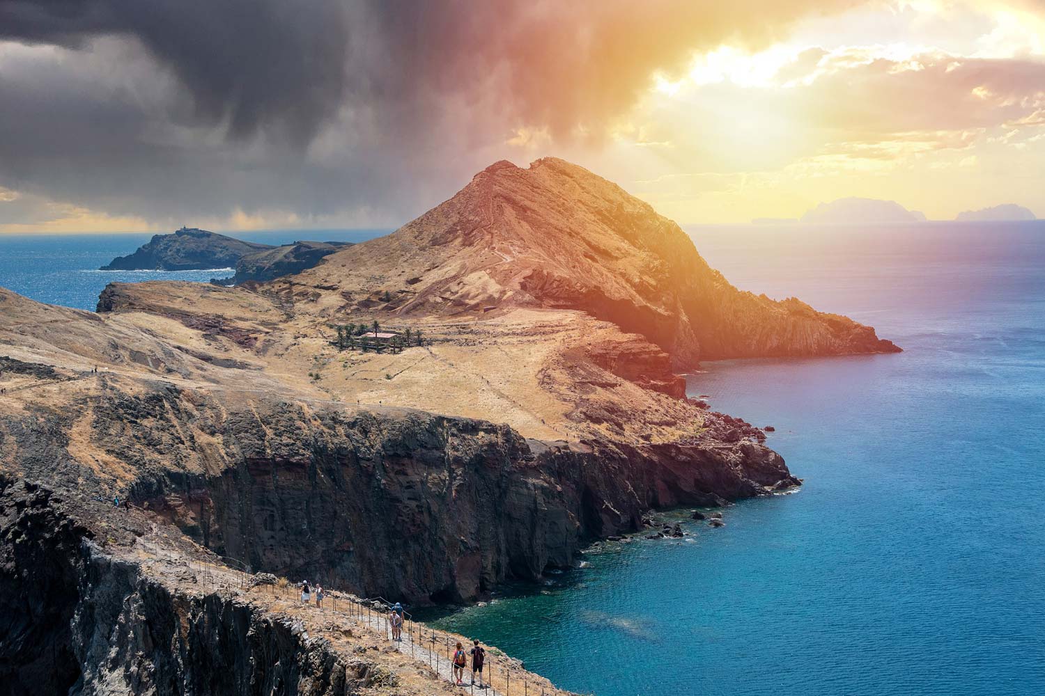
The trail leads among the stunning cliffs located on the far-advanced peninsula of St. Lawrence. This path is at the forefront of the most beautiful walking routes in Madeira. A must-see when visiting the island.
A detailed description of the trail can be found in a separate entry: The trail to the St. Lawrence (PR 8 Vereda da Ponta de Sao Lourenco) - map, description, directions, parking
Beginning of the trail: Baía d'Abra
Coordinates of the beginning of the trail:
32°44’35.8″N 16°42’03.5″W
32.743263, -16.700973 - click and route
End of the trail: Casa do Sardinha
End of trail coordinates:
32°44’31.8″N 16°41’00.2″W
32.742175, -16.683385 - click and route
Trail Length: 3 km (one way)
Walking time: 2 hours 30 minutes (one way)
Level of difficulty: average
Official Map: PR trail 8 - [click]
(map source: ifcn.madeira.gov.pt)
PR 9 - Levada to Caldeirao Verde
A very interesting trail leading partly along the Caldeirao Verde levada, crosses several mountain slopes, while maintaining an almost flat course, without tiring ascents and descents. How is this possible? The path leads through several hand-carved tunnels in the rock. So you don't have to climb to the top to cross the covered massif. During the trip, you need a flashlight, because the tunnels are not illuminated.
Beginning of the trail: Queimadas Forestry Park
Coordinates of the beginning of the trail:
32°47’01.6″N 16°54’20.9″W
32.783778, -16.905797 - click and route
End of the trail: Caldeira Verde
End of trail coordinates:
32°46’27.3″N 16°56’10.9″W
32.774250, -16.936361 - click and route
Trail Length: 8,7 km (one way)
Walking time: 3 hours (one way)
Level of difficulty: average
Official Map: PR trail 9 - [click]
(map source: ifcn.madeira.gov.pt)
PR 10 - Levada to Furado
A trail for lovers of long walks, leading along one of the oldest levadas purchased by the state: Levada do Furado. It connects with two other levadas: Juncal and Serra do Faial, so it carries the waters of three regions: the Ribeiro Frio valley, Porto da Cruz terraces and the Santana Mountains.
Beginning of the trail: Ribeira Frio
Coordinates of the beginning of the trail:
32°44’06.5″N 16°53’10.5″W
32.735139, -16.886239 - click and route
End of the trail: Portela
End of trail coordinates:
32°44’44.3″N 16°49’35.4″W
32.745647, -16.826486 - click and route
Trail Length: 11 km (one way)
Walking time: 5 hours (one way)
Level of difficulty: average
Official Map: PR trail 10 - [click]
(map source: ifcn.madeira.gov.pt)
PR 11 - Vereda dos Balcoes
A beautiful, atmospheric and very easy trail to the Balcoes viewpoint, with a spectacular view of the highest peaks of Madeira and the valley with the laurel forest.
A detailed description of the trail can be found in a separate entry: The trail to the Balcoes viewpoint: levada PR 11 Vereda dos Balcoes - map, description, access, parking
Beginning of the trail: Ribeira Frio
Coordinates of the beginning of the trail:
32°44’07.7″N 16°53’11.1″W
32.735464, -16.886419 - click and route
End of the trail: Balcoes
End of trail coordinates:
32°44’29.7″N 16°53’25.3″W
32.741589, -16.890350 - click and route
Trail Length: 1,5 km (one way)
Walking time: 1 hour 30 minutes (one way)
Level of difficulty: easy
Official Map: PR trail 11 - [click]
(map source: ifcn.madeira.gov.pt)
PR 12 - Caminho Real da Encumeada
The trail passes through part of Madeira's central mountain range. Its name "The Royal Route" is obviously not accidental. It is a historic road that was once used as one of the main routes through the island. Note that the pavement has been paved.
Beginning of the trail: Miradouro da Boca da Corrida
Coordinates of the beginning of the trail:
32°42’40.0″N 16°59’14.0″W
32.711097, -16.987231 - click and route
End of the trail: Encumead
End of trail coordinates:
32°45’12.2″N 17°01’15.6″W
32.753397, -17.020989 - click and route
Trail Length: 12,5 km (one way)
Walking time: 5 hours (one way)
Level of difficulty: average
Official Map: PR trail 12 - [click]
(map source: ifcn.madeira.gov.pt)
PR 13 - Vereda do Fanal
The trail for a long and quiet walk surrounded by a picturesque laurel forest. It connects to two other routes: PR 14 and PR 15. There is a small car park near the starting point.
Beginning of the trail: Assobiadores
Coordinates of the beginning of the trail:
32°46’01.5″N 17°06’27.8″W
32.767072, -17.107733 - click and route
End of the trail: Fanal
End of trail coordinates:
32°48’29.9″N 17°08’31.9″W
32.808308, -17.142183 - click and route
Trail Length: 10,8 km (one way)
Walking time: 4 hours (one way)
Level of difficulty: average
Official Map: PR trail 13 - [click]
(map source: ifcn.madeira.gov.pt)
PR 14 - Levada dos Cedros
The trail passes through what is considered to be the "area of rest and silence". The old and beautiful vegetation that developed in accordance with the natural rhythm without human influence is truly delightful here. The path runs from the Paul da Serra plateau along the Cedros Levada.
Beginning of the trail: Fanal
Coordinates of the beginning of the trail:
32°48’22.2″N 17°08’27.1″W
32.806164, -17.140869 - click and route
End of the trail: Curral False
End of trail coordinates:
32°49’33.3″N 17°09’28.6″W
32.825914, -17.157942 - click and route
Trail Length: 7,2 km {one way)
Walking time: 3 hours
Level of difficulty: average
Official Map: PR trail 14 - [click]
(map source: ifcn.madeira.gov.pt)
PR 15 - Vereda da Ribeira da Janela
The path runs along the old road, which was once used to transport wood from the forest. During the trip, in addition to the mountain and forest landscapes typical of Madeira, you will see characteristic, stepped terraced fields. The PR 15 trail is quite a short but varied and interesting walk.
Beginning of the trail: Assobiadores
Coordinates of the beginning of the trail:
32°46’01.5″N 17°06’27.8″W
32.767072, -17.107733 - click and route
End of the trail: Ribeira will give Janela
End of trail coordinates:
32°48’29.9″N 17°08’31.9″W
32.808308, -17.142183 - click and route
Trail Length: 2,7 km (one way)
Walking time: 1 hour 30 minutes
Level of difficulty: average
Official Map: PR trail 15 - [click]
(map source: ifcn.madeira.gov.pt)
PR 16 - Levada Fajã do Rodrigues
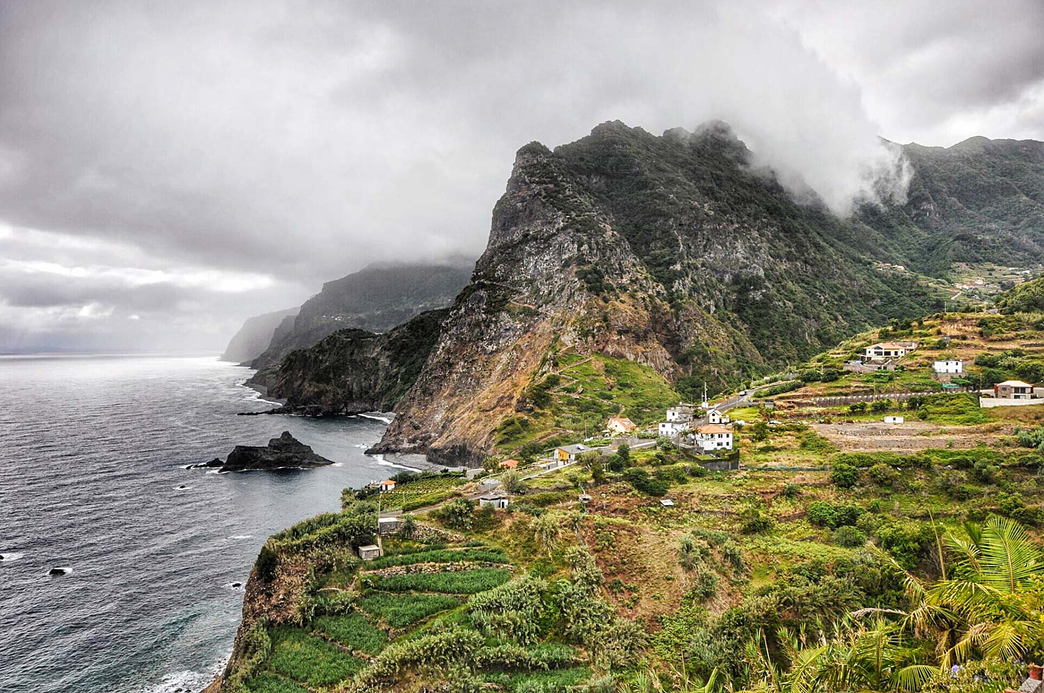
This is one of the weirdest hiking trails in Madeira and at the same time one of the strangest I know. The entire trail is less than 4 km long, and almost half of it runs through… tunnels. There are several of them on the route, and one is over a kilometer long (!!!). Between the tunnels there are views of the very photogenic Sao Vicente valley.
Beginning of the trail: ginjas
Coordinates of the beginning of the trail:
32°46’44.6″N 17°02’58.0″W
32.779067, -17.049450 - click and route
End of the trail: Ribeira to Inferno
End of trail coordinates:
32°47’19.3″N 17°04’38.6″W
32.788683, -17.077397 - click and route
Trail Length: 3,9 km (one way)
Walking time: 1 hour 45 minutes (one way)
Level of difficulty: average
Official Map: PR trail 16 - [click]
(map source: ifcn.madeira.gov.pt)
PR 17 - Caminho do Pináculo e Folhadal
The trail leads along two levadas, Serra and Norte. On the way, you will have the chance to see beautiful views of the Sao Vicente valley. There are several tunnels along the walking route. The longest one is about 750m and a flashlight will come in handy. The trail is quite long, and therefore it should be classified as difficult. Currently, the levada is closed periodically.
Beginning of the trail: Lombo to Mouro
Coordinates of the beginning of the trail:
32°45’15.2″N 17°01’09.7″W
32.754219, -17.019372 - click and route
End of the trail: Encumead
End of trail coordinates:
32°44’33.7″N 17°02’41.1″W
32.742703, -17.044753 - click and route
Trail Length: 15 km (one way)
Walking time: 6 hours 30 minutes (one way)
Level of difficulty: hard
Official Map: PR trail 17 - [click]
(map source: ifcn.madeira.gov.pt)
PR 18 - Levada do Rei
The trail goes along the levada with the XNUMX-year-old São Jorge watermill. Fed by levada waters, it grinds wheat, maize, barley and rye grown on the terraces of Sao Jorge. The first part of the trail leads through a wooded area. Lush vegetation creates characteristic tunnels.
Beginning of the trail: ETAR de Sao Jorge
Coordinates of the beginning of the trail:
32°49’00.9″N 16°55’28.7″W
32.816917, -16.924642 - click and route
End of the trail: Ribeiro Bonito
End of trail coordinates:
32°47’46.0″N 16°56’17.2″W
32.796108, -16.938122 - click and route
Trail Length: 5,3 km (one way)
Walking time: 2 hours (one way)
Level of difficulty: average
Official Map: PR trail 18 - [click]
(map source: ifcn.madeira.gov.pt)
PR 19 - Caminho Real do Paul do Mar
A short but very spectacular walk along the cliff path down the path all the way to the coast at Paul do Mar. The views from the trail are beautiful, and the trail itself meanders among terraced fields, the shape of which is supported by stone walls.
Beginning of the trail: Pleasures
Coordinates of the beginning of the trail:
32°45’08.8″N 17°13’01.2″W
32.752433, -17.217011 - click and route
End of the trail: Paul do Mar
End of trail coordinates:
32°45’09.6″N 17°13’25.8″W
32.752658, -17.223842 - click and route
Trail Length: 1,8 km (one way)
Walking time: 1 hour (one way)
Level of difficulty: average
Official Map: PR trail 19 - [click]
(map source: ifcn.madeira.gov.pt)
PR 20 - Vereda do Jardim do Mar
The trail starts on the same hill as the previously described PR 19 but on the other side of the cliff, towards the village of Jardim do Mar. It is short, steep and spectacular. Unfortunately, it has been temporarily closed for some time.
Beginning of the trail: Pleasures
Coordinates of the beginning of the trail:
32°44’54.1″N 17°12’36.4″W
32.748364, -17.210111 - click and route
End of the trail: Jardim to Mar
End of trail coordinates:
32°44’15.7″N 17°12’41.6″W
32.737686, -17.211561 - click and route
Trail Length: 1,9 km (one way)
Walking time: 1 hour 30 minutes (one way)
Level of difficulty: easy
Official Map: PR trail 20 - [click]
(map source: ifcn.madeira.gov.pt)
PR 21 - Caminho do Norte
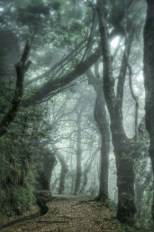
The walking path follows the old trail connecting the villages of the northern and southern parts of the island. The trail served as a trade route, and during local holidays it made it possible to participate in traditional pilgrimages. The first part of the trail runs in the surroundings of the UNESCO-listed laurel forest.
Beginning of the trail: Encumead
Coordinates of the beginning of the trail:
32°45’16.3″N 17°01’08.1″W
32.754514, -17.018925 - click and route
End of the trail: Ribeira Grande
End of trail coordinates:
32°46’27.9″N 17°01’25.4″W
32.774403, -17.023717 - click and route
Trail Length: 3,2 km (one way)
Walking time: 1 hour 30 minutes (one way)
Level of difficulty: average
Official Map: PR trail 21 - [click]
(map source: ifcn.madeira.gov.pt)
PR 22 - Vereda do Chao dos Louros
It is the only closed-loop trail in Madeira. So, after walking through the entire route, you will return to the starting point. The route is surrounded by the Chao dos Louro forest park, which is part of the UNESCO-protected laurel forest. The trail is designed to present the beauty of a forest specific to Madeira.
Beginning of the trail: Chao dos Louros
Coordinates of the beginning of the trail:
32°45’27.6″N 17°01’02.2″W
32.757658, -17.017289 - click and route
End of the trail: Chao dos Louros
End of trail coordinates:
32.757658, -17.017289 - click and route
Trail Length: 1,9 km
Walking time:
Level of difficulty: easy
Official Map: PR trail 22 - [click]
(map source: ifcn.madeira.gov.pt)
PR 23 - Levada da Azenha (Azenha - Caminho Velho do Castelo)
Lewada PR 23 is currently closed.
Madeira sightseeing itinerary
This entry is part of a complete one Madeira sightseeing plan - [click]. The guide contains plans, maps and descriptions of specific sightseeing routes.To see all currently available descriptions of attractions in Madeira, click on the link: Madeira - [click].
Safe car rental guide: Madeira - car rental without deposit?
Important to me!
Give the article a good rating (5 stars welcome 😀)!It's free, a for me it is very important! The blog lives on visits and thus has a chance to develop. Please do it and ... thank you in advance!
If you like my guides, you will certainly find the one I created useful guide catalog - [click]. There you will find ready-made ideas for your next trips, descriptions of other tourist destinations and an alphabetical list of guides divided into countries, cities, islands and geographical regions.
I also post link to Facebook profile - [click]. Come in and press "Follow"then you will not miss new, inspiring posts.
Unless you prefer Instagram. I'm not a social media demon, but you can always count on something nice to look at on my instagram profile - [click]. The profile will gladly accept any follower who likes it.
I make the content I create available free of charge with copyright, and the blog survives from advertising and affiliate cooperation. So, automatic ads will be displayed in the content of the articles, and some links are affiliate links. This has no effect on the final price of the service or product, but I may earn a commission for displaying ads or following certain links. I only recommend services and products that I find good and helpful. Since the beginning of the blog's existence, I have not published any sponsored article.
Some of the readers who found the information here very helpful, sometimes ask me how you can support the blog? I do not run fundraisers or support programs (type: patronite, zrzutka or "buy coffee"). The best way is to use links. It costs you nothing, and support for the blog is self-generating.
Pozdrawiam

Thanks, thanks, thanks…a mine of knowledge. I appreciate the effort put in.
Grazie mille complimenti davvero per le spiegazioni così dettagliate….prenoto subito il viaggio….
Great material, bravo for perfect preparation, the only thing I miss to visit in Funchal is the D'Oliveiras winery Rua Dos Ferreiros 107, 9000-082 Funchal
There is an inaccuracy in that the PR7 sign is placed in the wrong place on the general map. There are two Da Moinho levadas.
The one starting at the church in Lombada is not a marked trail - but it leads to beautiful waterfalls and you can also return on the Nova levada, located about 30m higher. The entire circle is about 10,5 km and takes about 4 hours.
The best website with descriptions and tips about mountain trails. Congratulations and thanks 😃🏔️
The article allowed me to plan trips. Thank you very much for such a dose of knowledge!
Thanks for the materials, very helpful!!!
A sensational compendium of knowledge about Madeira. I appreciate the contribution. In principle, no other guide to Madeira is needed. I give 5 stars only because you can't give seventeen.
I'm very pleased! 🙂
And instead of 17 stars, you can give 15 (I even prefer 15), adding 5 under the next two entries 🙂
Thank you and great experience!
I can only thank you for the above study. It came in handy when visiting Madeira.
Great! I'm glad it was useful!
Very reliable descriptions of routes in Madeira! It's worth taking advantage of. Today is the first day and the first tour of PR 20, but it rocked - because of the descent.
very useful! Still cannot believe that official tourist web do not have it sorted well. The only thing missing to perfection is gpx track to each trail. Did anyone come across that?
Complimenti. descrizioni molto dettagliate e utili
A revelation, extremely helpful materials; full professionalism
Jack, Great job. Thank you for the excellent compendium of knowledge! If I may complete the description of the 25 Fontes levada, I recommend a solution in which we park the car in the parking lot on the Estrada Doutor Roberto Monteiro road (32.753913, -17.149461) and enter the levada through a tunnel of 860m. You need to put on a jacket and bring a flashlight, but this avoids having to climb the 100 meters up the stairs from Rabaçal to the levada. In this case, the trail will be extended by 1,5 km, but in an almost even and very pleasant terrain. Our 8-year-old daughter covered the entire route in this way without any problems.
Super!
Thank you for your interesting attention! 👍👍👍
Thank you for your effort. A very useful page. I'm going in 3 days, and now I'm studying your routes. I wonder if it is possible to walk from the cemetery in Canical to Porto da Cruz… Mapy.cz shows a path there…
Best regards and I wish you success.
I am preparing a second trip to Madeira for the winter season. I am shocked at the amount of attractions that are still ahead of me. The study looks brilliant, I will definitely use it.👍
Thank you so much for putting together this amazing resource! I was so excited to find it. Obrigada!
PR9 seems to me to lead to Caldeirão do Inferno and not Caldeirao Verde. It is about 6,5 km to Verde and 8.7 km to Inferno
Condensed essential information before visiting Madeira - something we were looking for! Great site.
A very reliable collection of information about all levadas and routes in Madeira. I will use it and thank you very much in return
grazie per il materiale molto utile, posso pianificare il mio viaggio, grazie!